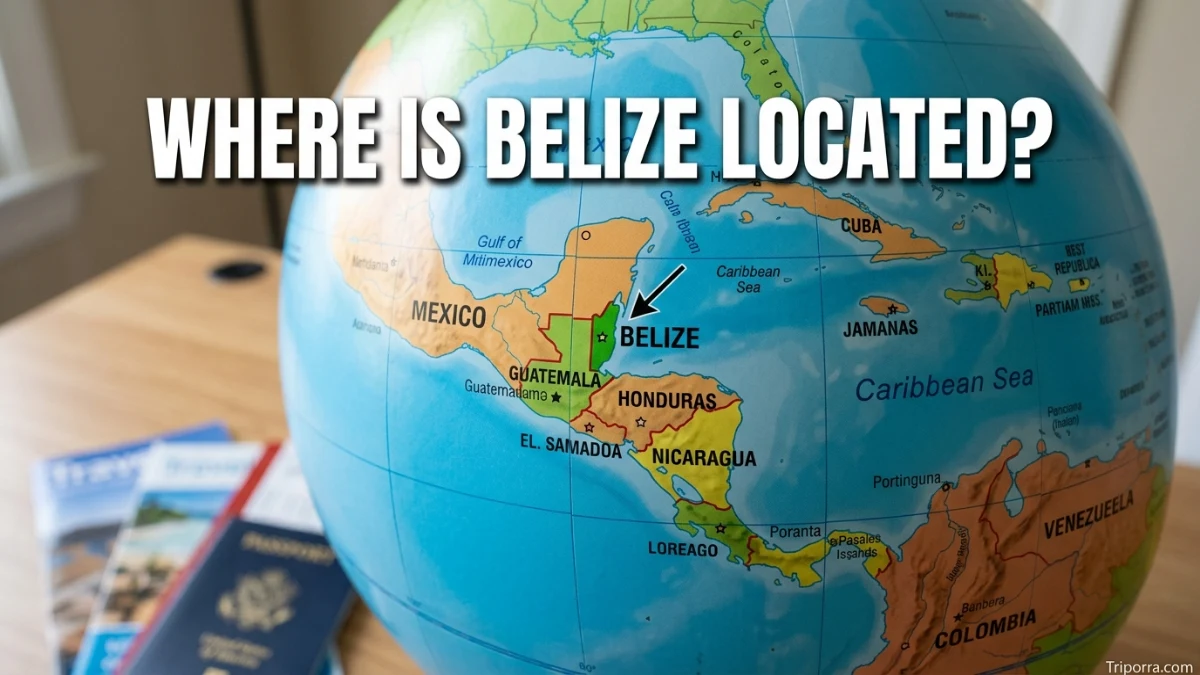
Belize is located in Central America on the Caribbean coast, between Mexico and Guatemala. It sits on the southeastern edge of the Yucatán Peninsula, with the Caribbean Sea to its east. Belize shares land borders with Mexico to the north and Guatemala to the west and south. Its capital, Belmopan, is inland, while Belize City sits on the Caribbean coast.
Introduction
If you are looking at a map of Central America, Belize is the small English-speaking country on the Caribbean coast, directly south of Mexico and east of Guatemala. It is not part of Mexico, Guatemala, or the United States. Belize is an independent country in Central America and is geographically part of North America.
Its location is easy to understand when you picture three sides: Mexico to the north, Guatemala to the west and south, and the Caribbean Sea to the east.
Belize is also notable because it is the only Central American country with no coastline on the Pacific Ocean. Instead, its entire coastal frontage faces the Caribbean Sea.
Quick Facts About Belize’s Location
| Fact | Information |
|---|---|
| Location | Central America, Caribbean coast |
| Country | Belize |
| Region | Central America |
| Continent | North America |
| Capital | Belmopan |
| Largest City | Belize City |
| Northern Neighbor | Mexico |
| Western & Southern Neighbor | Guatemala |
| Eastern Coast | Caribbean Sea |
| Coordinates | About 17°15′ N, 88°45′ W |
| Area | About 8,867 square miles (22,966 km²) |
| Time Zone | Central Standard Time (UTC−6) |
Belize covers about 8,867 square miles (22,966 square kilometers), making it slightly larger than the U.S. state of Massachusetts.
Where Is Belize Located?
Belize is in northern Central America, along the Caribbean Sea. It lies between Mexico and Guatemala, making it part of the narrow land region connecting North America with South America.
On a world map, Belize is in the Western Hemisphere and Northern Hemisphere. Its approximate geographic coordinates are 17°15′ north latitude and 88°45′ west longitude.
A simple way to picture Belize is:
- North: Mexico
- West: Guatemala
- South: Guatemala and the Caribbean region
- East: Caribbean Sea
- Southeast: Caribbean Sea and the Gulf of Honduras area
Belize’s position gives it a strong geographic connection to both Central America and the Caribbean.
Is Belize in Central America?
Yes. Belize is in Central America.
Central America is the land bridge between North America and South America. Belize occupies the northeastern part of this region along the Caribbean coast.
Although Belize is often associated with the Caribbean because of its coastline, islands, culture, and maritime geography, its geographic location is firmly in Central America. The U.S. Department of State describes Belize as a Central American country with maritime borders along the Caribbean Sea.
So, if someone asks, “What region is Belize in?”, the simplest answer is:
Belize is a country in Central America on the Caribbean coast.
Is Belize Part of North America?
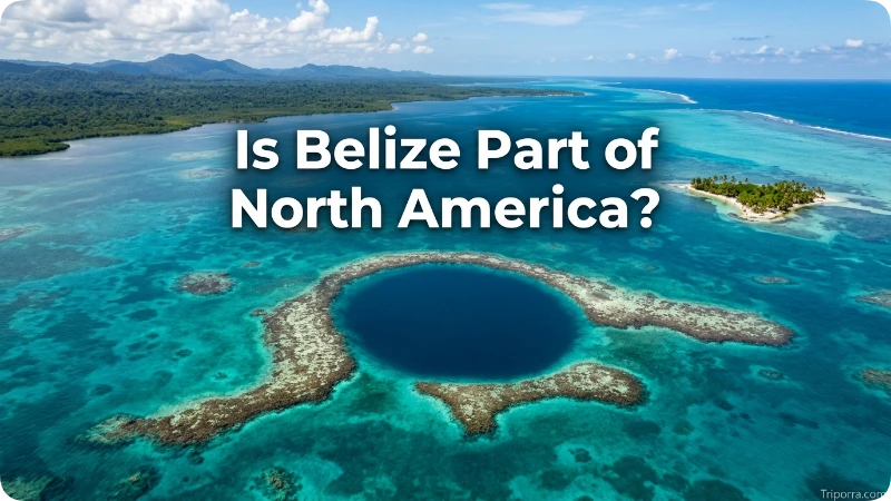
Yes. Belize is geographically part of North America.
This can be confusing because Belize is in Central America. Central America is generally considered a subregion of North America.
Therefore, these descriptions can all be correct:
- Continent: North America
- Subregion: Central America
- Coastal region: Caribbean
- Country: Belize
Belize should not be described as a South American country.
What Countries Border Belize?
Belize has two land neighbors: Mexico and Guatemala. It also faces the Caribbean Sea along its eastern coast.
Mexico
Mexico is north and northwest of Belize.
The Mexican state bordering Belize is Quintana Roo, on the southern part of Mexico’s Yucatán Peninsula.
The border makes northern Belize closely connected geographically to southeastern Mexico. The city of Chetumal, the capital of Quintana Roo, is located just north of the Belize-Mexico border.
Guatemala
Guatemala borders Belize to the west and south.
It occupies the large area immediately west of Belize. The Guatemalan department of Petén is particularly important when looking at Belize’s western border.
Belize therefore sits between Mexico and Guatemala, with the Caribbean Sea opening to the east.
Does Belize Border Honduras?
No, Belize does not share a land border with Honduras.
Honduras is farther south and southeast. Belize and Honduras are separated by the Caribbean Sea and the Gulf of Honduras area.
This distinction matters because Honduras is geographically close to Belize, but it is not a land-bordering country.
What Is Belize Near?
Belize is closest to Mexico and Guatemala because they share its land borders.
Other nearby geographic areas include:
- Chetumal, Mexico: just across the northern border
- Petén, Guatemala: directly west
- Guatemala City: farther southwest
- Honduras: southeast across the Caribbean
- Caribbean Sea: directly east
This position gives Belize a unique setting. It is a mainland Central American country, but much of its eastern geography extends into the Caribbean through islands, cayes, reefs, and coastal waters.
Where Is Belize on a Map?
On a map, look for Mexico’s Yucatán Peninsula. Move south toward Guatemala, and Belize appears along the Caribbean side.
The country is relatively narrow from west to east compared with its north-south length. Its eastern edge reaches the Caribbean Sea, while its western side meets Guatemala.
A useful mental map looks like this:
Mexico → Belize → Caribbean Sea
with Guatemala immediately west and south of Belize.
The CIA’s regional map places Belize between Mexico and Guatemala on the Caribbean side of Central America.
Where Is Belize City?
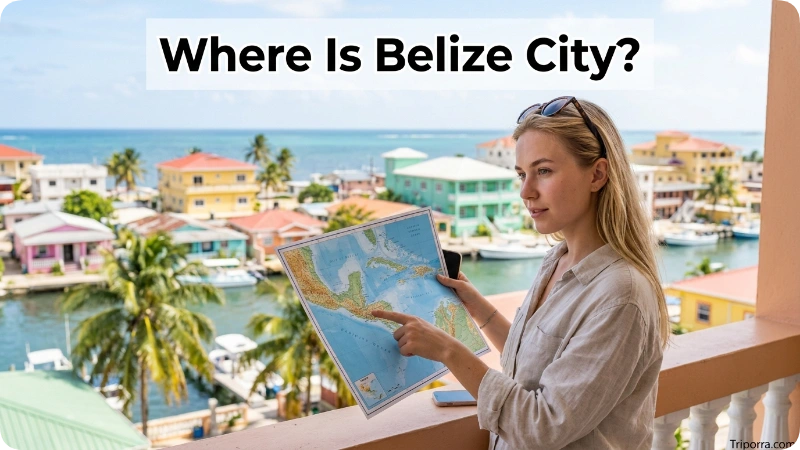
Belize City is on the eastern coast of Belize along the Caribbean Sea.
It is the country’s largest city and an important geographic reference point. However, Belize City is not the capital of Belize.
That distinction is important:
- Country: Belize
- Capital: Belmopan
- Largest city: Belize City
- Belize City location: Caribbean coast
Belize City is much closer to the coast than Belmopan, which sits inland in the central part of the country.
Where Is Belmopan?
Belmopan is the capital of Belize and is located inland, roughly in the central part of the country.
It is west of Belize City and sits near the foothills of the Maya Mountains.
This means Belize has an interesting geographic arrangement: its largest city is on the coast, while its capital is inland.
Belmopan became the capital after Belize City faced serious hurricane damage, and the government developed the inland capital as a safer administrative center. For a location-focused article, however, the key point is simple: Belmopan is inland and west of Belize City.
How Far Is Belize City From Belmopan?
Belize City and Belmopan are relatively close compared with the distances between Belize and other countries.
Belmopan is roughly 50 miles west of Belize City by road, depending on the route and starting point.
The two cities therefore provide a useful way to understand Belize’s geography:
Caribbean coast → Belize City → inland toward Belmopan
The distance is short enough that Belmopan and Belize City are closely connected within Belize’s central transportation network.
What Is Around Belize?
Belize has a mix of mainland and coastal geography.
Its surroundings include:
- Mexico to the north
- Guatemala to the west and south
- Caribbean Sea to the east
- Coastal lowlands
- Inland forests
- Maya Mountains
- Rivers and wetlands
- Offshore cayes and coral reefs
The country has about 386 kilometers, or 240 miles, of coastline.
Its eastern waters also contain many islands and cayes. Among the better-known geographic features are Ambergris Caye, Turneffe Islands, Lighthouse Reef, and Glover’s Reef.
These features help explain why Belize is often described as both a Central American country and a Caribbean coastal country.
What Geographic Region Is Belize In?
Belize is usually divided into six administrative districts:
- Belize District
- Cayo District
- Corozal District
- Orange Walk District
- Stann Creek District
- Toledo District
These districts cover the country’s mainland and associated coastal areas.
For location purposes, three broad areas are especially useful:
Northern Belize: closer to Mexico and the Yucatán Peninsula.
Central Belize: includes areas around Belize City and Belmopan.
Southern Belize: extends toward Guatemala and the Gulf of Honduras.
This layout makes Belize easier to understand than simply viewing it as a small rectangle on a map.
Where Is Belize Relative to Mexico?
Belize is directly south of Mexico.
The northern Belize-Mexico border meets Mexico’s Quintana Roo state. Chetumal is the most recognizable Mexican city near this border.
If you travel south from the Mexican Yucatán Peninsula, you eventually reach Belize.
So the basic relationship is:
Cancún and the Yucatán Peninsula → southern Mexico → Chetumal → Belize
Belize’s northern position also explains why it is geographically connected to the broader Yucatán region.
Where Is Belize Relative to Guatemala?
Belize is east and northeast of Guatemala.
Guatemala surrounds much of Belize’s western and southern side. The Guatemalan department of Petén lies immediately west of much of northern and central Belize.
This creates one of Belize’s most important geographic relationships:
Guatemala → Belize → Caribbean Sea
Belize is therefore the eastern neighbor of Guatemala in this part of Central America.
Where Is Belize Relative to Honduras?
Honduras is southeast of Belize.
Unlike Mexico and Guatemala, Honduras does not share a land border with Belize. The two countries are separated by Caribbean waters.
This is one reason Belize can sometimes appear geographically closer to the Caribbean countries than its mainland position might suggest.
Does Belize Have a Caribbean Coast?
Yes. Belize has a Caribbean coastline along its entire eastern side.
This is one of the defining features of its location.
The Caribbean Sea lies directly east of the mainland and offshore islands. Belize’s coast and marine territory include numerous cayes and reef systems.
In fact, Belize is the only country in Central America that does not have a coastline on the North Pacific Ocean.
So if you remember only one feature of Belize’s physical location, remember this:
Belize is the Central American country that faces the Caribbean Sea rather than the Pacific Ocean.
What Are the Coordinates of Belize?
The approximate geographic coordinates for Belize are:
17°15′ N, 88°45′ W
In decimal form, this is approximately:
17.25° N, 88.75° W
These coordinates represent a general center point for the country rather than a specific city or border crossing.
The latitude places Belize north of the equator, while the longitude places it in the Western Hemisphere.
What Time Zone Is Belize In?
Belize uses Central Standard Time (CST), UTC−6.
Belize does not observe daylight saving time, according to the U.S. Department of State.
For people in the United States, this makes Belize’s time zone relatively easy to understand. Its standard time aligns with Central Standard Time in the U.S., although the time difference can vary compared with U.S. locations that change clocks seasonally.
How Do You Get to Belize?
For most international travelers, the main air gateway is Philip S. W. Goldson International Airport, near Belize City.
Because Belize is located on the Caribbean side of Central America, it can be reached by air from major North American cities and by land from Mexico and Guatemala.
For a location question, the key point is that Belize is connected to the surrounding region through:
- International air travel
- Roads from Mexico
- Roads from Guatemala
- Coastal and island transportation
The country drives on the right-hand side of the road, which is also common in the United States, Mexico, and Guatemala.
Is Belize in the United States?
No. Belize is not part of the United States.
Belize is an independent country in Central America.
It is also not a U.S. state or U.S. territory. Its location is south of Mexico and east of Guatemala, along the Caribbean coast.
For U.S. readers, the easiest comparison is to think of Belize as a small independent country in Central America, just south of Mexico.
Is Belize Part of Mexico?
No. Belize is a separate independent country.
Although Belize borders Mexico and is located on the southeastern edge of the Yucatán Peninsula, it has its own government, territory, borders, and capital.
Mexico is Belize’s northern neighbor, not the country to which Belize belongs.
Is Belize an Island?
No. Belize is not an island country.
Most of Belize’s territory is on the mainland of Central America. However, the country also includes numerous offshore islands and cayes in the Caribbean Sea.
This combination of mainland territory and offshore islands can sometimes make Belize look more Caribbean than its mainland location suggests.
Frequently Asked Questions
1. Where is Belize located?
Belize is located in Central America on the Caribbean coast. It lies between Mexico to the north and Guatemala to the west and south, with the Caribbean Sea to the east.
2. What country is Belize in?
Belize is not inside another country. Belize itself is an independent country in Central America.
3. Is Belize in Central America or the Caribbean?
Geographically, Belize is in Central America. Its eastern coastline faces the Caribbean Sea, so it also has strong Caribbean geographic and cultural connections.
4. What countries border Belize?
Belize has two land-bordering countries: Mexico and Guatemala. The Caribbean Sea lies along its eastern coast.
5. Is Belize part of Mexico?
No. Belize is an independent country. Mexico is its neighbor to the north.
6. Is Belize part of the United States?
No. Belize is not a U.S. state or territory. It is an independent Central American country.
7. What is the capital of Belize?
The capital of Belize is Belmopan, an inland city located in the central part of the country.
8. Where is Belize City?
Belize City is on the Caribbean coast of Belize. It is the country’s largest city but is not the national capital.
9. Does Belize border Honduras?
No. Belize does not have a land border with Honduras. Honduras lies southeast of Belize across Caribbean waters.
10. What continent is Belize in?
Belize is geographically part of North America. Central America is considered a subregion of North America.
11. What are the coordinates of Belize?
Belize’s approximate coordinates are 17°15′ N, 88°45′ W, placing it north of the equator and west of the Prime Meridian.
12. What sea is Belize next to?
Belize is next to the Caribbean Sea, which lies along its eastern coast.
Conclusion
So, where is Belize located? Belize is a small independent country in Central America, positioned between Mexico and Guatemala and facing the Caribbean Sea to the east. Its capital, Belmopan, is inland, while Belize City sits on the Caribbean coast.
The easiest mental map is simple: Mexico is north, Guatemala is west and south, and the Caribbean Sea is east. Belize is therefore a Central American country with a distinctly Caribbean-facing location.

About Leo Sterling
Leo Sterling is a geography and travel writer at Triporra.com who believes understanding a place starts with knowing exactly where it is. He turns geographic details on countries, regions, islands, and cities into clear, engaging content for everyday readers.
For Leo, a good location article does more than mark a spot on a map. It shows what borders a place, which region it belongs to, and how it connects to the world around it—an approach reflected in guides like where is Anguilla, where solid research meets a simple, conversational style.
Whether readers are planning a trip, studying, or just curious, Leo’s goal is the same: deliver accurate, easy-to-understand information without unnecessary complexity.
Areas of Focus: Geography | Countries & Regions | Caribbean Islands | Travel Destinations | Location Research | “Where Is?” Content