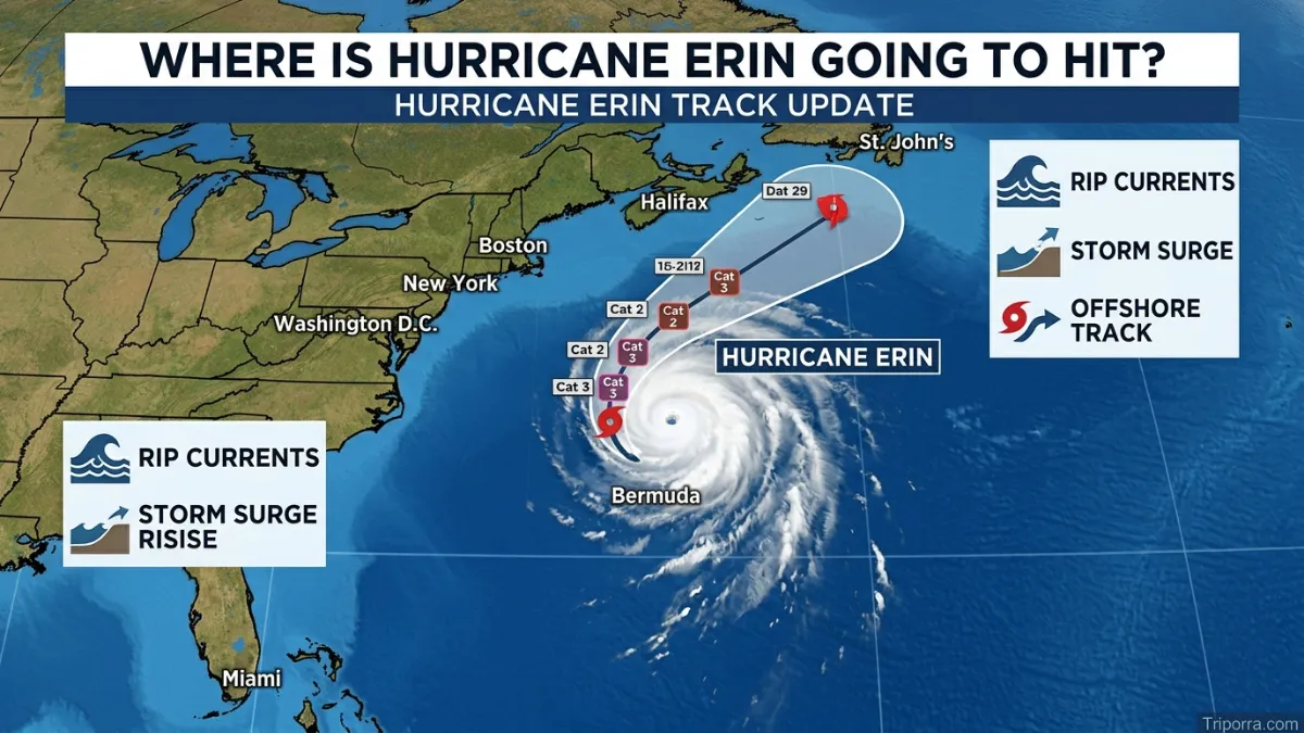
People searching “where is hurricane erin going to hit” need a clear and careful answer. As of the latest National Hurricane Center update available for July 3, 2026, there is no active Hurricane Erin in the Atlantic, so there is no current landfall point to name. The most recent major Hurricane Erin was the 2025 Atlantic storm, which did not make a direct hurricane landfall in the United States, but it did bring dangerous surf, rip currents, storm surge, and tropical-storm conditions to parts of the U.S. East Coast.
Featured Snippet Answer
Hurricane Erin is not currently active in the Atlantic as of the latest NHC update. The 2025 Hurricane Erin tracked through the Atlantic, stayed offshore from the U.S. East Coast, passed between Bermuda and the eastern United States, and affected North Carolina, the Mid-Atlantic, Bermuda, Atlantic Canada, and nearby waters.
Where Is Hurricane Erin Going to Hit? Latest Location and Track
The safest answer is this: there is no current Hurricane Erin forecast because the National Hurricane Center lists no active tropical cyclones in the Atlantic at this time. That means there is no live cone, no active warning area for Erin, and no confirmed future hit location right now.
For readers asking about the 2025 storm, Erin’s center moved across the Atlantic and stayed offshore of the U.S. East Coast. On August 21, 2025, the NHC placed Erin’s center about 205 miles east-southeast of Cape Hatteras, North Carolina, and about 440 miles west-northwest of Bermuda. At that time, it was moving north-northeast and was forecast to pass over the western Atlantic between the U.S. East Coast and Bermuda before passing south of Atlantic Canada.
So, did Erin “hit” land? As a tropical storm, Erin made landfall on Santo Antão in Cabo Verde early in its life. As a hurricane, it did not make a direct U.S. landfall. Still, its large wind field and powerful waves affected coastal areas far away from the storm’s center.
Quick Facts About Hurricane Erin
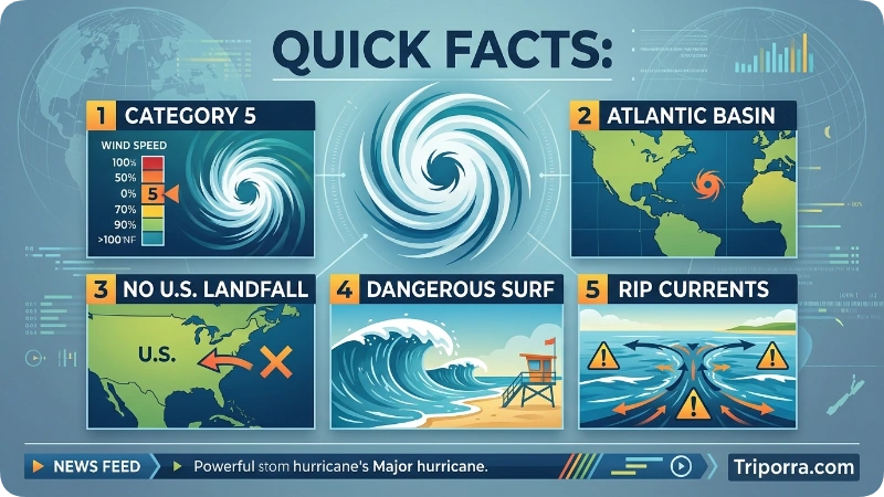
| Fact | Details |
|---|---|
| Official Name | Hurricane Erin (AL052025) |
| Entity Type | Tropical Cyclone / Atlantic Hurricane |
| Ocean Basin | North Atlantic Ocean |
| Active Dates | August 11–22, 2025 |
| Peak Category | Category 5 Hurricane |
| Peak Sustained Winds | 140 kt (about 160 mph / 257 km/h) |
| Lowest Central Pressure | Approximately 913 mb |
| Direct Landfall | Santo Antão, Cabo Verde (as a tropical storm) |
| U.S. Landfall | No direct hurricane landfall |
| Key Areas Affected | Cabo Verde, Virgin Islands, Puerto Rico, Turks and Caicos, Bahamas, Bermuda, U.S. East Coast, Atlantic Canada |
| Storm Track | Long, curved path across the North Atlantic |
| Notable Impacts | Dangerous surf, powerful rip currents, coastal flooding, and large ocean swells |
| Known For | Very large size, long duration, and Category 5 intensity |
| Highest Alert Level Reached | Category 5 on the Saffir–Simpson Hurricane Wind Scale |
| Current Status | No longer active (per latest NHC Atlantic update) |
| Official Monitoring Agency | National Hurricane Center (NHC) |
| Historical Significance | One of the most powerful and long-lived Cabo Verde hurricanes of the 2025 Atlantic season |
Where Is Hurricane Erin Located?
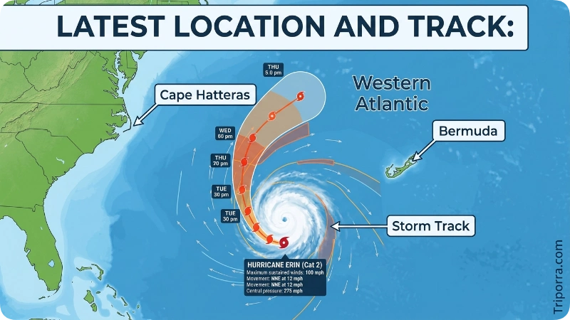
A hurricane does not have a fixed location like a city, island, or country. Its location changes hour by hour. During the 2025 storm, Erin formed from a tropical wave that moved off the west coast of Africa, developed near Cabo Verde, crossed the tropical Atlantic, passed north of the Caribbean islands, curved near the Bahamas, and then moved between Bermuda and the U.S. East Coast.
Near its closest major approach to the U.S. coast, Erin was over the western Atlantic, east-southeast of Cape Hatteras, North Carolina. That location mattered because Cape Hatteras and the Outer Banks are low, exposed barrier islands. Even when a hurricane stays offshore, large waves, surge, overwash, beach erosion, and rip currents can still threaten people and property.
Administrative hierarchy does not apply to the storm itself. Erin belonged meteorologically to the Atlantic hurricane basin, not to a country, state, or province. However, warnings and impacts were handled by different national weather agencies depending on the area, including the U.S. National Hurricane Center, local National Weather Service offices, the Bermuda Weather Service, and Canadian authorities.
Hurricane Erin on the Map
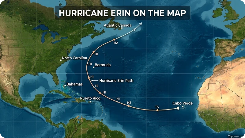
Picture the Atlantic Ocean as a wide open corridor between North America on the west, Africa on the east, the Caribbean to the southwest, and Bermuda in the middle of the western Atlantic. Erin began near Cabo Verde, a group of islands off West Africa. It then moved westward across warm tropical waters.
After that, the storm turned more northwest, passing north of Puerto Rico and near the Turks and Caicos and southeastern Bahamas. Later, it curved north and northeast. This curve kept its center offshore from Florida, Georgia, the Carolinas, and the Mid-Atlantic states.
The most important map area for U.S. readers was the water between Cape Hatteras and Bermuda. Erin’s center stayed offshore, but the storm was so wide that its outer circulation reached coastal zones. The NHC reported hurricane-force winds extending up to 105 miles from the center and tropical-storm-force winds extending up to 320 miles at one point.
Which Region Does Hurricane Erin Belong To?
Erin belonged to the Atlantic hurricane region. More specifically, it was a Cabo Verde hurricane, a term used for storms that develop from tropical waves moving westward from Africa, often near the Cabo Verde Islands.
This type of storm can have a long time over warm ocean water. That gives it room to strengthen, weaken, turn, or expand before reaching land. Erin followed that classic long-track pattern. It became a hurricane east of the northern Leeward Islands, rapidly intensified, reached Category 5 strength northeast of Anegada in the British Virgin Islands, and later moved toward the western Atlantic.
Jurisdiction changes with location. Over open ocean, marine warnings and tropical cyclone advisories are the main public tools. Near land, local emergency managers, weather offices, and national meteorological services guide evacuations, beach closures, travel changes, and safety alerts.
How Does Hurricane Erin Compare to Nearby Places?
Erin cannot be compared to nearby places in the same way a city compares to another city. A better comparison is between the storm’s center and the places it passed near.
Cape Hatteras was close enough to feel strong coastal effects, even though Erin’s eye stayed far offshore. Bermuda was also close enough to remain under watch conditions during part of the storm’s passage. Atlantic Canada needed to monitor Erin as it moved northeast and began changing into a post-tropical system.
Compared with a landfalling hurricane, Erin’s inland wind damage risk was lower for the United States. Compared with a small offshore storm, Erin was more dangerous along beaches because it was huge. Large hurricanes can push ocean energy across long distances, creating powerful surf and deadly rip currents even where skies may not look extreme.
The Outer Banks, in particular, are more exposed than many inland areas because they sit directly along the Atlantic. Low elevation, narrow barrier islands, and open water on both sides make them sensitive to storm surge, wave run-up, and road overwash.
How to Reach Hurricane Erin Updates
You cannot safely “reach” a hurricane. The right goal is to reach official information. For a live storm, the best starting point is the National Hurricane Center. It publishes advisories, forecast cones, wind speed probabilities, watches, warnings, marine hazards, and key messages.
For U.S. local impacts, check your local National Weather Service office. Local offices explain what the storm means for your specific county, beach, road, airport, or river area. The NHC gives the big storm picture, while local offices explain neighborhood-level risk.
Travelers should also check airlines, ferry operators, cruise lines, highway agencies, and emergency management pages. A storm that never makes landfall can still close beaches, cancel ferries, delay flights, shut bridges, or make coastal roads unsafe.
For international readers, the correct source depends on location. Bermuda, Canada, Cabo Verde, the Bahamas, Puerto Rico, and other island areas may have their own official weather and emergency channels. Always follow the agency responsible for the place where you are.
Why Is Hurricane Erin Famous?
Erin became notable because it was powerful, large, and long-lived. The NHC report says it reached Category 5 intensity, which is the highest level on the Saffir-Simpson Hurricane Wind Scale. Its peak intensity was 140 kt with a minimum central pressure near 913 mb.
Another reason people searched for Erin was its size. Even though the center stayed offshore from the United States, the storm’s wind field and waves spread hazards across a wide coastal zone. The NHC warned of life-threatening surf and rip currents along much of the U.S. East Coast.
Erin also showed why the “cone” is not the whole story. Many people focus only on the center line. That can be misleading. Wind, rain, surge, and waves can spread far outside the cone, especially with a large storm.
History of Hurricane Erin
Erin began as a tropical wave that moved off the west coast of Africa on August 8, 2025. A few days later, the system developed near Cabo Verde. It became a tropical depression near Sal and then became a tropical storm while making landfall on Santo Antão in the northwestern Cabo Verde Islands.
The storm moved across the Atlantic and strengthened slowly at first. By August 15, Erin became a hurricane east of the northern Leeward Islands. On August 16, it intensified quickly and reached Category 5 strength, with the eye located about 80 nautical miles northeast of Anegada.
After its peak, Erin weakened, strengthened again, and expanded. Its outer circulation affected parts of the Virgin Islands, Puerto Rico, Turks and Caicos, the southeastern Bahamas, North Carolina, and the Mid-Atlantic coastline. By August 22, Erin became a hurricane-force extratropical cyclone.
Climate and Weather
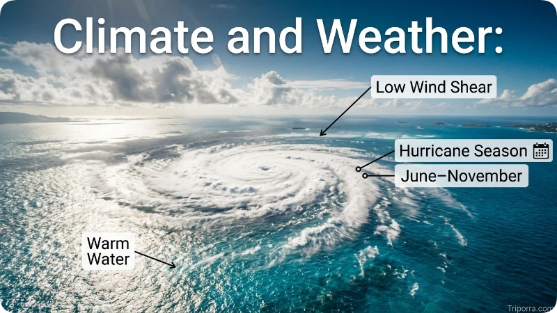
Atlantic hurricanes usually form during the Atlantic hurricane season, which runs from June 1 to November 30. NOAA says the season can still produce storms outside those dates, but most activity happens during the official season, with the peak around September 10.
Erin formed in August, which fits the more active part of the Atlantic season. Warm ocean water, moist air, low wind shear, and favorable steering currents can help tropical systems grow. Dry air, cooler water, land interaction, or strong upper-level winds can weaken them.
For coastal communities, the weather risk depends on more than the hurricane category. A Category 2 storm offshore can still create dangerous beach conditions. A large storm can cause long-lasting surf. A slow storm can create flooding rain. A storm arriving near high tide can make surge flooding worse.
Things to See and Do Nearby
A hurricane is not a tourist attraction. During any active storm threat, the smart choice is to avoid beaches, piers, jetties, flooded roads, and exposed coastlines.
After the danger passes and officials reopen areas, places linked to Erin’s track can be visited safely in normal weather. Cabo Verde offers volcanic islands, Atlantic beaches, and mountain scenery. Puerto Rico has historic towns, rainforests, and coastal communities. Bermuda is known for beaches, forts, and clear water. The Outer Banks has lighthouses, dunes, wildlife areas, and historic coastal villages.
Respect local recovery work after a storm. Beaches may look calm while rip currents remain dangerous. Roads may reopen before dunes, boardwalks, or access points are fully repaired. Wildlife areas can also need time to recover.
Best Time to Visit
For beach travel, the best time depends on the destination. Many Atlantic and Caribbean destinations are pleasant outside active storm periods, but hurricane season still runs from June through November. Travelers should buy flexible tickets, follow forecasts, and understand local emergency rules.
For the U.S. Outer Banks, late spring and early fall can be attractive, but August and September bring higher tropical risk. Bermuda and the Caribbean also need close weather monitoring during the warm-season storm months.
Do not plan storm-watching trips. They put visitors and rescuers at risk. If warnings are issued, leave early when asked, protect important documents, and avoid driving through water.
Common Misconceptions
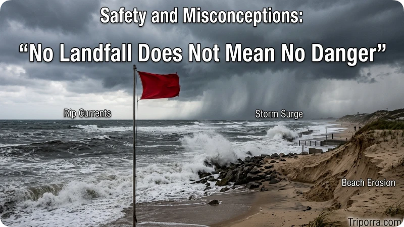
One common mistake is thinking “no landfall” means “no danger.” Erin did not make a direct U.S. hurricane landfall, yet it still produced dangerous surf, rip currents, wind gusts, surge, and beach erosion along parts of the Atlantic coast.
Another mistake is using old forecast maps as if they are current. Hurricane forecasts change often while a storm is active. If you see a map on social media, check the timestamp before trusting it.
Some readers also confuse storm names across years. Atlantic storm names are reused in six rotating lists unless a name is retired. The NHC name list shows how names rotate across years and how names can be replaced after especially deadly or costly storms.
Did you mean a different storm named Erin? The name has been used for several Atlantic tropical cyclones over past decades. The Erin discussed here is the major 2025 hurricane because that is the storm linked to recent “where will it hit” searches.
Places Related to Hurricane Erin
Cape Hatteras, North Carolina, is one of the most searched places connected with Erin because the storm passed offshore while sending tropical-storm conditions and surge risk toward parts of the Outer Banks.
Bermuda was another key point on the map. Erin passed between Bermuda and the U.S. East Coast, which is why forecasters watched both sides of the western Atlantic.
Atlantic Canada also mattered late in the storm’s life. As Erin moved northeast, Canadian coastal areas needed to monitor possible wind, wave, and marine impacts.
Cabo Verde belongs in the story because Erin developed there and made its early tropical-storm landfall on Santo Antão. The Virgin Islands, Puerto Rico, Turks and Caicos, and the southeastern Bahamas were also near enough to receive outer rainbands, wind, or surf effects during the storm’s path.
What Else Do People Want to Know?
Safety is the biggest concern. If your area is under a tropical storm warning, hurricane warning, storm surge warning, or evacuation order, treat it seriously. Do not wait for the center of the storm to arrive. Conditions often become unsafe before the worst weather.
Cost is another concern for travelers. Storms can cause flight changes, hotel cancellations, fuel shortages, road closures, and insurance claims. Flexible booking and travel insurance can help, but every policy has rules and exclusions.
Accessibility also matters. People who need medical equipment, mobility support, dialysis, refrigeration for medicine, or transportation help should prepare early. Local emergency management offices often provide guidance before storms threaten.
Local culture and community recovery deserve respect. After a storm, residents may be dealing with cleanup, damaged dunes, power outages, business closures, or wildlife losses. Visitors should follow posted signs and support local businesses only when officials say travel is safe.
FAQs
What Is Hurricane Erin 2026?
As of now, there is no officially named Hurricane Erin in the 2026 Atlantic hurricane season. “Erin” is a name on the hurricane naming list and will only be used if a storm receives that designation.
What Is the Hurricane Erin Path?
The path of Hurricane Erin depends on the specific storm. If a Hurricane Erin forms, meteorologists will update its forecast track regularly using official hurricane forecasts.
Is Hurricane Erin Still Active?
No. There is currently no active Hurricane Erin in the Atlantic basin.
What Was Hurricane Erin 2025?
Hurricane Erin (2025) was a powerful Category 5 Atlantic hurricane that stayed mostly offshore but still brought dangerous weather to parts of the Caribbean and the U.S. East Coast.
Where Can You Track Hurricane Erin?
You can track Hurricane Erin through official weather agencies like the National Hurricane Center, which provides real-time maps, forecasts, and advisories during active storms.
What Was the Hurricane Erin Death Toll?
Hurricane Erin (2025) was linked to 13 confirmed deaths, with additional people reported missing during the storm.
How Much Damage Did Hurricane Erin Cause?
Hurricane Erin (2025) caused an estimated $25 million in damage, mainly from flooding, strong winds, and coastal impacts.
What Was Hurricane Erin 1995?
Hurricane Erin (1995) was a Category 2 Atlantic hurricane that struck parts of Florida and the Gulf Coast, causing fatalities, widespread power outages, and significant property damage.
Will Hurricane Erin Hit the USA?
Hurricane Erin (2025) stayed offshore and did not make landfall in the United States, although it caused dangerous surf, rip currents, coastal flooding, and tropical storm conditions along parts of the East Coast.
Where Has Hurricane Erin Hit?
Hurricane Erin affected parts of the Caribbean, including Puerto Rico, the Turks and Caicos Islands, the Bahamas, and later impacted the U.S. East Coast with high surf and coastal flooding while remaining offshore.
Is Hurricane Erin Going to Hit Turks and Caicos?
Yes. Hurricane Erin brought tropical storm conditions, heavy rain, rough seas, and strong winds to the Turks and Caicos Islands, though the storm’s center passed just north of the islands.
What States Will Get Hit by Hurricane Erin?
Hurricane Erin did not directly hit any U.S. state, but North Carolina, Virginia, Maryland, New Jersey, New York, and parts of New England experienced coastal flooding, dangerous surf, and rip currents.
Conclusion: Hurricane Erin’s Track and What It Means
The answer is simple but important: no active Hurricane Erin is forecast to hit anywhere right now, based on the latest NHC Atlantic update. If you are asking about the 2025 storm, Erin stayed offshore from the U.S. East Coast as a hurricane, passed between Bermuda and the United States, and later moved toward Atlantic Canada. Its biggest lesson is that a hurricane does not need to make direct landfall to be dangerous.
Erin’s large size created surf, rip currents, storm surge concerns, and coastal impacts across a wide area. For any future storm, focus on official updates, local warnings, and real safety actions instead of old maps or social media guesses.

Silas Vance is a geography enthusiast, travel researcher, and location-focused content writer dedicated to helping readers better understand the world around them on triporra.com. He specializes in creating informative guides about cities, countries, islands, landmarks, universities, and other notable destinations. His work combines geographic accuracy, historical context, and practical insights to answer location-based questions in a simple and engaging way.