
Hurricane Erin was a strong Atlantic hurricane that formed in August 2025. It started far out in the Atlantic Ocean, moved toward the Caribbean, passed north of several Caribbean islands, and then moved toward the area near the Bahamas, Bermuda, and the U.S. East Coast.
Hurricane Erin became a Category 5 hurricane on August 16, 2025. However, it did not make a direct landfall in the United States. Its center stayed over the Atlantic Ocean. Even so, the storm caused dangerous waves, strong rip currents, coastal flooding, and rough seas along parts of the U.S. East Coast.
Erin later moved north and northeast into the North Atlantic. On August 22, 2025, it became a post-tropical cyclone. This means it was no longer a tropical hurricane.
Hurricane Erin was in the Atlantic Ocean during August 2025. It moved from the tropical Atlantic toward the Caribbean, then north of the Bahamas and near Bermuda and the U.S. East Coast. It never made a direct U.S. landfall and became a post-tropical cyclone on August 22, 2025.
Quick Facts About Hurricane Erin
| Fact | Details |
| Name | Hurricane Erin |
| Year | 2025 |
| Ocean | Atlantic Ocean |
| Formed | August 11, 2025 |
| Became a hurricane | August 15, 2025 |
| Strongest category | Category 5 |
| Peak winds | 160 mph |
| Main area | Atlantic Ocean and western Atlantic |
| Near U.S. | North Carolina coast |
| U.S. landfall | No |
| Near Bermuda | Yes |
| Became post-tropical | August 22, 2025 |
| Final status | Post-tropical cyclone |
Where Was Hurricane Erin Located?
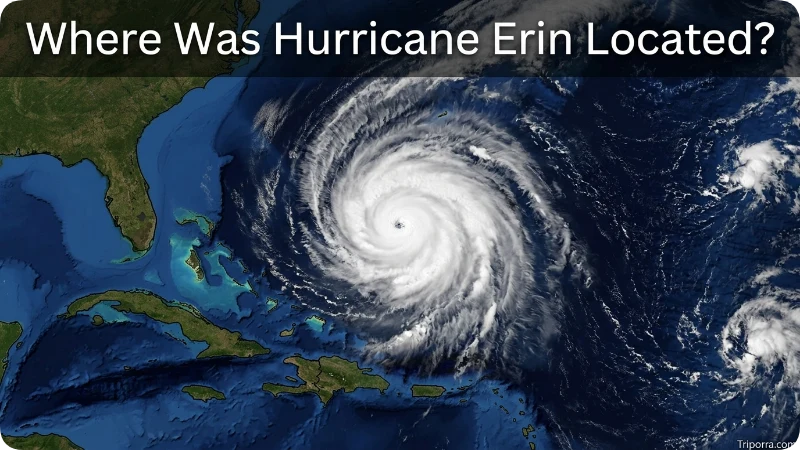
Hurricane Erin moved across the Atlantic Ocean during August 2025.
When it first formed, Erin was far from the United States and the Caribbean. It was in the tropical Atlantic, west of the Cabo Verde Islands.
The storm then moved west-northwest. As it became stronger, it moved closer to the Caribbean islands.
Erin later passed north of the northern Leeward Islands. It then continued toward the Bahamas and the western Atlantic Ocean.
The storm did not stay in one place. Its location changed almost every day as it traveled across the Atlantic.
Where Was Hurricane Erin on the Map?
You can think of Erin’s path as a long curve across the Atlantic:
Tropical Atlantic → Caribbean region → north of the Leeward Islands → north of the Bahamas → western Atlantic → near Bermuda → north of the U.S. East Coast → North Atlantic.
On August 16, Erin was near the northern Caribbean region when it reached Category 5 strength.
On August 18, the storm was east of the Bahamas. Its center was about 105 miles north-northeast of Grand Turk Island.
Erin then moved north toward the U.S. East Coast but stayed offshore.
Was Hurricane Erin Near the United States?
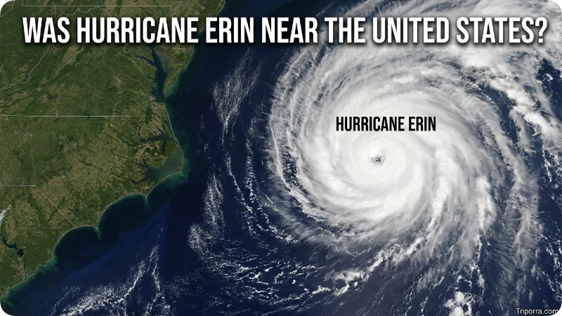
Yes. Hurricane Erin came close to the U.S. East Coast, but its center stayed over the Atlantic Ocean.
On August 20, Erin was about 455 miles south-southeast of Cape Hatteras, North Carolina.
The storm moved closer to the coast during the next day. However, it did not cross the coast.
Even though Erin did not make landfall, its large size caused dangerous ocean conditions along parts of the East Coast.
People near the coast had to watch for large waves, strong rip currents, flooding, and dangerous beach conditions.
Did Hurricane Erin Hit North Carolina?
No. Hurricane Erin did not make landfall in North Carolina.
However, the storm came close enough to affect the Outer Banks.
Parts of the North Carolina coast experienced tropical-storm conditions. The storm also produced dangerous surf and strong rip currents.
This is an important difference between a landfall and a coastal impact.
A hurricane does not have to make landfall to cause dangerous conditions along the coast.
Was Hurricane Erin Near Bermuda?
Yes. Erin traveled fairly close to Bermuda.
Bermuda is an island group in the western North Atlantic Ocean. It is located east of the U.S. East Coast.
As Erin moved north, the storm passed near Bermuda. However, the center of the storm did not pass directly over Bermuda.
On August 22, Erin’s center was about 605 miles north-northeast of Bermuda.
The main concerns around Bermuda and nearby waters included large waves, rough seas, and strong ocean swells.
How Strong Was Hurricane Erin?
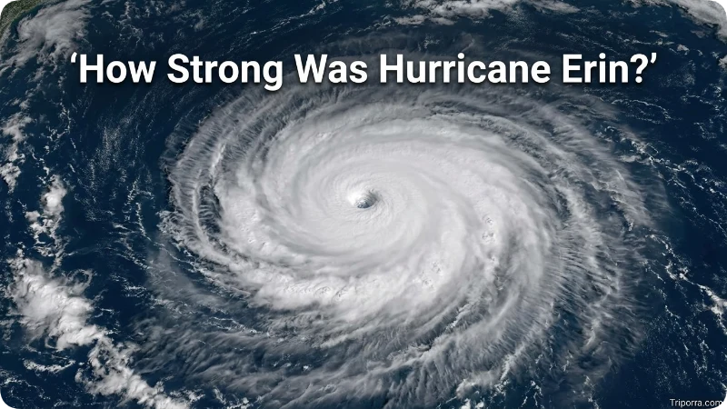
Erin became a hurricane on August 15, 2025.
It then became much stronger very quickly.
On August 16, Erin reached Category 5 strength. Its maximum sustained winds reached about 160 mph.
Category 5 is the highest level on the Saffir-Simpson Hurricane Wind Scale. Hurricanes at this level have extremely strong winds and can cause catastrophic damage if they make landfall.
Erin did not keep Category 5 strength for its entire journey. The storm weakened as it moved farther north.
What Areas Did Hurricane Erin Affect?
Hurricane Erin affected or threatened several areas around the Atlantic.
These included:
- Northern Leeward Islands
- Virgin Islands
- Puerto Rico
- Turks and Caicos
- Bahamas
- Bermuda
- North Carolina
- Virginia
- Other parts of the U.S. East Coast
- Atlantic Canada
The effects were different from place to place.
Some areas experienced strong winds and rain. Other places, especially along the coast, mainly experienced large waves, dangerous surf, rip currents, and coastal flooding.
The storm’s large size meant that dangerous ocean conditions extended far beyond the center of the hurricane.
Did Hurricane Erin Make Landfall?
No. Hurricane Erin did not make a direct landfall in the United States.
Its center remained over the Atlantic Ocean as it passed near the U.S. East Coast.
This does not mean the storm had no effect on the United States.
The Outer Banks of North Carolina experienced tropical-storm conditions. Other coastal areas faced dangerous waves and rip currents.
So, the correct answer is:
Erin affected the U.S. coast, but the hurricane’s center did not make landfall.
What Happened to Hurricane Erin?
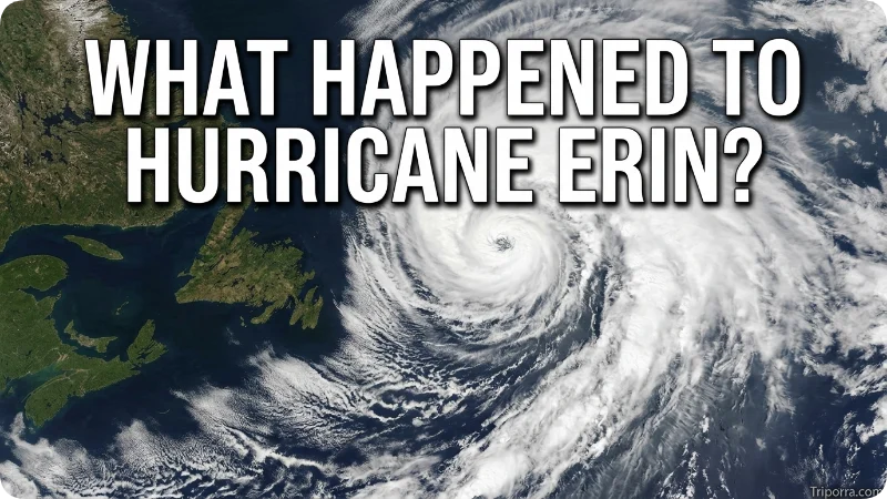
After passing near the U.S. East Coast, Erin continued moving north and then northeast.
The storm gradually lost its tropical characteristics.
On August 22, 2025, the National Hurricane Center classified Erin as a post-tropical cyclone.
At that time, Erin was over the western North Atlantic, about 605 miles north-northeast of Bermuda and about 375 miles south of Halifax, Nova Scotia.
A post-tropical cyclone is no longer a normal tropical hurricane. It can still produce strong winds and dangerous weather, but it no longer has the same tropical structure.
The National Hurricane Center issued its final advisory for Erin on August 22.
Is Hurricane Erin Still Active?
No. Hurricane Erin is not currently active.
Erin was a hurricane in 2025.
It became a post-tropical cyclone on August 22, 2025. The National Hurricane Center then ended its regular tropical cyclone advisories.
Therefore, if you search for “where is Hurricane Erin now,” remember that this refers to a storm from 2025. There is no active Hurricane Erin from that storm today.
Where Did Hurricane Erin End?
Erin ended its tropical life over the North Atlantic Ocean.
On August 22, 2025, its center was near 40.0°N, 59.7°W.
It was north-northeast of Bermuda and south of Halifax, Nova Scotia.
By this point, Erin had changed into a powerful post-tropical system.
It continued moving across the North Atlantic instead of returning toward the United States.
Why Was Hurricane Erin Important?
Hurricane Erin was important because it became an extremely strong hurricane in a short period of time.
It reached Category 5 strength on August 16, with winds of about 160 mph.
Another important point was the storm’s large size.
Erin did not need to make landfall to affect coastal communities. Its large wind field pushed large amounts of water and created dangerous waves and rip currents.
This is why people along the U.S. East Coast had to take the storm seriously even though its center stayed offshore.
Where Did Hurricane Erin Form?
Erin formed over the tropical Atlantic Ocean.
The storm was far east of the Caribbean when it first developed.
Its early position was west of the Cabo Verde Islands. It then traveled west-northwest across the Atlantic.
As it moved closer to the Caribbean, it became more organized and stronger.
Erin eventually became a hurricane on August 15.
How Far Did Hurricane Erin Travel?
Erin traveled a long distance across the Atlantic Ocean.
It started in the tropical Atlantic and moved west toward the Caribbean. It then curved northward and traveled toward the Bahamas, Bermuda, and the U.S. East Coast.
After passing the U.S. coast, it continued toward Atlantic Canada and the North Atlantic.
Because the storm changed direction several times, its path was not a straight line.
Frequently Asked Questions
Where is Hurricane Erin now?
Hurricane Erin is no longer active. The 2025 storm became a post-tropical cyclone on August 22, 2025, over the North Atlantic Ocean.
Where did Hurricane Erin form?
Hurricane Erin formed over the tropical Atlantic Ocean in August 2025. It was far east of the Caribbean when it first developed.
Was Hurricane Erin a Category 5 hurricane?
Yes. Erin reached Category 5 strength on August 16, 2025. Its maximum sustained winds reached about 160 mph.
Did Hurricane Erin hit Florida?
No. Hurricane Erin did not make landfall in Florida. Its main track stayed over the Atlantic Ocean.
Did Hurricane Erin hit North Carolina?
No. Erin did not make a direct landfall in North Carolina. However, the Outer Banks experienced tropical-storm conditions and dangerous coastal weather.
Did Hurricane Erin hit Bermuda?
No. Erin did not make landfall in Bermuda. The storm passed near Bermuda as it traveled north across the Atlantic.
When did Hurricane Erin become a hurricane?
Erin became a hurricane on August 15, 2025, over the Atlantic Ocean.
When did Hurricane Erin become a Category 5?
Erin reached Category 5 strength on August 16, 2025, with maximum sustained winds of about 160 mph.
When did Hurricane Erin end?
Erin became a post-tropical cyclone on August 22, 2025. The National Hurricane Center issued its final advisory that day.
Did Hurricane Erin make U.S. landfall?
No. Erin’s center remained offshore. However, its large size caused dangerous waves, rip currents, and other coastal hazards along parts of the U.S. East Coast.
Conclusion
Hurricane Erin was a powerful Atlantic hurricane that traveled across the ocean in August 2025. It formed in the tropical Atlantic, moved toward the Caribbean, passed north of the Leeward Islands and the Bahamas, and then traveled near Bermuda and the U.S. East Coast.
Erin reached Category 5 strength on August 16, with winds of about 160 mph. Despite its strength, the hurricane did not make a direct landfall in the United States. Its center stayed over the Atlantic Ocean.
The storm still affected coastal areas. North Carolina’s Outer Banks experienced tropical-storm conditions, while parts of the U.S. East Coast faced dangerous waves and rip currents.
Erin continued north toward Atlantic Canada and became a post-tropical cyclone on August 22, 2025. So, if you are asking where Hurricane Erin is now, the answer is simple: the 2025 Hurricane Erin is no longer an active storm.

Elena Rostova bridges the gap between premium hospitality and authentic local experiences. Armed with a background in luxury hospitality management and a passion for fine architecture, she spent years evaluating elite resorts before transitioning into travel journalism. Elena heads the luxury and boutique travel vertical on Triporra.com. Her meticulous guides strip away the guesswork from high-end travel, showcasing unique five-star escapes, fine regional dining, and bespoke private tours that elevate a standard vacation into an unforgettable journey.










