
Introduction
The Drake Passage is a large area of ocean between the southern tip of South America and the Antarctic Peninsula. It lies south of Cape Horn, near the southern ends of Chile and Argentina. The passage connects the southeastern Pacific Ocean with the southwestern Atlantic Ocean and is about 850 kilometers (530 miles) wide.
Featured Snippet Answer
The Drake Passage is located between southern South America and the Antarctic Peninsula. Cape Horn is near its northern end, while the Antarctic Peninsula lies to the south. The passage is about 850 kilometers (530 miles) wide and forms an important ocean connection between the Pacific and Atlantic.
Quick Facts
| Fact | Information |
|---|---|
| Name | Drake Passage |
| Type | Ocean passage |
| Location | Between South America and Antarctica |
| Northern side | Southern South America |
| Southern side | Antarctic Peninsula and South Shetland Islands |
| Nearby landmark | Cape Horn |
| Nearby countries | Chile and Argentina |
| Ocean region | Southern Ocean |
| Connected ocean areas | Pacific Ocean and Atlantic Ocean |
| Approximate width | 850 km (530 miles) |
| Nearby city | Ushuaia, Argentina |
| Continent to the north | South America |
| Continent to the south | Antarctica |
| Major ocean current | Antarctic Circumpolar Current |
| Approximate reference point | 59° S, 64.69° W |
Where Is the Drake Passage Located?
The passage is in the far south of the world, between South America and Antarctica.
To find it on a map, look at the southern tip of South America. Cape Horn is near the northern end. Then look south toward the Antarctic Peninsula. The wide area of ocean between these land areas is the Drake Passage.
The basic geographic layout is:
South America → Cape Horn → Drake Passage → Antarctic Peninsula → Antarctica
Chile and Argentina are the two South American countries closest to this part of the Southern Ocean.
The National Centers for Environmental Information describes the passage as lying between the southern and eastern ends of South America and the South Shetland Islands, north of the Antarctic Peninsula.
Where Is the Drake Passage on a Map?
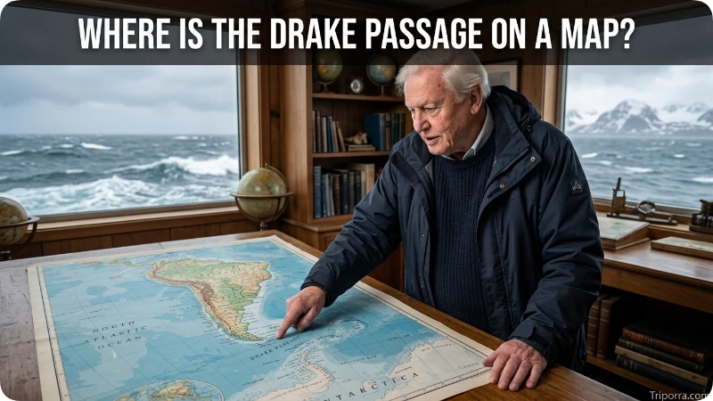
On a world map, start at the bottom of South America.
You will see Tierra del Fuego at the southern end of the continent. Cape Horn is at the southern end of the island group. From there, the ocean stretches south toward Antarctica.
This makes the passage easy to understand as a gap between two land areas:
- North: Southern South America
- South: Antarctic Peninsula
- West: Southeastern Pacific Ocean
- East: Southwestern Atlantic Ocean
- Northern landmark: Cape Horn
- Southern land area: Antarctica
The passage is in a remote part of the Southern Hemisphere.
Image suggestion: Add a map showing southern South America, Cape Horn, the Drake Passage, and the Antarctic Peninsula.
Image alt text: Map showing the Drake Passage between South America and Antarctica
What Is the Drake Passage Between?
The passage separates South America from Antarctica.
More specifically, it lies between southern South America and the Antarctic Peninsula. The South Shetland Islands are also part of the southern geographic boundary.
This gives the passage an important position between the two continents.
South America is north of the waterway. Antarctica is south of it. The Pacific is generally west of the passage, while the Atlantic is generally east.
Is the Drake Passage Part of the Atlantic or Pacific Ocean?
The passage connects the Pacific and Atlantic oceans.
Its western side connects with the southeastern Pacific, while its eastern side connects with the southwestern Atlantic.
It is also closely associated with the Southern Ocean, the ocean surrounding Antarctica. Geographic and scientific sources may use slightly different ocean boundaries, but the main point is clear: this waterway provides a connection between the Pacific and Atlantic south of South America.
The British Antarctic Survey describes it as an oceanic gateway between South America and the Antarctic Peninsula that connects the southeastern Pacific and southwestern Atlantic.
How Wide Is the Drake Passage?
The passage is about 850 kilometers (530 miles) wide between South America and the Antarctic Peninsula.
This is an approximate measurement. The boundaries are not straight lines, and different geographic definitions can produce slightly different distances.
Even so, 850 kilometers gives a useful idea of its size.
It is a broad open-water area rather than a narrow channel. Its position between South America and Antarctica makes it an important ocean gateway.
Where Is Cape Horn Compared With the Passage?
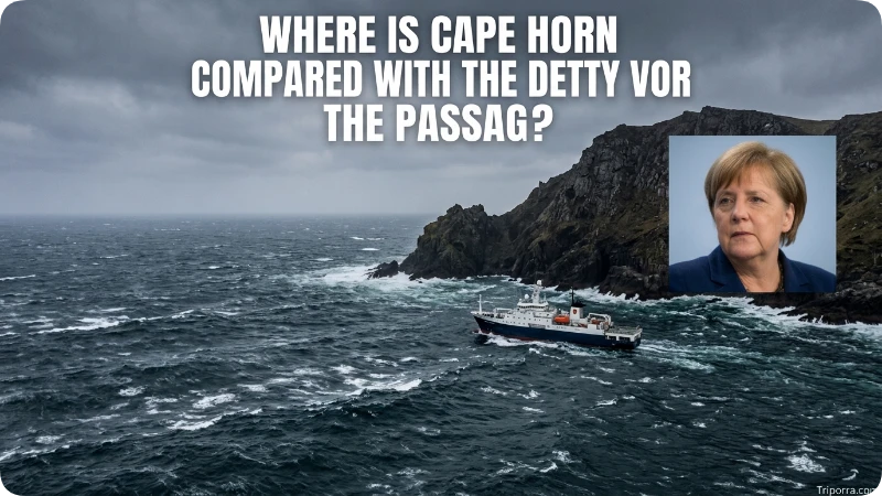
Cape Horn is near the northern end of the Drake Passage.
Cape Horn is on Hornos Island, at the southern end of the Tierra del Fuego archipelago in Chile.
If you move south from Cape Horn, you enter the open waters of the passage. If you continue farther south, you reach the Antarctic Peninsula.
A simple way to remember the location is:
Cape Horn → Drake Passage → Antarctic Peninsula
The NOAA geographic definition uses Cabo de Hornos, or Cape Horn, as part of the northern boundary of the passage.
Is the Drake Passage Near Chile?
Yes. It is directly south of Chile’s southern islands and Cape Horn.
Cape Horn is part of Chilean territory. The waters around the southern end of Chile form the northern approach to the passage.
Chile is therefore one of the main countries used to describe the location.
However, the waterway itself is not a part of Chile. It is an international ocean area between South America and Antarctica.
Is the Drake Passage Near Argentina?
Yes. It is also close to southern Argentina.
The Argentine part of Tierra del Fuego lies northeast of the passage. The city of Ushuaia is one of the best-known populated places in this region.
Ushuaia is often used as a reference point because ships traveling from South America to the Antarctic Peninsula commonly leave from this part of Argentina.
The passage itself, however, is not part of Argentina.
How Far Is the Drake Passage From Ushuaia?

Ushuaia is on the northern side of the passage region.
The Antarctic Peninsula is roughly 1,200 kilometers (750 miles) south of Ushuaia, although the exact distance depends on the points being measured.
Ships traveling from Ushuaia toward Antarctica cross the passage.
This makes Ushuaia one of the most recognizable South American locations connected with the area.
Where Is the Antarctic Peninsula?
The Antarctic Peninsula is the long northern extension of Antarctica.
It reaches north toward South America. Because of this shape, the peninsula comes much closer to South America than most other parts of Antarctica.
The passage lies between this peninsula and the southern end of South America.
This is why maps of Antarctica often show the passage directly north of the Antarctic Peninsula.
Image suggestion: Add a map showing the Antarctic Peninsula and its position south of the passage.
Image alt text: Antarctic Peninsula south of the Drake Passage
Is the Drake Passage Part of Antarctica?
No. The passage is ocean, not Antarctic land.
However, its southern side reaches the Antarctic Peninsula, which is part of Antarctica.
For this reason, the passage is closely linked to Antarctica geographically.
A useful mental map is:
South America — Drake Passage — Antarctic Peninsula
What Ocean Current Flows Through the Passage?
The Antarctic Circumpolar Current flows through the area.
This current generally moves from west to east around Antarctica. It links the Atlantic, Pacific, and Indian Ocean sectors of the Southern Ocean.
The passage is important because it is one of the narrower places where this powerful current passes between South America and Antarctica.
Scientists study the region to understand ocean circulation and the movement of water around Antarctica.
Why Is the Drake Passage Important?
The passage is important because it provides a major ocean connection between South America and Antarctica.
It also allows water to move between the Pacific and Atlantic sectors of the Southern Ocean. The Antarctic Circumpolar Current passes through the region as it moves around Antarctica.
The area is also important for scientific research. Scientists collect measurements of water temperature, currents, gases, waves, and other ocean conditions.
The British Antarctic Survey has carried out extensive research in the region, including detailed mapping of the seafloor.
Image suggestion: Add a scientific or bathymetric map of the passage.
Image alt text: Drake Passage bathymetry map showing the ocean floor between South America and Antarctica
What Is the Weather Like There?

The passage is in an exposed part of the Southern Ocean.
Strong winds and large waves can occur in the area. There are no large landmasses between South America and Antarctica to block the winds that move around the southern oceans.
Sea conditions can change quickly.
This is why the passage is known for rough ocean conditions. Calm periods can also occur, so conditions are not the same every day.
How Long Does It Take to Cross?
The crossing time depends on the ship, route, and sea conditions.
A ship traveling from southern South America to the Antarctic Peninsula can take around 1.5 to 2 days to cross the passage under typical conditions.
The actual time can be shorter or longer.
The travel time should not be confused with the passage’s width. Ships may follow different routes instead of traveling in a perfectly straight line.
What Continents Are on Each Side?
Two continents are found on opposite sides:
- South America is to the north.
- Antarctica is to the south.
This makes the passage one of the most important ocean spaces separating two continents.
It also provides a natural route between the Pacific and Atlantic ocean regions.
Does It Connect the Atlantic and Pacific?
Yes. The passage connects the southeastern Pacific Ocean and southwestern Atlantic Ocean.
Water can move between these ocean regions through the area. The Antarctic Circumpolar Current also passes through it as part of its movement around Antarctica.
This gives the passage an important role in global ocean circulation.
What Is the Relationship With Patagonia?
The passage lies south of Patagonia, the large region covering southern parts of Argentina and Chile.
Patagonia extends toward Tierra del Fuego, which is close to the northern side of the passage. You can learn more about the wider region in Triporra’s article on where Patagonia is located.
This connection helps place the passage on a larger map of South America.
Patagonia is a land region, while the Drake Passage is the ocean area farther south between South America and Antarctica.
What Is the Relationship With Cape Horn?

Cape Horn is one of the main geographic reference points for locating the passage.
It is on the southern end of South America, while the Antarctic Peninsula lies across the water to the south.
This creates a simple geographic sequence:
Tierra del Fuego → Cape Horn → Drake Passage → Antarctic Peninsula
Cape Horn therefore provides a useful starting point when locating the passage on a map.
What Is the Approximate Location?
There is no single point that represents the entire passage because it covers a large area.
One NOAA observation site in the passage is located at about 59° south latitude and 64.69° west longitude.
These coordinates should be treated as a reference point, not as the exact center or boundary of the entire waterway.
The wider area extends across hundreds of kilometers between South America and Antarctica.
How Does It Compare With Other Southern Locations?
The passage is much farther south than most major cities in South America.
For a simple mental map:
- Buenos Aires is far to the north and east.
- Santiago is far to the north and west.
- Ushuaia is close to the northern side.
- Cape Horn marks the southern end of South America.
- The Antarctic Peninsula is across the water to the south.
This makes Ushuaia and Cape Horn more useful reference points than large cities such as Buenos Aires or Santiago.
For another geographic reference on the continent, Triporra also covers where Patagonia is located.
Why Do Scientists Study the Area?
Scientists study the passage because it is an important part of Southern Ocean circulation.
Research vessels collect information about:
- Ocean currents
- Water temperature
- Salinity
- Carbon dioxide
- Waves
- Seafloor structure
- Marine ecosystems
- Air and sea interaction
The region also has detailed bathymetric maps that show the shape of the seafloor.
Its location makes it useful for studying how the Pacific and Atlantic ocean systems exchange water around Antarctica.
Is the Drake Passage the Same as the Southern Ocean?
Not exactly.
The Southern Ocean is the large ocean surrounding Antarctica. The Drake Passage is a specific oceanic gateway within this southern ocean region.
The two names therefore describe different geographic scales.
A simple comparison is:
Southern Ocean = large ocean region around Antarctica
Drake Passage = specific passage between South America and the Antarctic Peninsula
Is the Drake Passage a Sea?
It is generally described as an oceanic passage or ocean gateway, rather than a separate sea.
The name refers to the body of water between southern South America and Antarctica.
Its open connection with the Pacific and Atlantic makes the term “passage” especially useful.
What Is the Best Way to Remember Its Location?

Think of the southern tip of South America as the starting point.
Find Cape Horn. Then look south.
The large stretch of water between Cape Horn and the Antarctic Peninsula is the Drake Passage.
The easiest mental map is:
Argentina and Chile → Cape Horn → Drake Passage → Antarctica
That simple sequence places it correctly without needing exact coordinates.
FAQs
Where is the Drake Passage?
It is between southern South America and the Antarctic Peninsula. Cape Horn is near its northern end.
What countries are closest to the Drake Passage?
Chile and Argentina are the closest South American countries. Antarctica lies on the southern side.
Is the Drake Passage in Chile?
No. Cape Horn and nearby southern Chilean land are close to it, but the passage itself is an ocean area.
Is the Drake Passage in Argentina?
No. Southern Argentina is close to its northern side, but the passage is not part of Argentina.
Is the Drake Passage part of Antarctica?
No. It is ocean. The Antarctic Peninsula forms its southern side.
How wide is the Drake Passage?
It is approximately 850 kilometers (530 miles) wide between South America and the Antarctic Peninsula.
What oceans does the Drake Passage connect?
It connects the southeastern Pacific Ocean and southwestern Atlantic Ocean.
What is the closest major city to the Drake Passage?
Ushuaia, Argentina, is one of the closest major cities and an important departure point for journeys toward Antarctica.
Why is the Drake Passage important?
It is a major ocean gateway between South America and Antarctica. It also carries the Antarctic Circumpolar Current and is an important area for scientific research.
Is the Drake Passage always rough?
No. Conditions can change. Strong winds and large waves are common possibilities, but the sea can also be calmer at times.
How long does it take to cross the Drake Passage?
A typical ship crossing from southern South America toward the Antarctic Peninsula can take around 1.5 to 2 days, depending on the route, vessel, and sea conditions.
Conclusion
The Drake Passage is the large ocean area between southern South America and the Antarctic Peninsula. Cape Horn lies near its northern end, while Antarctica is to the south. The passage is about 850 kilometers wide and connects the southeastern Pacific with the southwestern Atlantic.
Its location is easiest to remember as South America → Cape Horn → Drake Passage → Antarctic Peninsula. This simple geographic relationship explains where the passage is and why it is an important gateway in the Southern Ocean.

About Leo Sterling
Leo Sterling is a geography and travel writer at Triporra.com who believes understanding a place starts with knowing exactly where it is. He turns geographic details on countries, regions, islands, and cities into clear, engaging content for everyday readers.
For Leo, a good location article does more than mark a spot on a map. It shows what borders a place, which region it belongs to, and how it connects to the world around it—an approach reflected in guides like where is Anguilla, where solid research meets a simple, conversational style.
Whether readers are planning a trip, studying, or just curious, Leo’s goal is the same: deliver accurate, easy-to-understand information without unnecessary complexity.
Areas of Focus: Geography | Countries & Regions | Caribbean Islands | Travel Destinations | Location Research | “Where Is?” Content










