The Arabian Peninsula is in southwestern Asia, in the southern part of the Middle East. It lies between the Red Sea to the west, the Persian Gulf to the northeast, and the Gulf of Oman and Arabian Sea to the east and south. Saudi Arabia covers most of the peninsula, while Yemen and Oman occupy much of the southern and southeastern areas.
Introduction
The answer to where is the Arabian Peninsula is simple: it is a large landmass in southwestern Asia, between Africa and the rest of Asia. It forms the southwestern part of the Asian continent and extends southward into the waters of the Red Sea, Gulf of Aden, and Arabian Sea.
The Arabian Peninsula is a geographic region, not a country. Saudi Arabia covers most of its mainland. Yemen is in the southwest, while Oman occupies much of the southeast. The United Arab Emirates, Qatar, and Kuwait are on the eastern and northeastern side. Bahrain is an island country in the Persian Gulf that is commonly grouped with the peninsula’s countries.
The region has clear water boundaries on three sides. The Red Sea separates it from Africa, while the Persian Gulf, Gulf of Oman, and Arabian Sea surround much of its eastern and southern sides. Its northern boundary is less clearly defined because the peninsula gradually connects with mainland Asia.
Quick Facts About the Arabian Peninsula
| Fact | Information |
|---|---|
| Location | Southwestern Asia |
| Broader Region | Middle East |
| Continent | Asia |
| Geographic Type | Peninsula and geographic region |
| Approximate Area | About 1.2 million sq mi (3.1 million sq km) |
| Largest Country | Saudi Arabia |
| Main Countries | Saudi Arabia, Yemen, Oman, UAE, Qatar, Kuwait, Bahrain |
| West | Red Sea |
| Southwest | Gulf of Aden and Bab el-Mandeb |
| South and Southeast | Arabian Sea |
| East | Gulf of Oman |
| Northeast | Persian Gulf |
| Major Desert | Arabian Desert |
| Major Sand Desert | Rub’ al Khali (Empty Quarter) |
| Northern Boundary | Broadly connected to mainland West Asia |
Area note: The exact size of the Arabian Peninsula varies slightly among geographic sources because its northern boundary does not have one universally accepted physical line. Most estimates place its area at about 1.2 million square miles (3.1 million square kilometers).
Where Is the Arabian Peninsula Located?
The Arabian Peninsula is located in southwestern Asia, south of the Levant and Mesopotamia. It occupies the southwestern corner of the Asian continent and sits between the eastern coast of Africa and the larger Asian mainland.
Its location can be understood through four major directions:
- West: The Red Sea separates the peninsula from northeastern Africa.
- South: The Gulf of Aden and Arabian Sea extend along the southern side.
- East: The Gulf of Oman and Arabian Sea border the southeastern coast.
- Northeast: The Persian Gulf separates the peninsula from Iran.
The northern side is different. There is no single ocean separating the Arabian Peninsula from the rest of Asia. Instead, the land gradually connects with the deserts and plains of Iraq, Jordan, and other parts of the Middle East.
A Simple Mental Map
For an easy mental picture, place Saudi Arabia in the center.
Then:
- Yemen is to the southwest.
- Oman is to the southeast.
- The United Arab Emirates is to the east.
- Qatar extends into the Persian Gulf from the eastern side.
- Kuwait is near the northeastern edge.
- Bahrain is an island in the Persian Gulf near the eastern coast.
- The Red Sea is to the west.
- The Persian Gulf is to the northeast and east.
- The Arabian Sea is to the south and southeast.
This gives you a clear picture of the peninsula without needing to memorize every border.
What Countries Are on the Arabian Peninsula?
The countries most commonly associated with the Arabian Peninsula are:
- Saudi Arabia
- Yemen
- Oman
- United Arab Emirates
- Qatar
- Kuwait
- Bahrain
The first six have mainland territory on or directly connected to the peninsula. Bahrain is an island country in the Persian Gulf and is commonly included in discussions of the Arabian Peninsula because of its geographic and regional relationship with the peninsula.
Some broader geographic definitions also include parts of Jordan and Iraq. The reason is that the northern boundary of the peninsula is not sharply marked by a major sea or mountain system.
Saudi Arabia
Saudi Arabia occupies most of the Arabian Peninsula and is the largest country in the region.
It stretches from the Red Sea in the west to the Persian Gulf in the east. Yemen lies along its southern border, while Oman and the United Arab Emirates are farther southeast. Kuwait lies toward the northeastern side.
The capital, Riyadh, is in the interior. Jeddah is on the Red Sea coast, while Mecca and Medina are in western Saudi Arabia.
Because of its size and central position, Saudi Arabia is the easiest geographic reference point for understanding the Arabian Peninsula.
Yemen
Yemen occupies the southwestern part of the Arabian Peninsula.
It borders Saudi Arabia to the north and Oman to the east. The country’s coastline reaches the Red Sea, Gulf of Aden, and Arabian Sea.
Its capital, Sana’a, lies in the mountainous interior. Aden is an important coastal city farther south.
Yemen’s position makes it a useful reference point for the southern end of the peninsula.
Oman
Oman occupies the southeastern part of the Arabian Peninsula.
It borders Saudi Arabia and the United Arab Emirates to the west and northwest and Yemen to the southwest. Its coastline faces the Gulf of Oman and Arabian Sea.
The capital, Muscat, is on the northern coast.
Oman also includes the Musandam Peninsula, which projects toward the Strait of Hormuz and is separated from the main part of Oman by UAE territory.
United Arab Emirates
The United Arab Emirates, or UAE, is on the eastern side of the Arabian Peninsula.
It shares borders with Saudi Arabia and Oman and has a long coastline along the Persian Gulf and Gulf of Oman.
Abu Dhabi is the capital, while Dubai is the country’s best-known major city. Both are useful reference points when locating the eastern Arabian Peninsula.
Qatar
Qatar is a small peninsula extending northward from the eastern side of the Arabian Peninsula.
It has a land border with Saudi Arabia and is surrounded by the Persian Gulf on its other sides.
The capital, Doha, is on the eastern coast.
This creates an important geographic distinction: Qatar is a peninsula within the larger Arabian Peninsula region.
Kuwait
Kuwait is located at the northeastern edge of the Arabian Peninsula.
It borders Iraq to the north and Saudi Arabia to the south. Its eastern coastline faces the Persian Gulf.
Kuwait City is the country’s main urban center and lies along the gulf coast.
Bahrain
Bahrain is an island country in the Persian Gulf, just off the eastern coast of the Arabian Peninsula.
It is not part of the peninsula’s mainland. However, it is commonly grouped with the Arabian Peninsula’s countries because of its location and close geographic relationship with the region.
Manama, the capital, is located on Bahrain’s main island.
Are Jordan and Iraq Part of the Arabian Peninsula?
This depends on the geographic definition being used.
The seven countries most commonly associated with the Arabian Peninsula are Saudi Arabia, Yemen, Oman, the UAE, Qatar, Kuwait, and Bahrain. However, some broader definitions extend the region northward into parts of Jordan and Iraq.
The reason is that the peninsula’s northern edge is not clearly marked by an ocean. Instead, the Arabian landmass gradually merges with the larger deserts and plains of mainland West Asia.
For a simple location answer, it is best to think of Saudi Arabia, Yemen, Oman, the UAE, Qatar, Kuwait, and Bahrain as the main countries associated with the Arabian Peninsula, while recognizing that geographic definitions can vary at the northern edge.
What Surrounds the Arabian Peninsula?
Several major bodies of water make the location of the Arabian Peninsula easy to understand.
Red Sea
The Red Sea forms the western boundary of the Arabian Peninsula.
Saudi Arabia and Yemen have coastlines along its eastern side. Across the water are countries in northeastern Africa, including Egypt, Sudan, and Eritrea.
The Red Sea continues south toward the Bab el-Mandeb Strait, which connects it with the Gulf of Aden.
Gulf of Aden
The Gulf of Aden lies south of Yemen.
It separates the southern Arabian Peninsula from the Horn of Africa, including Djibouti and Somalia.
The gulf connects the Red Sea area with the Arabian Sea, giving the southern peninsula an important link to the wider Indian Ocean.
Arabian Sea
The Arabian Sea lies south and southeast of the Arabian Peninsula.
It forms part of the northern Indian Ocean and stretches toward India and Pakistan.
Oman has a particularly long coastline facing the Arabian Sea, while Yemen also reaches the sea along its southern coast.
Gulf of Oman
The Gulf of Oman lies along the northeastern coast of Oman and the eastern UAE.
It connects the Arabian Sea with the Persian Gulf through the Strait of Hormuz.
This makes the Gulf of Oman an important geographic reference when locating Oman and the southeastern Arabian Peninsula.
Persian Gulf
The Persian Gulf lies along much of the northeastern and eastern side of the Arabian Peninsula.
Saudi Arabia, Kuwait, Qatar, Bahrain, and the UAE have coastlines along the gulf. Iran lies across the water to the north.
The gulf is one of the clearest geographic markers for the eastern side of the peninsula.
Where Is the Arabian Peninsula Near?
The Arabian Peninsula occupies a position between several major regions.
Africa
Africa lies west and southwest of the Arabian Peninsula.
The Red Sea separates most of the peninsula from northeastern Africa. At the southern end, the Bab el-Mandeb Strait separates Yemen from Djibouti and Eritrea.
This makes the Arabian Peninsula much closer to Africa than a basic world map might suggest.
Iran
Iran lies north and northeast of the Arabian Peninsula across the Persian Gulf and Gulf of Oman.
The eastern countries and coastal areas of the peninsula are therefore much closer to Iran than its western side.
The Strait of Hormuz provides the narrow maritime connection between the Persian Gulf and Gulf of Oman.
India and Pakistan
India and Pakistan are east of the Arabian Peninsula across the Arabian Sea.
Oman is the peninsula’s closest major geographic link toward South Asia. Its eastern and southern coastlines face the Arabian Sea.
The exact distance varies greatly depending on the starting point. For example, eastern Oman is much closer to western India than western Saudi Arabia is.
The Levant
The Levant lies north and northwest of the Arabian Peninsula.
Jordan provides a geographic connection between the Arabian Peninsula and the Levant. Iraq is also near the northern edge of the peninsula.
Unlike the coastal boundaries, this northern transition is gradual rather than clearly marked by one major physical feature.
Where Is the Arabian Peninsula on a Map?
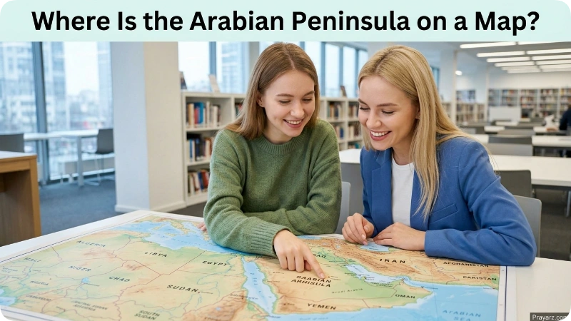
On a world map, first locate Asia and then move to its southwestern corner.
Look for Saudi Arabia. It occupies most of the large landmass that projects southward from mainland Asia.
From there:
- The Red Sea is west.
- Yemen is southwest and south.
- Oman is southeast.
- The UAE is east.
- Qatar extends into the Persian Gulf.
- Kuwait is near the northeastern edge.
- Bahrain is an island in the Persian Gulf.
- Iran is across the Persian Gulf and Gulf of Oman.
- Africa is across the Red Sea and Gulf of Aden.
- India and Pakistan are across the Arabian Sea.
This map relationship is the quickest way to understand the peninsula’s position in the world.
How Large Is the Arabian Peninsula?
The Arabian Peninsula covers roughly 1.2 million square miles, or about 3.1 million square kilometers.
That makes it one of the world’s largest peninsulas.
Its large size is important when discussing distances. The Arabian Peninsula is not a small area surrounding one city. It contains several countries and stretches across thousands of miles of coastline and inland terrain.
For that reason, saying that a city is “near the Arabian Peninsula” is often less useful than identifying its relationship with a specific country or coast.
For example, Muscat is in southeastern Arabia, while Jeddah is on the western side along the Red Sea. Both are on the Arabian Peninsula, but they are far apart.
What Is the Geography of the Arabian Peninsula?
The Arabian Peninsula has a varied physical landscape, although much of the interior is dry and desert-dominated.
Major geographic features include:
- Large deserts
- Rocky plateaus
- Mountain ranges
- Coastal plains
- Dry valleys
- Sandy regions
- Highlands in parts of Yemen and Oman
The interior is generally much drier than some of the mountain and coastal areas.
The western side has mountain ranges that run roughly parallel to the Red Sea. Yemen and southwestern Saudi Arabia contain some of the region’s higher elevations.
Oman also has major mountain areas, especially in the north.
The landscape changes considerably from the Red Sea coast to the central desert and then toward the mountains and coasts of Oman and Yemen.
Where Is the Arabian Desert?
The Arabian Desert covers a large part of the Arabian Peninsula.
It extends across much of Saudi Arabia and into neighboring areas of Oman, Yemen, the UAE, Jordan, and Iraq, depending on the geographic definition used.
The desert is not one single landscape. It includes sand seas, gravel plains, rocky terrain, and other dry environments.
The vast desert interior is one of the main physical features that distinguishes the Arabian Peninsula from many other parts of Asia.
Where Is the Empty Quarter?
The Rub’ al Khali, commonly called the Empty Quarter, is a huge sand desert in the southern part of the Arabian Peninsula.
Most of the Empty Quarter is in Saudi Arabia, with smaller portions extending into Oman, the United Arab Emirates, and Yemen.
It occupies a large area south and southeast of central Saudi Arabia.
The Empty Quarter is one of the most useful geographic landmarks for understanding the southern Arabian interior. It lies between major populated areas of Saudi Arabia and the countries farther southeast.
Is the Arabian Peninsula in Asia or the Middle East?
The Arabian Peninsula is geographically located in Asia.
More specifically, it is part of West Asia. It is also one of the major geographic regions that make up the broader Middle East.
These terms describe different levels of geography:
- Continent: Asia
- Subregion: West Asia
- Broader region: Middle East
- Geographic landform: Arabian Peninsula
So, if someone asks whether the Arabian Peninsula is in Asia or the Middle East, both can be correct when used in their proper geographic context. Asia identifies the continent, while the Middle East identifies the broader regional setting.
Why Is the Arabian Peninsula Geographically Important?
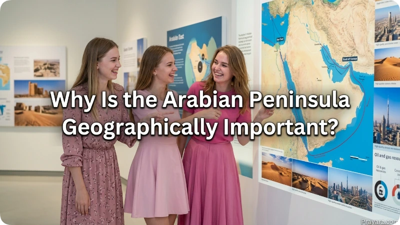
The Arabian Peninsula has a distinctive position between Asia and Africa and beside several major waterways.
The Red Sea and Bab el-Mandeb connect the waters around Arabia with the wider Indian Ocean and the route toward the Suez Canal and Mediterranean Sea.
On the eastern side, the Strait of Hormuz connects the Persian Gulf with the Gulf of Oman and Arabian Sea.
As a result, the peninsula sits beside several major maritime routes. Its location also places it close to Africa, Iran, Central Asia, and South Asia.
This geographic position helps explain why the Arabian Peninsula is an important reference point when studying the geography of the Middle East.
Frequently Asked Questions
1. Where is the Arabian Peninsula?
The Arabian Peninsula is in southwestern Asia, in the southern part of the Middle East. It lies between the Red Sea, Persian Gulf, Gulf of Oman, Gulf of Aden, and Arabian Sea.
2. Is the Arabian Peninsula a country?
No. It is a large geographic landmass and region that contains several countries.
3. What countries are on the Arabian Peninsula?
The main countries associated with the peninsula are Saudi Arabia, Yemen, Oman, the United Arab Emirates, Qatar, Kuwait, and Bahrain. Some broader geographic definitions also include parts of Jordan and Iraq.
4. Which country covers most of the Arabian Peninsula?
Saudi Arabia covers most of the peninsula and is its largest country.
5. Is the Arabian Peninsula in Asia?
Yes. It is located in southwestern Asia, or West Asia.
6. Is the Arabian Peninsula part of the Middle East?
Yes. The Arabian Peninsula is one of the main geographic areas within the broader Middle East.
7. What is west of the Arabian Peninsula?
The Red Sea is west of the peninsula. Northeastern Africa lies across the Red Sea.
8. What is east of the Arabian Peninsula?
The Persian Gulf, Gulf of Oman, and Arabian Sea lie along the eastern and southeastern sides. Iran is across the Persian Gulf and Gulf of Oman.
9. What is south of the Arabian Peninsula?
The Gulf of Aden and Arabian Sea lie along its southern side. Yemen occupies much of the southwestern part of the peninsula.
10. Is Qatar part of the Arabian Peninsula?
Yes. Qatar is a smaller peninsula extending northward from the eastern side of the Arabian Peninsula.
11. Is Bahrain part of the Arabian Peninsula?
Bahrain is an island country in the Persian Gulf rather than part of the mainland peninsula. However, it is commonly grouped with the countries of the Arabian Peninsula.
12. Is Yemen on the Arabian Peninsula?
Yes. Yemen occupies the southwestern part of the Arabian Peninsula.
13. Is Oman on the Arabian Peninsula?
Yes. Oman occupies the southeastern part of the Arabian Peninsula and has coastlines along the Gulf of Oman and Arabian Sea.
14. What is the largest desert on the Arabian Peninsula?
The Arabian Desert is the major desert region covering much of the peninsula. The Rub’ al Khali, or Empty Quarter, is its largest continuous sand desert.
15. Where is the Arabian Peninsula compared with India?
The Arabian Peninsula is west of India, with the Arabian Sea between them. Oman provides one of the closest geographic connections between the peninsula and western India.
16. Where is the Arabian Peninsula compared with Africa?
The Arabian Peninsula is east and northeast of northeastern Africa. The Red Sea separates most of the two regions, while the Bab el-Mandeb Strait separates Yemen from the Horn of Africa.
Conclusion
The Arabian Peninsula is located in southwestern Asia, within the broader Middle East. Saudi Arabia occupies most of the peninsula, while Yemen, Oman, the UAE, Qatar, and Kuwait occupy other major parts. Bahrain is an island country in the Persian Gulf that is commonly associated with the region.
The clearest mental map is Saudi Arabia in the center, the Red Sea to the west, Yemen to the southwest, Oman to the southeast, and the Persian Gulf along the northeast and east. Across the surrounding waters are Africa to the west and southwest, Iran to the northeast, and India and Pakistan farther east.
In short, the Arabian Peninsula is the large southwestern Asian landmass positioned between the Red Sea, Persian Gulf, Gulf of Oman, Gulf of Aden, and Arabian Sea.

About Leo Sterling
Leo Sterling is a geography and travel writer at Triporra.com who believes understanding a place starts with knowing exactly where it is. He turns geographic details on countries, regions, islands, and cities into clear, engaging content for everyday readers.
For Leo, a good location article does more than mark a spot on a map. It shows what borders a place, which region it belongs to, and how it connects to the world around it—an approach reflected in guides like where is Anguilla, where solid research meets a simple, conversational style.
Whether readers are planning a trip, studying, or just curious, Leo’s goal is the same: deliver accurate, easy-to-understand information without unnecessary complexity.
Areas of Focus: Geography | Countries & Regions | Caribbean Islands | Travel Destinations | Location Research | “Where Is?” Content