
The equator is an imaginary circle around the widest part of Earth. It sits halfway between the North and South Poles and forms the starting point for measuring latitude. Its global route shapes climate, ecosystems, navigation, timekeeping, and even the way rockets are launched.
Where is the equator
It is located at 0 degrees latitude and circles Earth from west to east. The line divides the planet into the Northern and Southern Hemispheres, crossing parts of South America, Africa, Asia, three major oceans, and several island regions.
Quick Facts About the Equator
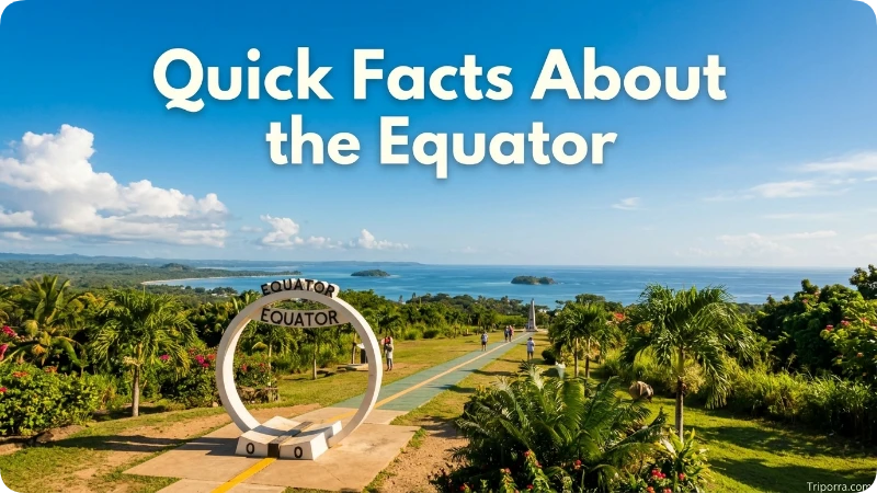
| Fact | Details |
|---|---|
| Official Name | Earth’s Equator |
| Classification | Imaginary line of latitude |
| Coordinates | 0° latitude at every longitude |
| Approximate Length | 40,075 kilometres (24,901 miles) |
| Position | Halfway between the North Pole and the South Pole |
| Hemispheres Divided | Northern Hemisphere and Southern Hemisphere |
| Main Regions Crossed | South America, Africa, and Southeast Asia |
| Oceans Crossed | Atlantic Ocean, Indian Ocean, and Pacific Ocean |
| Countries Crossed | 11 sovereign countries |
| Known For | Dividing Earth into two hemispheres, climate patterns, latitude measurement, biodiversity, and Earth’s rotational speed |
| Earth’s Equatorial Diameter | Approximately 12,756 kilometres (7,926 miles) |
| Earth’s Polar Diameter | Approximately 12,714 kilometres (7,900 miles) |
| Interesting Fact | Earth is slightly wider at the Equator than from pole to pole, creating an equatorial bulge due to its rotation. |
Where Is the Equator?
This line runs around the middle of the planet at 0° latitude. Every location north of it has a northern latitude, while every point south of it has a southern latitude. Lines parallel to it are used to calculate how far north or south a place lies.
The route crosses northern South America, central Africa and parts of Indonesia. It also travels through the Atlantic, Indian and Pacific Oceans. In human-distance terms, it lies approximately 24 kilometres north of central Quito in Ecuador, around 32 kilometres south of Kampala in Uganda and roughly 6 kilometres north of central Kisumu in Kenya.
This is the simplest answer to where is the equator: it is not in one country or city. It is a complete global circle, with most of its route passing over water rather than land.
The Equator on the Map
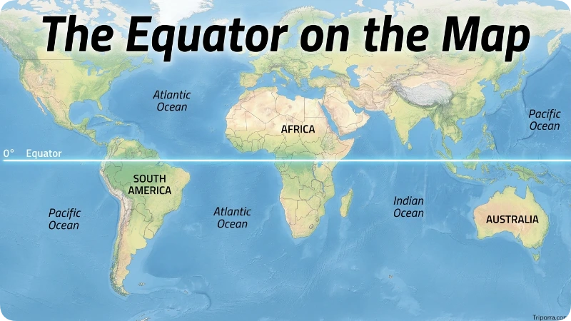
On a standard world map, the line appears horizontally across the centre. It begins at no fixed starting point because it forms an unbroken circle. Geographers often describe its route from the Prime Meridian, where 0° latitude meets 0° longitude in the Gulf of Guinea.
From there, it travels east across central Africa, the Indian Ocean and Indonesia. It continues through the Pacific, reaches Ecuador’s Galápagos Islands and mainland, then passes across Colombia and northern Brazil before returning to the Atlantic.
The line crosses land in these 11 sovereign states:
- São Tomé and Príncipe
- Gabon
- Republic of the Congo
- Democratic Republic of the Congo
- Uganda
- Kenya
- Somalia
- Indonesia
- Ecuador
- Colombia
- Brazil
It also passes through the territorial seas of the Maldives, Kiribati and the United States near Baker Island. This difference explains why some maps say 11 countries while popular lists may report 13 or more. They are not always counting the same type of territory.
Equator Countries by Continent
The Equator crosses 11 sovereign countries across Africa, South America, and Asia. Although the Equator circles the entire Earth, only a small number of countries lie directly on 0° latitude.
Africa
The Equator crosses seven African countries:
- São Tomé and Príncipe
- Gabon
- Republic of the Congo
- Democratic Republic of the Congo
- Uganda
- Kenya
- Somalia
Africa has the highest number of Equator countries. The line passes through tropical rainforests, lakes, mountains, and grasslands, making the continent one of the most geographically diverse regions along the Equator.
South America
The Equator crosses three South American countries:
- Ecuador
- Colombia
- Brazil
In South America, the line travels through the Andes Mountains, the Amazon rainforest, and the Galápagos Islands before reaching the Atlantic Ocean.
Asia
Indonesia is the only Asian country crossed by the Equator. The line runs across several Indonesian islands, making it one of the few places where people can easily visit an Equator monument in Southeast Asia.
Pole and Equator: What’s the Difference?
The Equator and the poles are opposite reference points on Earth. The Equator lies at 0° latitude and divides the planet into the Northern and Southern Hemispheres, while the North Pole and South Pole are located at 90° north and 90° south latitude. Areas near the Equator receive fairly consistent daylight and warm temperatures throughout the year, whereas the poles experience extreme seasonal daylight changes and much colder climates. Together, they help define Earth’s latitude system and global climate zones.
Where Is the Equator in Africa?
Africa is the continent with the largest number of countries crossed by the Equator. The line passes through São Tomé and Príncipe, Gabon, the Republic of the Congo, the Democratic Republic of the Congo, Uganda, Kenya, and Somalia.
Some of Africa’s best-known Equator landmarks include the Equator crossing near Nanyuki in Kenya, islands in Lake Victoria, and rainforest regions in Central Africa. These areas experience warm temperatures throughout the year, although rainfall and elevation create different climates from one country to another.
Because the Equator crosses forests, lakes, mountains, and dry regions, Africa demonstrates that being on the Equator does not mean every place has the same landscape or weather.
Where Is the Equator in South America?
The Equator crosses Ecuador, Colombia, and Brazil before continuing across the Atlantic Ocean. Much of its route passes through the Amazon rainforest, while another section crosses the Andes Mountains and Ecuador’s famous Galápagos Islands.
Ecuador is one of the most popular destinations for visitors who want to stand on the Equator. Attractions such as Ciudad Mitad del Mundo and the Quitsato Sundial allow travellers to experience the world’s most famous latitude line. In Colombia and Brazil, much of the Equator passes through remote rainforest areas with extraordinary biodiversity.
Why Is the Equator Important?
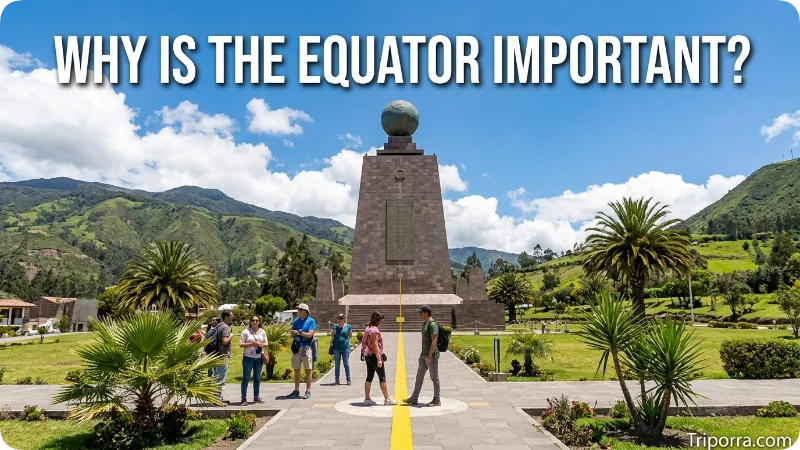
Its strongest role is as the world’s main reference line for latitude. The equator is numbered 0°, the North Pole is 90° north, and the South Pole is 90° south. Together with longitude, these measurements form the coordinate system used in maps, aircraft navigation, shipping and GPS devices. One degree of latitude covers approximately 111 kilometres.
One of the most noticeable effects of the Equator is the consistent amount of sunlight it receives throughout the year. As a result, many equatorial regions experience nearly equal lengths of day and night. The Equator also influences global weather patterns, ocean circulation and biodiversity, making it one of the most important reference lines in geography.
The line also marks the widest part of Earth. Because the planet rotates, material is pushed slightly outward around its middle. A person standing there is moving eastward at roughly 1,670 kilometres per hour as Earth spins, even though the ground feels still.
This rotational speed gives spacecraft an extra push when they launch eastward from low latitudes. Less fuel may be needed to reach certain orbits compared with a launch from farther north or south. That is why several space facilities are built in or near tropical latitudes.
The equatorial zone is also linked with some of Earth’s largest rainforests, including the Amazon and Congo basins and the forests of Southeast Asia. These regions receive strong sunlight throughout the year and support extraordinary plant and animal diversity.
What most guides miss is that the line does not guarantee low, flat or humid land. It passes through islands, rainforest, lakes, dry areas and high mountain landscapes. Elevation can produce cool conditions even very close to 0° latitude.
Which Country Is Closest to the Equator?
Although the Equator crosses 11 countries, several others lie very close to 0° latitude without being crossed by the line. Countries such as Equatorial Guinea, despite its name, are not crossed by the Equator. Among the countries the Equator does cross, Ecuador, Kenya, Uganda and Indonesia are well known for having cities and landmarks located directly on or very near the line. The closest country depends on whether you mean a country crossed by the Equator or one located just north or south of it.
If you are referring to countries that the Equator actually crosses, the answer includes Ecuador, Colombia, Brazil, Uganda, Kenya, Indonesia, Somalia, Gabon, the Republic of the Congo, the Democratic Republic of the Congo, and São Tomé and Príncipe. If you mean the nearest country that is not crossed by the Equator, the answer depends on how close its borders are to 0° latitude.
How the Equator Was Measured
People understood that Earth was round long before modern satellites. Around the third century BCE, the Greek scholar Eratosthenes compared shadows in Alexandria and Syene, now Aswan, in Egypt. He used the difference in the Sun’s angle and the distance between the two cities to estimate Earth’s circumference.
His result was close to modern measurements, even though he worked with basic tools and long-distance estimates. NOAA describes his calculation as remarkably accurate for a method developed more than 2,000 years ago.
During the 18th century, scientists debated whether Earth was stretched at the poles or flattened there. French-led measuring expeditions were sent near the equator in present-day Ecuador and toward the Arctic region of Europe. Their measurements supported Isaac Newton’s view that Earth is slightly flattened at the poles and wider around the middle.
Modern GPS, satellite observations and geodesy now allow scientists to measure Earth’s shape and surface movement with very high accuracy. The mapped line remains 0° latitude, although Earth’s real rotation axis can shift slightly over time.
Climate and Weather Near the Equator
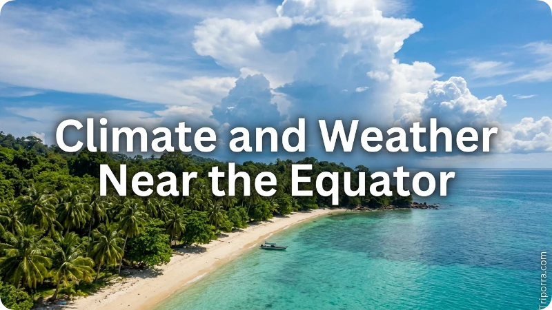
Areas near 0° latitude receive strong solar energy throughout the year. Day length changes very little compared with places in Europe, North America or the far south. Many equatorial regions experience wet and dry periods rather than four clear seasons.
Tropical rainforest areas often have warm mornings, humid afternoons and frequent rain. Typical tropical-wet temperatures may range from around 20–23°C before sunrise to 30–33°C in the afternoon. However, these figures do not apply to every location on the line.
High-altitude parts of Ecuador, Colombia, Kenya and other nearby regions can be cool. Mountain weather may change within hours. Coastal islands can have different rainy months from inland forests because regional winds, ocean currents and the movement of the Intertropical Convergence Zone affect rainfall.
Travellers often overlook this seasonal trap: “near the equator” does not mean every month has identical weather. Temperature may remain steady while rainfall, road conditions and cloud cover change sharply.
Is the Equator Hot?
Yes, the Equator is generally warm because it receives direct sunlight throughout the year. However, it is not always the hottest place on Earth. Frequent cloud cover, heavy rainfall, and high humidity often keep temperatures lower than those in many subtropical deserts.
Altitude also has a major effect on temperature. For example, Quito in Ecuador lies close to the Equator but has a mild climate because it sits high in the Andes Mountains. This shows that elevation can influence temperature just as much as latitude.
Places to Experience the Equator
Monuments and Science Sites
Ciudad Mitad del Mundo, Ecuador: This large monument and museum complex stands north of Quito. It is one of the world’s most photographed equatorial attractions, although the monument itself is slightly away from the modern GPS position of 0°.
Quitsato Sundial, Ecuador: Located near Cayambe, this circular solar site uses the equatorial location to explain the Sun, shadows, seasons and Earth’s position.
Marco Zero, Macapá, Brazil: A monument and viewing area mark the line as it crosses the Brazilian city. The nearby stadium is known for sitting close to both hemispheres.
Pontianak Equator Monument, Indonesia: Pontianak is one of the best-known cities crossed by the line. Its monument hosts educational displays and solar-shadow events.
Nature and Landscapes
Isabela Island, Galápagos: The line crosses Ecuador’s largest Galápagos island, an area known for volcanic terrain, marine life and distinctive wildlife.
Lake Victoria: The route crosses the lake and several Ugandan islands before continuing toward Kenya.
Ilhéu das Rolas: This small island south of São Tomé has a marker showing the passage of 0° latitude.
Amazon Basin: The line cuts across remote forest areas of Ecuador, Colombia and Brazil, including regions with rivers, wetlands and very high biodiversity.
Equatorial Kenya: Signs and demonstrations are found near towns such as Nanyuki and around roads crossing 0° latitude.
Travellers often overlook how different these locations feel. Standing at a tiled monument near a city is very different from reaching an equatorial island, rainforest or mountain road.
Best Time to Visit an Equatorial Landmark
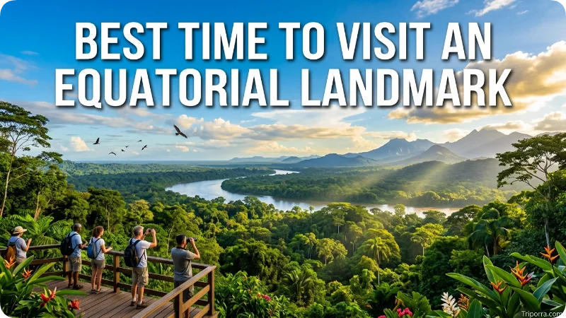
There is no single best month because the line circles the world. Choose the destination first, then check its local wet season, road access and altitude.
Dry or relatively less-rainy periods are usually easier for outdoor sightseeing, boat trips and rainforest roads. These months can also bring higher visitor numbers and increased accommodation prices. Wetter periods may offer greener scenery, stronger waterfalls and fewer crowds, but heavy showers can interrupt transport.
Highland destinations near Quito or Cayambe require sun protection and a light jacket throughout the year. The sunlight can feel strong during the day, while cloud, wind and elevation may make evenings cool.
For Indonesia, the Amazon, East Africa or island destinations, never rely on a general “equatorial climate” chart alone. Rainfall timing differs across oceans and regions.
Common Misconceptions
A search for where is the equator often brings up several misleading claims. Equatorial Guinea is not crossed by the line despite its name; most of the country is north of it, while Annobón Island lies south.
Another wrong idea is that the equatorial zone must contain the hottest places on Earth. Humidity, cloud, rain and elevation often keep temperatures below those found in dry subtropical deserts.
Maps also disagree on the number of countries because some count only land crossings, while others include territorial waters.
Related Geographic Lines
Prime Meridian: The 0° longitude line passes through Greenwich in London and divides the Eastern and Western Hemispheres.
Tropic of Cancer: Located approximately 23.5° north, it marks the northern limit where the midday Sun can appear directly overhead.
Tropic of Capricorn: Found approximately 23.5° south, it is the southern partner of the Tropic of Cancer.
International Date Line: This irregular line lies mostly in the Pacific Ocean and separates one calendar day from the next.
Arctic and Antarctic Circles: These high-latitude lines mark regions where 24-hour daylight or darkness can occur during parts of the year.
What Else Do People Want to Know?
There is no special equator visa, currency or language. Entry rules depend entirely on the country being visited. A trip to a marker in Ecuador requires different documents and costs from a visit to Kenya, Brazil or Indonesia.
Urban monuments such as those near Quito, Macapá and Pontianak are generally easier to reach than rainforest, island or lake crossings. Remote locations may require guides, boats, permits or organised transport.
At many markers, visitors are offered demonstrations involving balancing objects or draining water. Treat these as entertainment unless the experiment is carried out under controlled scientific conditions. Small changes in the bowl, water movement or setup can affect the result more than the Coriolis effect, which is most important across large weather and ocean systems.
Frequently Asked Questions
Where is the Equator on a map?
The Equator appears as the horizontal line at 0° latitude, running around the middle of Earth and dividing it into the Northern and Southern Hemispheres.
Where is the Equator in the world?
The Equator circles the Earth at 0° latitude, crossing parts of South America, Africa, Southeast Asia, and the Atlantic, Indian, and Pacific Oceans.
What is the Equator in geography?
In geography, the Equator is an imaginary line at 0° latitude that serves as the starting point for measuring latitude and divides Earth into two hemispheres.
Which countries does the Equator pass through?
The Equator crosses 11 countries: Ecuador, Colombia, Brazil, São Tomé and Príncipe, Gabon, Republic of the Congo, Democratic Republic of the Congo, Uganda, Kenya, Somalia, and Indonesia.
What is the Equator of Earth?
The Equator is an imaginary circle around Earth’s widest point at 0° latitude, separating the Northern and Southern Hemispheres.
Which country is closest to the Equator?
Several countries lie very close to the Equator, while 11 countries are crossed by it, including Ecuador, Kenya, Uganda, and Indonesia.
What is the difference between the Pole and the Equator?
The Equator is at 0° latitude around Earth’s middle, while the North and South Poles are at 90° latitude and mark the planet’s northernmost and southernmost points.
What happens at the Equator?
The Equator receives strong sunlight year-round, resulting in nearly equal day and night lengths and supporting diverse tropical climates and ecosystems.
Can hurricanes cross the equator?
Tropical cyclones rarely form very close to 0° because the Coriolis effect is too weak to create the rotation they need. Established storms also almost never cross from one hemisphere to the other.
Where is the equator located on a globe?
Find the horizontal line marked 0° latitude halfway between the North and South Poles. It usually appears through northern South America, central Africa and Indonesia.
What country is on the Equator?
The Equator passes through 11 countries across South America, Africa, and Asia. These countries are Ecuador, Colombia, Brazil, São Tomé and Príncipe, Gabon, the Republic of the Congo, the Democratic Republic of the Congo, Uganda, Kenya, Somalia, and Indonesia.
What state in the US is closest to the Equator?
Hawaii is the U.S. state closest to the Equator because it is located farther south than any other state. However, the Equator does not pass through any part of the United States.
How hot is it at the Equator?
Temperatures near the Equator commonly range from 20°C to 33°C (68°F to 91°F), depending on elevation, rainfall, and local climate. Some mountain regions near the Equator remain cool throughout the year, while lowland rainforest areas are warm and humid.
What country can you stand on the Equator in?
You can stand on the Equator in several countries, including Ecuador, Kenya, Uganda, Indonesia, Brazil, Colombia, Gabon, Somalia, the Republic of the Congo, the Democratic Republic of the Congo, and São Tomé and Príncipe. Ecuador is especially popular because of its famous Equator monuments near Quito.
Final Thoughts
Once you understand where is the equator, it becomes easier to read maps, coordinates, climate zones and hemispheres. The line links rainforests, cities, oceans, islands and highlands across the entire planet. Choose one of the accessible monuments for a simple visit, or explore its wider route to see how much geography can change along a single latitude.

About Leo Sterling
Leo Sterling is a geography and travel writer at Triporra.com who believes understanding a place starts with knowing exactly where it is. He turns geographic details on countries, regions, islands, and cities into clear, engaging content for everyday readers.
For Leo, a good location article does more than mark a spot on a map. It shows what borders a place, which region it belongs to, and how it connects to the world around it—an approach reflected in guides like where is Anguilla, where solid research meets a simple, conversational style.
Whether readers are planning a trip, studying, or just curious, Leo’s goal is the same: deliver accurate, easy-to-understand information without unnecessary complexity.
Areas of Focus: Geography | Countries & Regions | Caribbean Islands | Travel Destinations | Location Research | “Where Is?” Content










