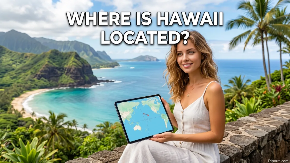
Hawaii is located in the central Pacific Ocean, about 2,400 miles southwest of California. It is the westernmost U.S. state and consists of an island chain rather than one landmass. The Hawaiian Islands lie in the North Pacific, far from the continental United States, and include eight main islands.
Where Is Hawaii Located?
Hawaii is an island state in the central Pacific Ocean. It sits southwest of the continental United States and roughly 2,400 miles from California. Because Hawaii is separated from the mainland by thousands of miles of ocean, it is easy to miss its location when looking at a standard map of the United States.
Hawaii is not connected by land to any other U.S. state. Instead, it is an archipelago, or chain of islands, stretching across the Pacific.
The state is made up of eight main islands:
- Hawaiʻi, also called the Big Island
- Maui
- Oʻahu
- Kauaʻi
- Molokaʻi
- Lānaʻi
- Niʻihau
- Kahoʻolawe
The Hawaiian Islands extend generally from northwest to southeast, with the Big Island at the southeastern end of the main island chain.
Hawaii Location: Quick Facts
FactInformationLocationCentral Pacific OceanStateHawaiiRegionPacific / PolynesiaCountryUnited StatesContinentNorth AmericaGeographic settingHawaiian island chainApproximate coordinatesAround 20° N, 155° WMainland distanceAbout 2,400 miles from CaliforniaCapitalHonoluluMain island groupHawaiian IslandsTime zoneHawaii-Aleutian Standard Time
Hawaii’s exact coordinates vary because the state covers many islands spread across the Pacific. The U.S. Census Bureau’s geographic data places Hawaii County, for example, around 19.6° N, 155.5° W, while Honolulu County is centered farther northwest.
Where Is Hawaii on a Map?
On a map of the United States, Hawaii appears far southwest of the continental states, surrounded entirely by the Pacific Ocean.
A simple way to picture its location is:
California → Pacific Ocean → Hawaii
However, Hawaii is not directly south of California. The islands are positioned southwest of the mainland and sit in the North Pacific.
The nearest Hawaiian islands are roughly 2,000 miles from the U.S. mainland, while the Big Island is about 2,400 miles from California. The exact distance depends on which island and mainland reference point are being measured.
What State Is Hawaii In?
Hawaii does not belong to another state. Hawaii itself is a U.S. state.
It became the 50th state of the United States in 1959. Geographically, however, Hawaii is quite different from the contiguous 48 states because its territory consists of islands in the Pacific Ocean.
This is why you may see Hawaii shown separately in maps of the United States.
Is Hawaii Part of the United States?
Yes. Hawaii is part of the United States and is one of the country’s 50 states.
Although it is thousands of miles from the continental U.S., it is politically part of the United States. Its geographic isolation does not change its status as a state.
Hawaii is also the only U.S. state made up entirely of islands.
Where Is Hawaii in the Pacific Ocean?
Hawaii lies in the North Pacific Ocean, well away from the mainland United States.
The islands form part of a much larger volcanic chain known as the Hawaiian-Emperor seamount chain. Much of this volcanic mountain system lies beneath the ocean, while the Hawaiian Islands are its exposed peaks.
This setting explains why Hawaii looks so isolated on a world map.
It is roughly:
- Southwest of California
- Southeast of Alaska
- Northeast of Polynesia’s more southern island groups
- Far east of East Asia
These relationships give Hawaii its distinctive position in the Pacific.
Where Is Hawaii Compared With California?
California is the most useful mainland reference point when locating Hawaii.
Hawaii lies approximately 2,400 miles southwest of California. That means the Pacific Ocean separates the Hawaiian Islands from the West Coast by a considerable distance.
For a simple mental map, imagine traveling west from California across a large stretch of the Pacific. Hawaii is located roughly in that oceanic space, although its position is somewhat southwest rather than due west.
How Far Is Hawaii From the U.S. Mainland?
The distance varies depending on which Hawaiian island and mainland location you use.
The nearest of Hawaii’s eight main islands is about 2,000 miles from the U.S. mainland, according to the U.S. Geological Survey. California is commonly used as the mainland comparison point, with the Big Island roughly 2,400 miles away.
So, rather than thinking of Hawaii as a short distance offshore, picture it as an isolated island chain separated from the mainland by thousands of miles of open ocean.
What Is Hawaii Near?
Hawaii is relatively isolated from other major land areas.
Its closest important geographic relationships include:
- California: roughly 2,400 miles to the northeast
- Alaska: north and northwest across the North Pacific
- North America: northeast across the Pacific
- Asia: far to the northwest
- Polynesia: generally south and southwest
Hawaii’s isolation is one of its defining geographic characteristics.
What Are the Main Hawaiian Islands?
The state contains eight main islands, but they are not all the same size or equally populated.
Hawaiʻi — The Big Island
The southeasternmost and largest island is Hawaiʻi, commonly called the Big Island. It is home to major volcanic mountains and is the island farthest southeast in the main Hawaiian chain.
Maui
Maui sits northwest of the Big Island. It is one of the state’s best-known islands and forms part of Maui County.
Oʻahu
Oʻahu is farther northwest and contains Honolulu, Hawaii’s capital and largest major urban center.
Kauaʻi
Kauaʻi is toward the northwestern end of the main Hawaiian island chain.
Molokaʻi and Lānaʻi
These islands lie between some of the larger islands in the central portion of the chain.
Niʻihau and Kahoʻolawe
Niʻihau is near the southwestern side of Kauaʻi, while Kahoʻolawe lies close to Maui and the Big Island.
Together, these islands form the core geographic structure of the state.
Where Is Honolulu Located?
Honolulu is located on the island of Oʻahu in the Hawaiian Islands.
It is Hawaii’s capital and the state’s main population and transportation center. Honolulu is therefore a useful reference point when someone asks where Hawaii is located.
On a map, Honolulu is on the southeastern coast of Oʻahu, while Oʻahu itself sits in the central part of the Hawaiian island chain.
The U.S. Census Bureau’s geographic data places Honolulu County around 21.46° N, 158.20° W for its interior point.
Where Is the Big Island Compared With Honolulu?
The Big Island lies southeast of Oʻahu, where Honolulu is located.
This means Honolulu and the Big Island are part of the same state but are on separate islands. They are separated by the Pacific Ocean rather than connected by roads or bridges.
This distinction is important: Hawaii is the state, while Hawaiʻi is also the name of the state’s largest island.
That is why the largest island is often called the Big Island to avoid confusion.
Which Direction Is Hawaii From the Mainland U.S.?
Hawaii sits well out in the Pacific Ocean, separated from the U.S. mainland by thousands of miles of open water. If you look from California, the Hawaiian Islands lie generally to the southwest. From Alaska, Hawaii is positioned farther south and slightly east, roughly in a south-southeasterly direction. Overall, Hawaii lies far beyond the continental United States in the central Pacific.
The directional relationship is more useful than simply saying Hawaii is “west of the United States,” because the islands are not directly west of the mainland. Their position has both western and southern components.
Is Hawaii Part of North America?
Politically, Hawaii is a U.S. state, and the United States is generally classified as part of North America.
Geographically and culturally, however, Hawaii is part of Polynesia, within the broader Pacific region of Oceania.
So the answer depends on the context:
- Country: United States
- State: Hawaii
- Ocean: Pacific Ocean
- Cultural/geographic island region: Polynesia
- Common continental classification: North America
This distinction helps explain why Hawaii can be both an American state and a Pacific island destination.
Where Is Hawaii in Relation to Alaska?
Alaska is another U.S. state separated from the contiguous United States, but Hawaii is much farther south.
Hawaii and Alaska are both located outside the contiguous 48 states. However, Alaska extends into the far northern Pacific region, while Hawaii lies much farther south in the central North Pacific.
The two are separated by thousands of miles of open ocean. The U.S. Geological Survey notes that Hawaii and Alaska’s Aleutian Islands are separated by more than 2,430 miles of open ocean in the North Pacific.
Why Does Hawaii Look So Far Away on a U.S. Map?
Hawaii looks distant because it really is distant from the mainland.
The state is an isolated island chain rather than part of the continental landmass. The nearest of its main islands is about 2,000 miles from the U.S. mainland.
Maps also commonly use an inset box to display Hawaii beside the continental United States. This can make Hawaii look closer than it actually is.
On a globe, its location is easier to understand: Hawaii sits alone in the central Pacific, between North America and the broader Polynesian region.
How Do You Get to Hawaii?
Because Hawaii is separated from the mainland by the Pacific Ocean, visitors generally reach the islands by air travel or, in some cases, by sea.
The major gateway for many travelers is Honolulu International Airport on Oʻahu. Other Hawaiian islands also have commercial airports, allowing travelers to reach destinations beyond Oʻahu.
For understanding Hawaii’s location, the key point is simple: you cross a large section of the Pacific Ocean to reach the islands from the U.S. mainland.
What Is the Geographic Setting of Hawaii?
Hawaii’s physical setting is closely tied to its location in the Pacific.
The islands are volcanic landforms that emerged from the ocean. The Hawaiian-Emperor seamount chain extends for thousands of miles, while the islands themselves represent exposed portions of this much larger underwater volcanic system.
This gives Hawaii a geographic landscape unlike that of most U.S. states.
Instead of broad continental plains and land borders, Hawaii is defined by:
- Pacific Ocean surroundings
- Volcanic mountains
- Island coastlines
- Deep valleys
- Tropical landscapes
- Separate islands within one state
Hawaii Location at a Glance
If you need to remember Hawaii’s location quickly, use this mental map:
Hawaii → Pacific Ocean → southwest of California → U.S. state → Polynesian island chain
The most important facts are that Hawaii is not on the U.S. mainland, it is surrounded by the Pacific Ocean, and it is approximately 2,400 miles southwest of California.
Frequently Asked Questions About Hawaii’s Location
1. Where is Hawaii located?
Hawaii is located in the central North Pacific Ocean. It is an island state of the United States, approximately 2,400 miles southwest of California.
2. Is Hawaii part of the United States?
Yes. Hawaii is one of the 50 U.S. states. It became the 50th state in 1959.
3. What state is Hawaii in?
Hawaii is itself a state. It does not belong to another state.
4. Is Hawaii in the Pacific Ocean?
Yes. The Hawaiian Islands are located in the North Pacific Ocean.
5. How far is Hawaii from California?
The Big Island is roughly 2,400 miles from California. The exact distance varies depending on the Hawaiian island and California location being measured.
6. Is Hawaii close to the mainland United States?
No. Hawaii is separated from the U.S. mainland by roughly 2,000 miles or more of Pacific Ocean, depending on the points being compared.
7. Where is Honolulu located?
Honolulu is located on the island of Oʻahu. It is the capital and largest major city of Hawaii.
8. What continent is Hawaii on?
Hawaii is politically part of the United States, which is in North America. Geographically, Hawaii is also part of the Pacific and Polynesian island region.
9. How many main islands does Hawaii have?
Hawaii has eight main islands: Hawaiʻi, Maui, Oʻahu, Kauaʻi, Molokaʻi, Lānaʻi, Niʻihau, and Kahoʻolawe.
10. Is Hawaii west or east of California?
Hawaii is west and somewhat south of California, so southwest is the clearest directional description.
11. Where is the Big Island?
The Big Island, officially named Hawaiʻi, is the southeasternmost of the main Hawaiian Islands. It is also the largest island in the state.
12. Why is Hawaii separated from the other U.S. states?
Hawaii is an island chain located in the Pacific Ocean. Unlike mainland states, it has no land connection to the rest of the United States.
Conclusion
Hawaii is located in the central North Pacific Ocean, roughly 2,400 miles southwest of California. It is a U.S. state made up of a chain of islands, with Oʻahu, Maui, Kauaʻi, and the Big Island among its best-known islands.
The easiest mental picture is California to the northeast, thousands of miles of Pacific Ocean in between, and Hawaii in the central Pacific. Although geographically isolated, Hawaii is fully part of the United States and remains the country’s only island state.

About Leo Sterling
Leo Sterling is a geography and travel writer at Triporra.com who believes understanding a place starts with knowing exactly where it is. He turns geographic details on countries, regions, islands, and cities into clear, engaging content for everyday readers.
For Leo, a good location article does more than mark a spot on a map. It shows what borders a place, which region it belongs to, and how it connects to the world around it—an approach reflected in guides like where is Anguilla, where solid research meets a simple, conversational style.
Whether readers are planning a trip, studying, or just curious, Leo’s goal is the same: deliver accurate, easy-to-understand information without unnecessary complexity.
Areas of Focus: Geography | Countries & Regions | Caribbean Islands | Travel Destinations | Location Research | “Where Is?” Content