
Belize is the country; Belize City is its largest city and former capital. The national capital is Belmopan.
If you are asking where is Belize located, look at the northeastern coast of Central America, between Mexico, Guatemala, and the Caribbean Sea. Its position matters because it connects mainland Central America with the culture, climate, and marine life of the Caribbean.
Featured answer
Where is Belize located? Belize is an independent country on the Caribbean coast of Central America. Mexico lies to its north, Guatemala borders it to the west and south, and the Caribbean Sea runs along its eastern side. It is known for its English-speaking culture, Maya sites, cayes, and barrier reef.
Quick Facts About Belize
| Fact | Details |
| Official name | Belize |
| Country | Independent sovereign country |
| Region | Central America; Caribbean coast |
| Population | 397,483 household residents in the 2022 census |
| Area | 22,966 square kilometres or 8,867 square miles |
| Coordinates | Approximately 17.19° N, 88.50° W |
| Time zone | Central Standard Time, UTC−6; no daylight saving time |
| Capital | Belmopan |
| Known for | Belize Barrier Reef, Great Blue Hole, Maya sites, rainforests, and cayes |
| Official language | English; Kriol, Spanish, Maya languages, and Garifuna are also spoken |
| Currency | Belize dollar, or BZD |
Belize’s census figure comes from the Statistical Institute of Belize, while its area, capital, and currency are recorded by CARICOM.
Does Belize Use US Dollars?
The official currency of Belize is the Belize Dollar (BZD). It is permanently pegged to the US Dollar at a rate of 2 Belize Dollars = 1 US Dollar.
US dollars are widely accepted throughout Belize, especially in hotels, restaurants, tour companies, and popular tourist destinations. However, change is often given in Belize Dollars, so carrying some local currency is useful for smaller shops, local markets, and public transportation.
Credit cards are accepted in many tourist areas, but cash is still commonly used in smaller towns and villages.
Where Is Belize Located?
Belize sits on the eastern edge of the Yucatán Peninsula. Mexico’s state of Quintana Roo is directly north. Guatemala lies along the western and southern land borders, while the Caribbean Sea forms the eastern coastline. Honduras is across the sea to the southeast rather than sharing a land border.
Road conditions and ferry schedules can make journeys longer than the map suggests. Belize City is the main transport centre for water taxis to Ambergris Caye and Caye Caulker. Belmopan lies inland, San Ignacio is near Guatemala, and Punta Gorda sits in the far south. This compact layout lets one trip combine reef, jungle, caves, and archaeological sites.
Administrative Status
Belize is a sovereign state divided into six districts: Belize, Cayo, Corozal, Orange Walk, Stann Creek, and Toledo. It is a member of CARICOM and the Commonwealth, and English is its official language. The country uses UTC−6 throughout the year, so visitors do not need to adjust for daylight saving time.
Visa rules depend on nationality. Many travellers may enter for a short visit without obtaining a visa in advance, while others must apply. Stays beyond the period granted on entry require an extension, so check the Belize Immigration Department before booking.
Belize is internationally recognized as an independent country. Guatemala maintains a territorial, insular, and maritime claim, and the dispute has been submitted to the International Court of Justice for settlement.
Is Belize a Rich or Poor Country?
Belize is considered an upper-middle-income developing country, but it is not among the wealthiest nations in the Americas. Tourism, agriculture, fisheries, and financial services play important roles in the economy.
Income levels vary across the country. While tourism areas often benefit from international investment, some rural communities face higher levels of poverty and fewer economic opportunities.
Overall, Belize has a smaller economy than many neighboring countries, but it maintains a relatively stable financial system and continues to depend heavily on tourism and exports.
What Language Is Spoken in Belize?
English is the official language of Belize, making it the only country in Central America where English is used for government, education, and official business. Road signs, legal documents, and school instruction are primarily in English.
However, everyday life is multilingual. Many people also speak Belizean Kriol, Spanish, Garifuna, and several Maya languages. In tourist areas, English is widely spoken, so most international visitors have no difficulty communicating.
The country’s mix of languages reflects its diverse cultural heritage, including Creole, Mestizo, Maya, Garifuna, Mennonite, and other communities.
Where Is Belize Located on the World Map?
From Cancún, Belize lies to the south along the Caribbean side of the Yucatán Peninsula. From Guatemala City, it lies mainly to the northeast, beyond Guatemala’s Petén region and the forested western border.
Mexico touches only the northern edge. Guatemala wraps around the west and south. To the east, hundreds of cayes and offshore reefs spread into the Caribbean Sea. The reef does not sit directly against the shore everywhere; a shallow lagoon separates much of it from the mainland. This creates two different travel zones: the inland country of forests and farms, and the coastal world of islands, mangroves, and coral.
What Is Belize Known For?
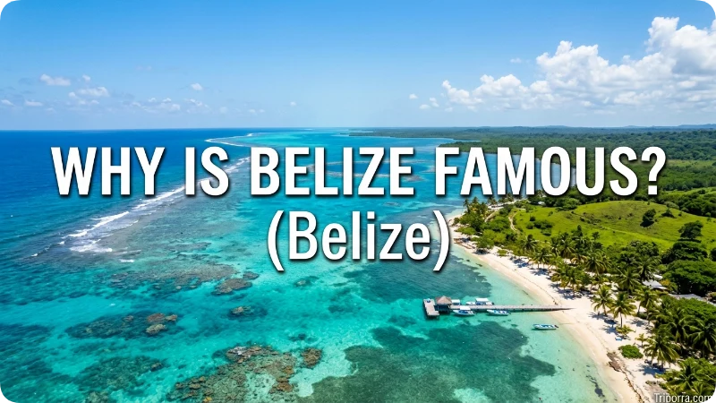
The strongest draw is the Belize Barrier Reef Reserve System. UNESCO describes it as the largest barrier reef in the Northern Hemisphere, with offshore atolls, sand cayes, mangrove forests, lagoons, and habitats for threatened marine species. The Great Blue Hole, a deep marine sinkhole within Lighthouse Reef, is its best-known landmark.
Inland areas add major Maya sites such as Caracol, Xunantunich, Lamanai, and Altun Ha. Limestone caves hold archaeological remains, while forest reserves protect jaguars, tapirs, howler monkeys, and toucans. Belize’s National Institute of Culture and History manages many of the country’s archaeological reserves.
Travellers often overlook the country’s cultural range. Belizean life reflects Maya, Mestizo, Creole, Garifuna, Mennonite, and other communities. Daily conversations may move between English, Kriol, Spanish, Maya languages, and Garifuna.
A common mistake is to treat Belize as a Spanish-speaking version of Guatemala or Mexico. British rule shaped a different legal and linguistic system, while food, music, and family ties still connect it to Central America and the Caribbean.
A Short History of Belize
Maya communities lived across the region for centuries before European settlement. Large centres developed trade networks, ceremonial buildings, farms, and reservoirs. Sites such as Caracol and Lamanai show that the area was not an empty forest before colonial rule.
British settlers later cut logwood and mahogany along rivers and the coast. The territory became the colony of British Honduras in 1862. The Battle of St. George’s Caye in 1798 became an important national story, marking the defeat of a Spanish attempt to remove the British settlement. The colony changed its name to Belize in 1973 and gained independence on 21 September 1981.
That history remains visible in the official language, the inland capital, Maya place names, Spanish-speaking northern communities, and Garifuna towns along the southern coast.
Climate and Season
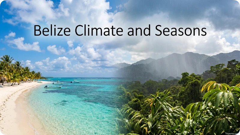
Belize has a tropical climate, with greater differences in rainfall and humidity than in temperature. The National Meteorological Service reports mean temperatures of about 27°C along the coast and about 21°C in the hills. January is usually the coolest month, while May is often the hottest.
The drier months generally run from late winter into spring, while the wetter season covers much of summer and autumn. Rainfall varies sharply: the south is wetter than the north, and the Mountain Pine Ridge can feel cooler than the coast. Tropical storms and hurricanes are possible during the Atlantic hurricane season.
The seasonal trap is assuming “rainy season” means rain all day. Showers may be brief, but storms can disrupt boats, caves, unpaved roads, and flights, so flexible plans matter.
Things to See and Do
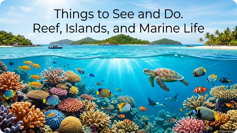
Reef, Islands, and Marine Life
- Hol Chan Marine Reserve: A popular snorkeling and diving area near Ambergris Caye.
- Great Blue Hole: Best suited to experienced divers or scenic flights; casual snorkelers may prefer shallower reef sites.
- Caye Caulker: A small island known for water activities and a slower pace.
- Ambergris Caye: The country’s main island base, with San Pedro as its largest settlement.
Maya Sites, Caves, and Forest
- Xunantunich: A Maya site near San Ignacio, reached by crossing the Mopan River.
- Caracol: A large archaeological site deep in the Cayo District.
- Actun Tunichil Muknal Cave: A guided cave journey with archaeological importance and strict access rules.
- Cockscomb Basin Wildlife Sanctuary: A broad forest reserve associated with jaguar conservation.
- Mountain Pine Ridge Forest Reserve: Pine forest, waterfalls, caves, and cooler upland air.
- Lamanai: A Maya site often reached by river, making the journey part of the experience.
What most guides miss is the time needed to move between these places. A reef day from San Pedro and a cave day from San Ignacio belong in separate parts of an itinerary. Trying to combine them without changing bases creates long transfers and little time on site.
Best Time to Visit
December through April is the main visitor season because rainfall is usually lower and sea conditions are often more dependable. The trade-off is higher demand for flights, hotels, guides, and island rooms.
Late April and May are hotter but often less crowded. June and early July may bring lower rates and more showers. September and October usually carry the greatest weather uncertainty, and some businesses reduce hours.
Travellers often overlook November. Conditions can still be changeable, yet the month may provide a useful balance between improving weather and lower demand. No month guarantees perfect conditions, so reef trips and remote excursions should always have a backup day.
Common Misconceptions

Belize is not an island. It is a mainland Central American country with many offshore islands called cayes.
Belize City is not the national capital; Belmopan holds that role. Belize City remains the largest city and a major transport hub.
The country is not located in South America, and it is not part of Mexico. Another frequently repeated claim says Belize alone has the world’s second-largest barrier reef. A more careful description is that its reef forms a major part of the wider Mesoamerican Reef, while UNESCO calls the Belize protected system the largest barrier reef in the Northern Hemisphere.
Related Places
Guatemala: The western and southern neighbour offers Tikal and highland cities. The crossing near San Ignacio can support a combined trip.
Mexico’s Yucatán Peninsula: Chetumal, Bacalar, Tulum, and Cancún lie to the north, with road links into Belize.
Honduras: It lies southeast across the Caribbean; its Bay Islands share the region’s reef culture.
Caye Caulker: A small caye suited to snorkeling, walking, and slower island days.
San Ignacio: The main inland base for Maya sites, caves, rivers, and the western border.
What Else Do People Want to Know?
Belize can feel expensive compared with parts of Guatemala because many island goods are imported and tours often require boats, licensed guides, or specialist equipment. Mainland guesthouses and local restaurants usually cost less than beachfront island resorts.
Safety conditions vary by area. As of March 2026, the U.S. State Department advises increased caution in Belize and recommends reconsidering travel to Southside Belize City because of crime. Visitors should avoid isolated areas after dark, use trusted transport, protect valuables, and choose certified operators for diving or remote adventures.
Philip S. W. Goldson International Airport is the main international gateway. Domestic flights, buses, shuttles, rental cars, and water taxis connect the main destinations. Respectful dress and behaviour are sensible in villages, churches, and family-run places.
Is Belize Safe to Visit?
Belize is generally safe for tourists who use normal travel precautions. Most visitors enjoy their trips without problems, especially in popular destinations such as Ambergris Caye, Caye Caulker, Placencia, San Ignacio, and the major archaeological sites.
Crime is more common in certain parts of Belize City, particularly Southside Belize City, which many governments advise travelers to avoid unless necessary. Visitors should stay in well-reviewed accommodations, avoid walking alone late at night, keep valuables out of sight, and use licensed taxis or tour operators.
Outdoor activities such as snorkeling, diving, cave tubing, and jungle tours are considered safe when booked through certified guides. Before traveling, check the latest travel advisories issued by your country’s government because recommendations may change.
Frequently Asked Questions
How do you pronounce Belize?
The usual English pronunciation is “buh-LEEZ,” with the stress on the second syllable.
Which continent is Belize in?
Belize is in North America, within the Central American subregion. Its eastern shore faces the Caribbean Sea.
Does Belize have a Pacific coastline?
No. Its entire sea coast is on the Caribbean side of Central America.
Is Belize north or south of Honduras?
Belize is northwest of mainland Honduras. The two countries face each other across part of the western Caribbean and share a maritime boundary.
Is Belmopan near the beach?
No. Belmopan was built inland, while Belize City and many tourism areas sit on or near the Caribbean coast.
Can you reach the cayes without flying?
Yes. Scheduled water taxis connect the Belize City area with Caye Caulker and Ambergris Caye, while other islands may require private or tour boats.
Is Belize in the same time zone as Cancún?
Not always. Belize remains on UTC−6 throughout the year, while Cancún uses UTC−5, so Cancún is normally one hour ahead.
Can you drive into Belize from Mexico or Guatemala?
Yes, road border crossings connect Belize with both neighbours. Drivers should confirm vehicle documents, insurance, opening hours, and entry rules before arrival.
Can one trip include both jungle and reef activities?
Yes. A practical plan uses San Ignacio or another inland base first, followed by a coastal town or caye, rather than making long daily transfers.
Do visitors need a passport?
International visitors normally need a valid passport. Visa rules and passport-validity requirements depend on nationality, so check Belize’s immigration authorities before travel.
Is Belize a rich or poor country?
Belize is classified as an upper-middle-income developing country. Tourism is one of its largest industries, but income levels vary across different regions of the country.
What language do people speak in Belize?
English is Belize’s official language. Many residents also speak Belizean Kriol, Spanish, Garifuna, and several Maya languages.
Does Belize accept US dollars?
Yes. US dollars are widely accepted across Belize because the Belize Dollar is fixed at 2 BZD to 1 USD. However, many businesses give change in Belize Dollars.
Is Belize safe for American tourists?
Most tourist destinations are considered safe when visitors take normal precautions. Travelers should avoid high-crime areas, use licensed transportation, and follow current travel advisories.
Where exactly is Belize located in the world?
Belize is located on the northeastern coast of Central America. It borders Mexico to the north, Guatemala to the west and south, and the Caribbean Sea to the east.
Final Thoughts
Understanding where Belize is located makes it easier to appreciate why this small country attracts travelers from around the world. Belize sits on the northeastern coast of Central America, bordered by Mexico to the north, Guatemala to the west and south, and the Caribbean Sea to the east. Its unique location creates a blend of Caribbean culture, Central American landscapes, and rich biodiversity that is difficult to find elsewhere.
When planning a trip, it helps to divide your itinerary into regions. Start with an inland base where you can explore ancient Maya ruins, lush rainforests, cave systems, waterfalls, and wildlife reserves. Popular inland destinations include San Ignacio and the Cayo District. Afterward, move to a coastal town or island destination such as Ambergris Caye or Caye Caulker to enjoy the Belize Barrier Reef, snorkeling, diving, fishing, and beautiful Caribbean beaches. This balanced approach minimizes travel time, reduces unnecessary transfers, and allows you to experience Belize’s diverse natural and cultural attractions at a comfortable pace.

Silas Vance is a geography enthusiast, travel researcher, and location-focused content writer dedicated to helping readers better understand the world around them on triporra.com. He specializes in creating informative guides about cities, countries, islands, landmarks, universities, and other notable destinations. His work combines geographic accuracy, historical context, and practical insights to answer location-based questions in a simple and engaging way.










