
Introduction
It lies along the United States–Canada border in North America’s Upper Midwest. In the United States, its shoreline reaches Minnesota, Wisconsin, and Michigan. To the north, the lake borders Ontario, Canada. It is the westernmost of the five Great Lakes and sits north of Wisconsin and Michigan.
Featured Snippet Answer
It is located along the United States–Canada border in the Upper Midwest. Minnesota, Wisconsin, and Michigan border the lake on the U.S. side, while Ontario borders it to the north. It is the largest Great Lake by surface area and connects eastward to Lake Huron through the St. Marys River.
Quick Facts
| Fact | Information |
|---|---|
| Name | Lake Superior |
| Type | Great Lake and freshwater lake |
| Location | United States–Canada border |
| U.S. States | Minnesota, Wisconsin, Michigan |
| Canadian Province | Ontario |
| U.S. Region | Midwest |
| Geographic Region | Great Lakes / Upper Midwest |
| Approximate Coordinates | 47.7° N, 87.5° W |
| Countries | United States and Canada |
| Continent | North America |
| Largest Great Lake by Surface Area | Lake Superior |
| Nearby Major Cities | Duluth, Superior, Thunder Bay, Marquette |
| Outlet | St. Marys River |
| Connected Great Lake | Lake Huron |
| Time Zones | Central and Eastern |
Where Is Lake Superior Located?

It occupies the northwestern part of the Great Lakes system. Its enormous basin extends across the international boundary between the United States and Canada.
On the U.S. side, Minnesota forms much of the western shoreline. Farther east, Wisconsin borders the southern shore, while Michigan’s Upper Peninsula reaches the lake along its eastern and southeastern side.
Meanwhile, Ontario extends along the northern shoreline. As a result, it is both a major U.S. geographic feature and a shared international waterway.
Where Is Lake Superior on a Map?
On a map of the Great Lakes, it appears at the far northwest. It sits above Wisconsin and Michigan and east of Minnesota.
The lake also lies directly south of Ontario. This position makes it easy to identify among the five Great Lakes.
From west to east, the Great Lakes are:
- Lake Superior
- Lake Michigan
- Lake Huron
- Lake Erie
- Lake Ontario
However, the lakes are not arranged in a simple straight line. Their connected waterways form a large drainage system that stretches from the interior of North America toward the Atlantic Ocean.
Which States Border Lake Superior?
Three U.S. states touch it :
Minnesota
Minnesota borders the western and southwestern part of the lake. The city of Duluth stands at the western end, making it a useful reference point for understanding Lake Superior’s position.
Wisconsin
Wisconsin reaches the lake along its southern shoreline. The Bayfield Peninsula extends into Lake Superior, and the Apostle Islands lie just offshore.
Michigan
Michigan’s Upper Peninsula borders Lake Superior along much of the lake’s eastern and southeastern side. The peninsula separates Lake Superior from Lake Michigan and Lake Huron in other directions.
Together, these three states make up the U.S. portion of Lake Superior’s shoreline.
Does Lake Superior Border Canada?
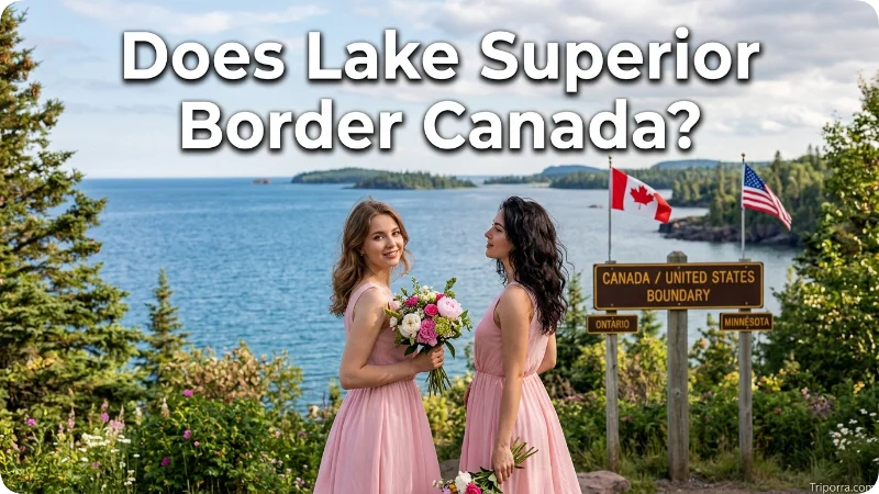
Yes. Ontario, Canada, borders Lake Superior along its northern shore.
The Canadian side includes extensive shoreline, islands, and protected areas. Thunder Bay is a major community near the northwestern part of the lake.
Therefore ,it is an international lake rather than a lake located entirely within the United States.
What Region Is Lake Superior In?
It belongs to the Great Lakes region and forms part of the geographic Upper Midwest.
The five Great Lakes create one of the largest connected freshwater systems in the world. It occupies the system’s northwestern end.
In the United States, the lake is associated primarily with Minnesota, Wisconsin, and Michigan. Across the border, Ontario forms its northern geographic boundary.
What Is Lake Superior Near?
Several cities help establish Lake Superior’s location.
Duluth, Minnesota, sits at the western end of the lake. Directly across the St. Louis River is Superior, Wisconsin.
Farther north, Thunder Bay, Ontario, lies along the Canadian shore. On the Michigan side, Marquette sits on the southern shoreline of the Upper Peninsula.
These cities are useful reference points because they are located directly on or close to it .
How Far Is Lake Superior From Chicago?
It is roughly 400 miles north of Chicago, although the exact distance depends on which point of the lake is measured.
Chicago sits along Lake Michigan, southeast of it . Consequently, traveling from Chicago toward Lake Superior generally means moving north through Wisconsin or toward Michigan’s Upper Peninsula.
The two lakes are part of the same Great Lakes system, but Lake Superior is considerably farther north.
How Far Is Lake Superior From Minneapolis?
It is approximately 150 miles northeast of Minneapolis, depending on the destination point.
Duluth provides the clearest geographic reference because it lies at the western end of it . The city is roughly 150 miles northeast of Minneapolis.
Thus, the lake is relatively close to Minnesota’s major population center compared with its much more distant eastern shoreline.
How Far Is Lake Superior From Detroit?

It is roughly 300 miles northwest of Detroit, with the exact distance varying by location.
Detroit sits near Lake Erie and Lake St. Clair in southeastern Michigan. By contrast, Lake Superior lies much farther north and west, beyond Michigan’s Lower Peninsula.
The Upper Peninsula provides the main land connection between southeastern Michigan and the southern shore of Lake Superior.
How Large Is Lake Superior?
It covers about 31,700 square miles, including its islands. It is the largest Great Lake by surface area.
The lake is also the largest freshwater lake in the world by surface area when considered as a single lake. Its great size gives it a major role in the geography of the Upper Midwest.
Because the lake stretches hundreds of miles from west to east, its shoreline includes several distinct geographic areas.
What Is Lake Superior Connected To?
It drains toward Lake Huron through the St. Marys River.
The St. Marys River flows between Michigan’s Upper Peninsula and Ontario. It provides the main outlet from it into the lower Great Lakes.
From Lake Huron, water continues through the Great Lakes system toward Lake Erie and Lake Ontario. Eventually, the system reaches the Atlantic Ocean through the St. Lawrence River.
Thus, it forms the starting point of the Great Lakes’ eastward water route.
Where Is Duluth in Relation to Lake Superior?
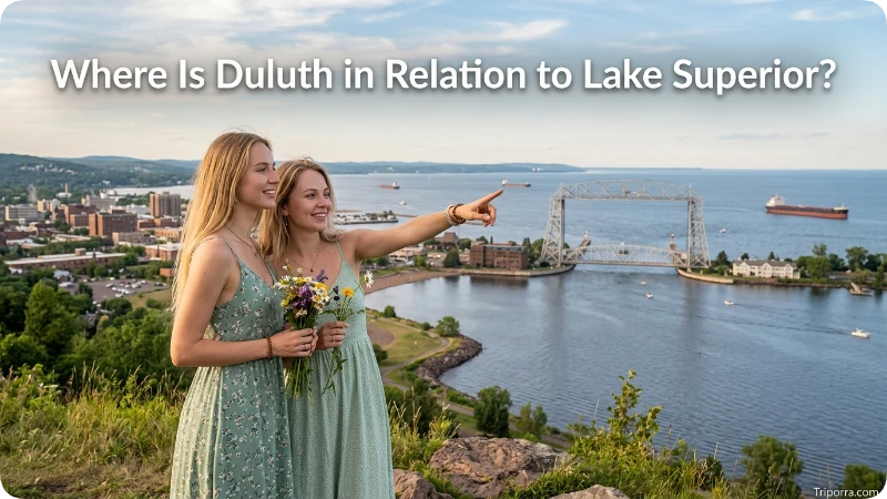
Duluth, Minnesota, is located at the western end of it .
The city sits near the point where the western lake meets the St. Louis River. Superior, Wisconsin, lies directly across the waterway.
Because of this position, Duluth is one of the most recognizable U.S. locations for identifying it on a map.
Where Is Michigan’s Upper Peninsula in Relation to Lake Superior?
Michigan’s Upper Peninsula lies along the southern and eastern side of it .
The lake forms much of the peninsula’s northern boundary. Lake Michigan and Lake Huron lie along other sides of the peninsula.
As a result, the Upper Peninsula occupies an important position between several Great Lakes. It also places Michigan directly on Lake Superior’s southern and eastern shores.
How Deep Is Lake Superior?
It is the deepest of the five Great Lakes. Its maximum depth is about 1,333 feet.
The lake’s great depth adds to its enormous volume of freshwater. Much of its basin was shaped by glaciers during the last Ice Age.
Glacial erosion helped create the deep basin and rugged shorelines found around parts of it .
Which Great Lakes Are Connected to Lake Superior?
It connects directly to Lake Huron through the St. Marys River.
Lake Huron also connects with Lake Michigan through the Straits of Mackinac. Therefore, it has a direct water connection to both Lake Huron and, through that system, Lake Michigan.
Farther east, the Great Lakes continue through Lake Erie and Lake Ontario.
Does Lake Superior Have Islands?

Yes. It contains many islands along both its U.S. and Canadian shores.
Isle Royale is one of the most notable. The island belongs to Michigan and is the centerpiece of Isle Royale National Park in the northwestern part of the lake.
Wisconsin’s Apostle Islands form another well-known island group along the southern shore. Ontario also contains numerous islands within the lake.
What Time Zone Is Lake Superior In?
Lake Superior’s shoreline spans Central Time and Eastern Time.
Minnesota and Wisconsin communities along the lake use Central Time. Michigan’s Upper Peninsula and Ontario communities on the eastern and northern shores generally use Eastern Time.
Therefore, the local time can differ depending on which side of the lake you are visiting or referencing.
Why Is Lake Superior Important Geographically?
It is a major physical feature of the Great Lakes basin. It also forms part of the international geography between the United States and Canada.
Its location connects several areas:
- Minnesota to the west
- Wisconsin to the south
- Michigan to the east and southeast
- Ontario to the north
- Lake Huron to the east through the St. Marys River
Furthermore, its enormous surface area and depth make it one of the most significant freshwater bodies in North America.
FAQs
What states border Lake Superior?
Minnesota, Wisconsin, and Michigan border Lake Superior. Ontario, Canada, also borders the lake along its northern shore.
Is Lake Superior in the United States or Canada?
It is in both the United States and Canada. The international border passes through the lake, with three U.S. states on its southern and western sides and Ontario to the north.
Where is Lake Superior compared with Lake Michigan?
It is northwest of Lake Michigan. It is also the westernmost and largest of the five Great Lakes by surface area.
Is Lake Superior near Chicago?
Yes. It is roughly 400 miles north of Chicago, depending on the point measured. Chicago is located on Lake Michigan, which lies southeast of Lake Superior.
What cities are near Lake Superior?
Major cities near the lake include Duluth, Minnesota; Superior, Wisconsin; Thunder Bay, Ontario; and Marquette, Michigan. Each provides a different reference point along the lake’s shoreline.
What country is north of it ?
Canada is north of it . More specifically, the province of Ontario borders the lake’s northern shoreline.
Which Great Lake is the largest?
It is the largest Great Lake by surface area. It is also the deepest of the five Great Lakes.
Where does it drain?
It drains through the St. Marys River into Lake Huron. Water then moves through the connected Great Lakes toward the Atlantic Ocean.
Conclusion
It lies along the United States–Canada border in the Upper Midwest. Minnesota, Wisconsin, and Michigan border its U.S. shores, while Ontario borders the north. The lake is the largest Great Lake by surface area and connects eastward to Lake Huron through the St. Marys River. Together, these geographic relationships place it at the northwestern end of the Great Lakes system.

Elena Rostova bridges the gap between premium hospitality and authentic local experiences. Armed with a background in luxury hospitality management and a passion for fine architecture, she spent years evaluating elite resorts before transitioning into travel journalism. Elena heads the luxury and boutique travel vertical on Triporra.com. Her meticulous guides strip away the guesswork from high-end travel, showcasing unique five-star escapes, fine regional dining, and bespoke private tours that elevate a standard vacation into an unforgettable journey.










