
Introduction
Kansas City is located in western Missouri, along the Missouri River near the Missouri-Kansas state line. The city is part of Jackson, Clay, Platte, and Cass counties and belongs to the Midwest region of the United States. It sits directly across the state line from Kansas City, Kansas, making the two cities part of the same large metropolitan area but separate municipalities.
The city is near the geographic center of the continental United States and serves as an important reference point for the central Midwest. Its approximate coordinates are 39.1° N, 94.6° W. Kansas City lies where the Missouri River and Kansas River meet in the broader metropolitan area.
Its location helps explain why Kansas City is closely connected with both Missouri and Kansas. The city itself is in Missouri, while Kansas City, Kansas, lies immediately west across the state line. Other nearby communities include Independence, North Kansas City, Overland Park, and Olathe.
Featured Snippet Answer
Kansas City is located in western Missouri, in the Midwestern United States. It extends across Jackson, Clay, Platte, and Cass counties and sits near the Missouri-Kansas border along the Missouri River. Its approximate coordinates are 39.1° N, 94.6° W. Kansas City, Kansas, is directly west across the state line.
Quick Facts
| Fact | Information |
|---|---|
| City | Kansas City |
| State | Missouri |
| Country | United States |
| U.S. Region | Midwest |
| State Subregion | Western Missouri |
| Counties | Jackson, Clay, Platte, and Cass |
| Approximate Coordinates | 39.1° N, 94.6° W |
| Major River | Missouri River |
| Nearby State | Kansas |
| Nearby Major City | Kansas City, Kansas |
| State Border | Missouri–Kansas state line |
| Time Zone | Central Time |
| Standard Time | Central Standard Time (CST) |
| Daylight Time | Central Daylight Time (CDT) |
| Land Area | About 315 square miles |
| Capital of Missouri? | No |
| Missouri State Capital | Jefferson City |
The U.S. Census Bureau identifies Kansas City as a city in Missouri. Census geographic data also shows portions of the city within Cass, Clay, Jackson, and Platte counties.
Where Is Kansas City in the United States?

Kansas City is in the central part of the United States, within the Midwest. More specifically, it is in western Missouri, close to the state’s western boundary with Kansas.
On a map of the United States, Kansas City sits roughly between the major population centers of the Midwest and the Great Plains. It is farther west than St. Louis, Missouri, and farther east than many of the major cities of the Great Plains.
The city is also well north of southern Missouri. Its location at approximately 39° north latitude places it in the central part of the country.
Kansas City is sometimes associated with both Missouri and Kansas because the metropolitan area crosses the state line. However, the municipality commonly called Kansas City, Missouri is entirely a Missouri city. The separate Kansas City, Kansas, is in Wyandotte County, Kansas.
That distinction is important when answering where Kansas City is located.
Is Kansas City in Missouri or Kansas?
The answer depends on which Kansas City is meant.
Kansas City, Missouri, is in Missouri. It is the larger and more commonly referenced city when the name “Kansas City” is used without a state abbreviation.
Kansas City, Kansas, is a separate city located west of the Missouri state line. The two cities are next to each other and form part of the same metropolitan area.
Therefore, if a map, address, government record, or geographic question refers simply to Kansas City, Missouri, the city is in western Missouri.
The U.S. Census Bureau specifically identifies the municipality as Kansas City city, Missouri.
Which County Is Kansas City In?
Kansas City is unusual because its city limits extend into four Missouri counties:
- Jackson County
- Clay County
- Platte County
- Cass County
Much of the city is associated with Jackson County, including its central and eastern areas. However, the city extends north into Clay County, west into Platte County, and south into Cass County.
Census Bureau geographic data confirms the city’s relationship with all four counties.
This means it would be inaccurate to describe Kansas City as being entirely in Jackson County.
The city also should not be confused with Jackson County, Kansas, which is a completely different county located in Kansas. Geographic names in this area can be confusing because Kansas and Missouri share several similar place names.
What Region Is Kansas City In?
Kansas City is in the Midwest region of the United States.
For geographic purposes, the city is in the western part of the Midwest, close to the transition between the Midwest and the Great Plains.
Its location gives it connections in several directions:
- West: Kansas
- East: Central and eastern Missouri
- North: Northern Missouri and Iowa farther beyond
- South: Central and western Missouri and Kansas
The nearby Missouri-Kansas border is one of the most important geographic features for understanding Kansas City’s position.
Kansas City is not the capital of Missouri. The state capital is Jefferson City, which lies east of Kansas City in central Missouri.
Where Is Kansas City Relative to the Missouri River?

Kansas City is located along the Missouri River, one of the major rivers of North America.
The river forms an important part of the city’s northern geographic setting. Kansas City developed near the meeting area of the Missouri River and Kansas River, which helped make the location important for transportation and commerce.
The city’s relationship with the Missouri River also helps explain why northern Kansas City extends toward the river while other parts of the metropolitan area spread south and west.
The river is not simply a local landmark. It is part of a major river system that eventually joins the Mississippi River farther downstream.
Historical Census geographic descriptions also place Kansas City along the Missouri River near the mouth of the Kansas River.
Where Is Kansas City Relative to Kansas?
Kansas City, Missouri, is immediately next to Kansas.
The Missouri-Kansas state line runs along the western side of the Kansas City metropolitan area. Kansas City, Kansas, lies directly across this boundary.
This creates one of the most distinctive features of the area: the metropolitan region crosses a state border.
Other Kansas communities near Kansas City include:
- Overland Park
- Olathe
- Shawnee
- Lenexa
- Leawood
These cities are in Kansas even though they are part of the same broader metropolitan area as Kansas City, Missouri.
The state line is therefore important when using an address, looking up local government services, checking county information, or determining which state a particular community belongs to.
Where Is Kansas City Relative to Nearby Cities?
Kansas City has several recognizable cities nearby. Approximate straight-line or general map distances can vary depending on the point used within each city.
Kansas City, Kansas
Kansas City, Kansas, is immediately west of Kansas City, Missouri.
The two municipalities share the metropolitan area but remain separate cities in different states.
Independence, Missouri
Independence is about 10 miles east of central Kansas City.
It is located in Jackson County and forms part of the eastern side of the Kansas City urban area.
St. Joseph, Missouri
St. Joseph is roughly 50 to 60 miles north of Kansas City.
It is also located along the Missouri River and sits in northwestern Missouri.
Topeka, Kansas
Topeka is roughly 60 to 70 miles west of Kansas City.
It is the capital of Kansas and lies farther into the Great Plains than Kansas City.
Columbia, Missouri
Columbia is roughly 120 miles east of Kansas City.
It is located in central Missouri along the major transportation corridor connecting Kansas City with central and eastern parts of the state.
St. Louis, Missouri
St. Louis is roughly 240 to 250 miles east of Kansas City.
The two cities are among Missouri’s best-known urban centers, but Kansas City is in the western part of the state while St. Louis is on the eastern side.
These relationships provide a useful mental map: Kansas City is near the western edge of Missouri, while St. Louis is near the state’s eastern edge.
What Are the Coordinates of Kansas City?

Kansas City’s approximate geographic coordinates are:
39.1° N latitude, 94.6° W longitude
A commonly used representative point for Kansas City is around 39.0997° N, 94.5786° W.
These coordinates place the city in western Missouri, close to the Kansas state line and the Missouri River.
Coordinates are useful because the name “Kansas City” can refer to more than one municipality. Including the state or coordinates removes much of that ambiguity.
For example:
- Kansas City, Missouri: approximately 39.1° N, 94.6° W
- Kansas City, Kansas: a separate city west of the Missouri state line
For general geographic purposes, the rounded coordinates are sufficient. Exact coordinates can vary depending on whether the reference point is the city center, municipal boundary, or another location.
Is Kansas City Near the Center of Missouri?
Kansas City is not near the geographic center of Missouri. It is in the state’s western portion.
Missouri stretches a considerable distance from west to east. Kansas City is close to the western border, while St. Louis is near the eastern side of the state.
Its location can therefore be understood as:
Western Missouri → near the Kansas border → along the Missouri River → Midwest
This geographic position is one reason Kansas City often serves as a bridge between the Midwest and Great Plains.
Is Kansas City in the Great Plains?
Kansas City is closely associated with the Great Plains, but it is more commonly classified as part of the Midwest in standard U.S. regional divisions.
The city sits near the eastern edge of the Great Plains and the western portion of the Midwest. This gives the Kansas City area geographic characteristics connected with both regions.
For a simple U.S. regional answer, however, Kansas City is in the Midwest.
Its position near Kansas helps explain why the metropolitan area extends westward into the Great Plains.
What State Is Kansas City the Capital Of?
Kansas City is not a state capital.
The capital of Missouri is Jefferson City, located in central Missouri.
Kansas City is the largest city in Missouri by population and land area, according to Census-based geographic information, but it does not serve as the state’s administrative capital.
Kansas City also is not the capital of Kansas. The capital of Kansas is Topeka.
This distinction is useful because Kansas City’s name can make its relationship with Kansas confusing.
What River Is Kansas City Near?
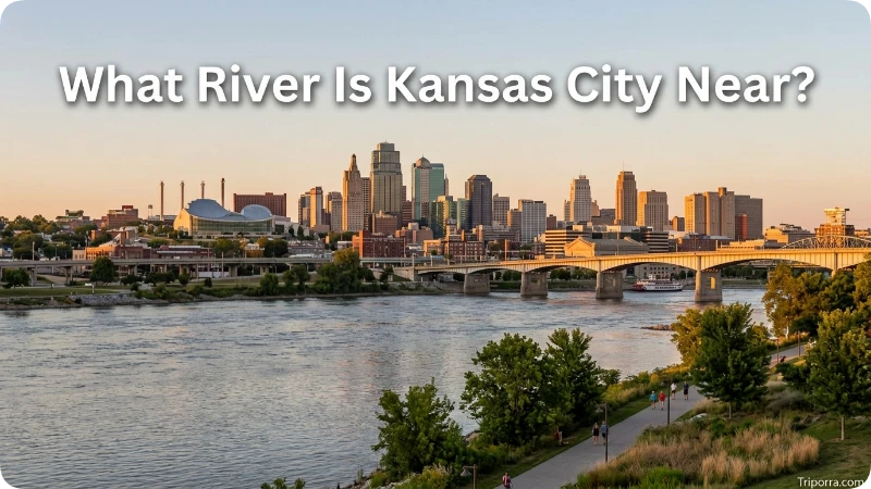
The major river associated with Kansas City is the Missouri River.
The city developed along and near this major waterway. The Kansas River also reaches the Missouri River in the Kansas City area.
Together, these waterways help explain the city’s location and its historical importance as a transportation center.
The Missouri River flows generally eastward from the Kansas City area before eventually joining the Mississippi River.
On a map, the river provides an easy geographic reference for understanding the northern portion of the city and the surrounding metropolitan area.
What Time Zone Is Kansas City In?
Kansas City uses the Central Time Zone.
During standard time, it observes Central Standard Time (CST), which is UTC−6. During daylight saving time, it observes Central Daylight Time (CDT), which is UTC−5.
The same general time zone covers most of Missouri and Kansas.
This means Kansas City has the same standard time as cities such as:
- St. Louis
- Chicago
- Minneapolis
- Dallas
Time changes during daylight saving periods, so the local clock can shift between CST and CDT during the year.
Why Is Kansas City Sometimes Confused With Kansas?

The confusion comes mainly from the name.
There are two separate incorporated cities:
Kansas City, Missouri is in Missouri.
Kansas City, Kansas is in Kansas.
They are located next to each other and belong to the same metropolitan area. The Missouri city is larger and extends across four Missouri counties.
The easiest way to avoid confusion is to include the state abbreviation:
- Kansas City, MO
- Kansas City, KS
The abbreviation KCMO is also commonly used to distinguish Kansas City, Missouri, from the Kansas-side city.
What Is Kansas City Close To?
Kansas City is close to several important geographic features and communities.
Kansas City sits along the Missouri–Kansas state line, giving it a unique position within the western part of Missouri. Just across the border to the west is Kansas City, Kansas, which forms part of the same large metropolitan area. The Missouri River lies to the north, with communities stretching toward St. Joseph. Meanwhile, Independence and other communities of central and eastern Jackson County extend eastward into Missouri. Farther south, the city connects with areas of southern Kansas City and Cass County, while the wider metropolitan region continues across both Missouri and Kansas.
This makes Kansas City an easy geographic reference point for understanding the western side of Missouri.
Is Kansas City in Jackson County?
Partly. Kansas City is located in Jackson County, but the city is not limited to that county.
Its municipal boundaries extend into:
- Jackson County
- Clay County
- Platte County
- Cass County
Census Bureau data specifically demonstrates these four county relationships for Kansas City city, Missouri.
So the most accurate short answer is:
Kansas City is in western Missouri and spans four counties: Jackson, Clay, Platte, and Cass.
How Far Is Kansas City From St. Louis?
Kansas City is approximately 240 to 250 miles west of St. Louis, depending on the points used for the measurement.
The two cities sit on opposite sides of Missouri. Kansas City is near the state’s western border, while St. Louis is near the eastern border along the Mississippi River.
This east-west relationship is useful for understanding Missouri’s overall geography.
Kansas City → western Missouri Columbia → central Missouri St. Louis → eastern Missouri
The three cities form a broad geographic line across the state.
How Far Is Kansas City From Topeka?
Kansas City is approximately 60 to 70 miles east of Topeka, Kansas.
Topeka is the capital of Kansas, while Kansas City is a Missouri city immediately across the state border from Kansas.
The relatively short distance between the two helps demonstrate how closely Kansas City is connected geographically with Kansas despite being located in Missouri.
How Far Is Kansas City From St. Joseph?
St. Joseph is roughly 50 to 60 miles north of Kansas City.
Both cities are in Missouri and have strong geographic connections to the Missouri River.
St. Joseph is farther north near the Nebraska border, while Kansas City is farther south near the Missouri-Kansas border.
This makes St. Joseph a useful reference point when locating Kansas City within northwestern Missouri.
FAQs
Is Kansas City in Missouri or Kansas?
Kansas City can refer to two separate cities. Kansas City, Missouri, is in western Missouri, while Kansas City, Kansas, is in Kansas. The two cities sit next to each other and form part of the same metropolitan area.
What county is Kansas City in?
Kansas City, Missouri, extends across Jackson, Clay, Platte, and Cass counties. It is therefore not entirely contained within one county.
Is Kansas City in the Midwest?
Yes. Kansas City is generally classified as a Midwestern city. It lies in western Missouri near the eastern edge of the Great Plains.
What state is Kansas City the capital of?
Kansas City is not a state capital. Jefferson City is the capital of Missouri, while Topeka is the capital of Kansas.
What river is Kansas City located near?
Kansas City is located along the Missouri River. The Kansas River also joins the Missouri River in the Kansas City area.
What are the coordinates of Kansas City?
Kansas City is approximately at 39.1° N, 94.6° W. A commonly used representative point is about 39.0997° N, 94.5786° W.
Is Kansas City close to the Kansas state line?
Yes. Kansas City, Missouri, is immediately next to the Kansas state line. Kansas City, Kansas, lies directly west of the Missouri city.
What time zone is Kansas City in?
Kansas City is in the Central Time Zone. It uses CST during standard time and CDT during daylight saving time.
Conclusion
Kansas City is located in western Missouri in the Midwest, close to the Kansas state line and along the Missouri River. The city extends across Jackson, Clay, Platte, and Cass counties and sits next to Kansas City, Kansas. Its position near the Missouri-Kansas border makes it an important geographic link between Missouri, Kansas, the Midwest, and the Great Plains.

Elena Rostova bridges the gap between premium hospitality and authentic local experiences. Armed with a background in luxury hospitality management and a passion for fine architecture, she spent years evaluating elite resorts before transitioning into travel journalism. Elena heads the luxury and boutique travel vertical on Triporra.com. Her meticulous guides strip away the guesswork from high-end travel, showcasing unique five-star escapes, fine regional dining, and bespoke private tours that elevate a standard vacation into an unforgettable journey.










