Introduction
Baghdad is the capital of Iraq, situated in the central part of the country along the Tigris River. It lies in western Asia and is commonly included within the broader Middle East region. The capital sits in the lowlands of the Tigris-Euphrates river system at approximately 33.34° N latitude and 44.40° E longitude.
The city is also the main urban center of Baghdad Governorate. Its inland position places it between major cities in northern Iraq and important population centers farther south. Although Iraq has a coastline on the Persian Gulf, the capital is located far inland, with the Tigris serving as its most important geographic feature.
Featured Snippet Answer
Baghdad is the capital of Iraq in central western Asia. It stands along the Tigris River at approximately 33.34° N, 44.40° E. The city is south of Mosul and Kirkuk, southwest of Erbil, northeast of Karbala, and northwest of Basrah. It is an inland city within the Middle East.
Quick Facts
| Fact | Information |
|---|---|
| City | Baghdad |
| Country | Iraq |
| Capital of | Iraq |
| Administrative area | Baghdad Governorate |
| Geographic region | Middle East |
| Subregion | Western Asia |
| Continent | Asia |
| Position within Iraq | Central Iraq |
| Major river | Tigris River |
| Approximate coordinates | 33.34° N, 44.40° E |
| Hemisphere | Northern and Eastern |
| Nearby major city | Karbala |
| Other major cities | Kirkuk, Najaf, Erbil, Mosul |
| Time zone | UTC+3 |
| Geographic setting | Tigris-Euphrates lowland |
Where Is Baghdad Located?
Baghdad sits in central Iraq on the banks of the Tigris River. Iraq occupies a strategic position in western Asia, between several important geographic regions.
The capital is surrounded by the broad lowlands associated with the Tigris and Euphrates river systems. Unlike Iraq’s southeastern coastal areas, this part of the country is entirely inland.
On a map, the city provides a useful reference point for the rest of Iraq. Mosul and Kirkuk are farther north, while Erbil lies to the northeast. Karbala and Najaf are southwest, and Basrah is much farther toward the southeast.
What Country Is Baghdad In?
The city is in Iraq, a country in western Asia.
Iraq shares borders with Turkey, Iran, Kuwait, Saudi Arabia, Jordan, and Syria. It also has a short coastline along the Persian Gulf in the southeast.
Baghdad is the national capital and the main urban center of Baghdad Governorate. The country’s physical geography changes considerably across its territory.
For instance, mountains dominate parts of the north and northeast, while large desert areas cover much of the west. Central and southern Iraq contain broad river plains. The capital is located within this central lowland landscape.
Is Baghdad the Capital of Iraq?
Yes. Baghdad is the national capital of Iraq.
It functions as the country’s main political and administrative center and is the largest urban area within Baghdad Governorate.
Its role is different from that of a state capital in the United States. Baghdad serves as the capital of an independent country, so it belongs to Iraq’s national government and administrative system.
Where Is Baghdad on a Map?
The city is positioned at approximately 33.34° N and 44.40° E.
The Tigris River passes directly through the urban area, dividing parts of the city on its eastern and western banks. Geographically, the capital lies somewhat east of the center of Iraq.
Its surrounding relationships can be summarized as follows:
- North: Kirkuk and Mosul
- Northeast: Erbil
- Southwest: Karbala and Najaf
- Southeast: Basrah
- East: Eastern Iraq and Iran beyond the international border
- West: Western Iraq
These directions offer a simple way to understand its position without relying on exact driving routes.
What Region Is Baghdad In?
Baghdad is part of the Middle East and lies within western Asia.
Its geographic hierarchy can be shown as:
Baghdad → Iraq → Western Asia → Middle East → Asia
The Middle East is a broad regional term rather than an official administrative division. In continental terms, Iraq belongs to Asia, while regional classifications commonly place it in the Middle East.
Is Baghdad in Asia?
Yes. The city is in Asia, specifically western Asia.
Iraq lies between Anatolia, Iran, the Arabian Peninsula, and the eastern Mediterranean region. Its capital is located well within the Asian continent rather than near its outer boundary.
At approximately 33° north and 44° east, the city is also clearly within the Northern and Eastern hemispheres.
What River Is Baghdad Located On?
The Tigris River runs through Baghdad.
It is one of the two major rivers of Iraq and flows from the country’s north toward the south. The river continues beyond the capital toward the lower Iraqi plain.
Its presence has strongly shaped the city’s physical geography. Urban areas developed on both sides of the waterway, making the Tigris one of the easiest landmarks for identifying the capital.
The river also forms part of the wider Tigris-Euphrates basin, which covers much of central and southern Iraq.
Is Baghdad a Coastal City?
No. Baghdad is an inland city.
Iraq reaches the Persian Gulf in the southeast, but that coastline is far from the capital. As a result, the Tigris is a much more important geographic feature for understanding the city’s location.
Basrah, in southeastern Iraq, has a much closer geographic relationship with the Gulf coast.
What Is Baghdad Governorate?
Baghdad Governorate is one of Iraq’s administrative divisions and includes the capital and its surrounding urban area.
The term governorate should not be treated as an exact equivalent of a U.S. state or county. Iraq has its own administrative structure, with governorates serving as major subdivisions of the country.
Therefore, Baghdad describes the city, while Baghdad Governorate provides the wider administrative setting.
Where Is Baghdad Compared With Mosul?
The capital is south of Mosul.
Mosul is a major city in northern Iraq, while Baghdad is located considerably farther south in the central part of the country.
A simple comparison is:
Mosul → northern Iraq
Baghdad → central Iraq
The approximate straight-line distance is about 220 miles. Actual travel distance can be longer because roads follow different routes.
Where Is Baghdad Compared With Erbil?
The capital is southwest of Erbil.
Erbil lies in northern Iraq and is the capital of the Kurdistan Region. Baghdad is farther south and slightly west of it.
The two cities are roughly 200 miles apart in a straight line. Thus, Erbil provides a useful northeastern reference point when looking at Iraq’s geography.
Where Is Baghdad Compared With Kirkuk?
The capital lies south of Kirkuk.
Kirkuk is in northern Iraq at approximately 35.5° north latitude. By comparison, Baghdad is around 33.3° north latitude.
Because their longitudes are relatively close, the main geographic relationship is north-south. The straight-line distance is approximately 150 miles, although road distances vary.
Where Is Baghdad Compared With Karbala?
The capital is northeast of Karbala.
Karbala lies southwest of the Iraqi capital in central Iraq. The two cities are approximately 55 miles apart in a straight line.
Because of this relatively short distance, Karbala is one of the most useful nearby urban reference points when describing the capital’s location.
Where Is Baghdad Compared With Najaf?
The city is northeast of Najaf.
Najaf lies farther south and southwest within Iraq’s central lowlands. Both cities are connected geographically by the broad plains surrounding the Tigris-Euphrates system.
Consequently, Najaf provides another useful southern reference point.
Where Is Baghdad Compared With Basrah?
The capital is northwest of Basrah.
Basrah lies in southeastern Iraq near the Persian Gulf. It is therefore much closer to the country’s Gulf coastline.
The straight-line distance between the two cities is approximately 280 miles. This creates a clear northwestern-to-southeastern relationship between the national capital and one of Iraq’s major southern cities.
What Are the Coordinates of Baghdad?
The approximate coordinates are:
33.34° N latitude, 44.40° E longitude
These coordinates place the city in both the Northern Hemisphere and the Eastern Hemisphere.
Coordinates provide a precise geographic reference and help distinguish the capital from cities farther north, south, east, or west.
Is Baghdad in Northern or Southern Iraq?
Baghdad is in central Iraq.
It is farther south than northern cities such as Mosul and Erbil, but it is also well north of Basrah and other areas near the southern end of the country.
The surrounding landscape is mainly associated with central Iraqi river plains. In contrast, northern Iraq contains more mountainous terrain, while the southeast approaches the Persian Gulf.
What Is the Geography Around Baghdad?
The area surrounding the capital forms part of the Tigris-Euphrates lowland system.
Central Iraq is relatively flat compared with the mountainous areas farther north and northeast. The Tigris is the dominant natural geographic feature in the immediate area.
Moving westward, the landscape becomes increasingly dry and arid. Farther south, the terrain transitions toward the lower river plains connected with the Tigris and Euphrates.
Overall, the city can be described as an inland river city on the central Iraqi plain.
How Far Is Baghdad From Major Iraqi Cities?
Approximate straight-line distances show how the capital relates to other major population centers:
| City | Approximate Distance | Direction |
|---|---|---|
| Karbala | 55 miles | Southwest |
| Kirkuk | 150 miles | North |
| Erbil | 200 miles | Northeast |
| Mosul | 220 miles | North |
| Basrah | 280 miles | Southeast |
These are geographic estimates rather than driving distances. Actual road distances depend on the route and road network.
More importantly, the pattern shows the capital’s central position between several major parts of Iraq.
What Time Zone Is Baghdad In?
Baghdad uses UTC+3.
Iraq operates under one national time zone, so the capital does not have a separate time zone from the rest of the country.
For people in the United States, the time difference varies depending on the U.S. time zone and seasonal daylight-saving changes.
Why Is Baghdad Located Along the Tigris?
The Tigris is central to the city’s geographic setting.
Rivers provide water and support fertile lowland environments, which can encourage settlement and agriculture. The waterway also connects the capital with the larger river system running through Iraq.
From a location perspective, the key fact is straightforward: the Tigris passes directly through the city and continues southward across Iraq.
How Does Baghdad Fit Into Iraq’s Geography?
The capital is a useful reference point for understanding Iraq as a whole.
Toward the north, the country extends toward Mosul, Kirkuk, and the mountainous areas near Turkey.
To the northeast, the landscape reaches toward Erbil and the Kurdistan Region.
Southwest of the capital are cities such as Karbala and Najaf. Farther southeast, the Tigris continues toward Basrah and the Persian Gulf.
Meanwhile, western Iraq becomes increasingly arid as the land approaches Jordan and Syria.
These relationships make the capital a practical geographic midpoint for describing many other parts of Iraq.
Is Baghdad Near the Persian Gulf?
The capital is not close to the Persian Gulf compared with cities in southern Iraq.
The Gulf is located southeast of the city, while Basrah is much nearer to the coastline.
Therefore, its geographic setting is best described as inland central Iraq. The Persian Gulf belongs to the country’s southeastern coastal zone rather than the area around the capital.
Is Baghdad Near Iran?
Iran lies east of Baghdad.
Iraq and Iran share a long international border, but the capital does not sit directly along that boundary. Iranian territory begins farther east beyond Iraq’s eastern provinces.
As a result, the city’s position is closer to Iraq’s eastern side than to its western borders with Jordan and Syria.
Is Baghdad Near Syria?
Syria lies west of Iraq.
Baghdad is therefore east of Syria and well inside Iraqi territory. The western part of Iraq contains broad arid areas between the capital and the Syrian border.
The city itself is not located near an international border.
Is Baghdad Near Turkey?
Turkey lies north of Iraq.
The capital is considerably farther south than the Iraqi-Turkish border. Northern cities such as Mosul provide a more direct geographic reference for Iraq’s proximity to Turkey.
Even so, Baghdad remains well within central Iraq rather than near the country’s northern frontier.
Baghdad’s Geographic Position in One View
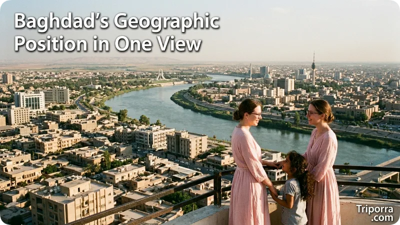
The city’s location can be remembered through these main geographic relationships:
- Country: Iraq
- Capital status: National capital
- Administrative area: Baghdad Governorate
- Region: Middle East
- Subregion: Western Asia
- Continent: Asia
- Position in Iraq: Central Iraq
- River: Tigris
- Coordinates: About 33.34° N, 44.40° E
- Karbala: Southwest
- Najaf: Southwest
- Kirkuk: North
- Mosul: North
- Erbil: Northeast
- Basrah: Southeast
- Persian Gulf: Southeast
- Time zone: UTC+3
Together, these relationships provide a clear picture of the city’s geographic setting without repeating the same description.
FAQs
Where is Baghdad located?
Baghdad is located in central Iraq along the Tigris River. It serves as the country’s national capital and lies within western Asia and the broader Middle East.
What country is Baghdad in?
The city is in Iraq.
Is Baghdad the capital of Iraq?
Yes. Baghdad is the national capital of Iraq.
Is Baghdad in Asia?
Yes. It is located in western Asia and is commonly classified as part of the Middle East.
What river runs through Baghdad?
The Tigris River runs directly through the city.
What are the coordinates of Baghdad?
The approximate coordinates are 33.34° N, 44.40° E.
Is Baghdad a coastal city?
No. It is an inland city. Iraq’s Persian Gulf coastline lies much farther southeast.
How far is Baghdad from Mosul?
The two cities are roughly 220 miles apart in a straight line, with Mosul lying to the north.
How far is Baghdad from Erbil?
The straight-line distance is roughly 200 miles, with Erbil located to the northeast.
How far is Baghdad from Basrah?
The approximate straight-line distance is 280 miles, with Basrah situated to the southeast.
What time zone is Baghdad in?
Baghdad uses UTC+3.
Conclusion
Baghdad is the national capital of Iraq, situated in central Iraq along the Tigris River. The city belongs to western Asia and is commonly included within the broader Middle East region.
Its approximate coordinates are 33.34° N, 44.40° E. Mosul and Kirkuk lie to the north, Erbil is northeast, Karbala and Najaf are southwest, and Basrah is southeast. Unlike Iraq’s Gulf-facing areas, the capital is an inland city.
In simple geographic terms, Baghdad is Iraq’s capital on the Tigris River in central western Asia.

Elena Rostova bridges the gap between premium hospitality and authentic local experiences. Armed with a background in luxury hospitality management and a passion for fine architecture, she spent years evaluating elite resorts before transitioning into travel journalism. Elena heads the luxury and boutique travel vertical on Triporra.com. Her meticulous guides strip away the guesswork from high-end travel, showcasing unique five-star escapes, fine regional dining, and bespoke private tours that elevate a standard vacation into an unforgettable journey.