
Introduction
Uvalde is a city in Uvalde County, Texas, in South Texas. It lies west of San Antonio and north of the Mexico border region. Uvalde sits along the Leona River and serves as the county seat of Uvalde County. Its location places it between the Texas Hill Country to the north and the broader South Texas landscape to the south.
Featured Snippet Answer
Uvalde, Texas, is in Uvalde County in South Texas, about 85 miles west of San Antonio. The city lies along the Leona River, roughly 70 miles north of the Mexico border. Uvalde is part of the South Texas region and sits near the transition between the Hill Country and the South Texas Plains.
Quick Facts
| Fact | Information |
|---|---|
| City | Uvalde |
| State | Texas |
| County | Uvalde County |
| County seat | Uvalde |
| U.S. region | South Texas |
| Geographic setting | Inland South Texas |
| Nearby river | Leona River |
| Country | United States |
| Continent | North America |
| Approximate coordinates | 29.21° N, 99.79° W |
| Nearby major city | San Antonio |
| Distance from San Antonio | About 85 miles west |
| Distance from Del Rio | About 65 miles east |
| Distance from Eagle Pass | About 60 miles north |
| Mexico border | About 70 miles south |
| Time zone | Central Time |
Where Is Uvalde Located in Texas?
It sits in the southwestern part of Texas. The city belongs to Uvalde County, which is located west of San Antonio and east of the larger border-region communities around Del Rio and Eagle Pass.
On a Texas map, Uvalde appears well inland rather than directly along the Gulf Coast. The city also sits south of the main Hill Country area and north of the Rio Grande border region.
Its approximate coordinates are 29.21° north latitude and 99.79° west longitude.
The location gives Uvalde a useful position between several important parts of southern Texas. San Antonio lies to the east, Del Rio lies to the west, and the Mexico border lies to the south.
What County Is Uvalde, Texas, In?
Uvalde is in Uvalde County and serves as the county seat.
Uvalde County lies in the southwestern portion of Texas. The county extends from the Hill Country-influenced landscape in the north toward the South Texas Plains farther south.
Because Uvalde is the county seat, it serves as the main governmental center for the county.
What Part of Texas Is Uvalde In?
It is generally considered part of South Texas.
Its exact geographic setting can vary depending on how regions are defined. The city lies close to the southern edge of the Texas Hill Country, while areas farther south have stronger connections to the South Texas Plains.
This gives Uvalde a location between two recognizable Texas geographic areas rather than placing it clearly inside only one landscape.
Where Is Uvalde on a Map?
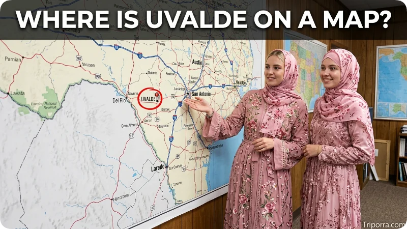
On a Texas map, Uvalde is located:
- West of San Antonio
- East of Del Rio
- North of Eagle Pass
- North of the Mexico border
- Southwest of the main Hill Country area
- Along the Leona River
The city sits on the U.S. Highway 90 corridor, which connects communities across southern Texas. This road helps place Uvalde within the wider network between San Antonio and the Texas-Mexico border region.
How Far Is Uvalde From San Antonio?
Uvalde is approximately 85 miles west of San Antonio by road, although the exact driving distance depends on the route and starting point.
San Antonio is the nearest major metropolitan area of national prominence. Traveling west from San Antonio takes you toward Uvalde through the inland South Texas landscape.
Because San Antonio is much larger than Uvalde, people often use it as the easiest reference point when explaining where Uvalde is located.
How Far Is Uvalde From Del Rio?
Uvalde is roughly 65 miles east of Del Rio.
Del Rio sits farther west near the Rio Grande and the Mexico border. Uvalde therefore occupies a position between the San Antonio area and the Del Rio border region.
The two cities are connected by U.S. Highway 90.
How Far Is Uvalde From Eagle Pass?
Uvalde is approximately 60 miles north of Eagle Pass.
Eagle Pass lies directly along the Rio Grande opposite Piedras Negras, Mexico. From Uvalde, traveling south takes you toward the border region around Eagle Pass.
This makes Eagle Pass another useful geographic reference for understanding Uvalde’s position in southwestern Texas.
How Far Is Uvalde From the Mexico Border?
Uvalde is roughly 70 miles north of the Mexico border, although the exact distance varies depending on which point along the border you measure.
The Rio Grande forms much of the international boundary between Texas and Mexico. It does not sit directly on that river, but the city is close enough to the border region to have strong geographic ties to southwestern Texas.
What River Is Near Uvalde?
The Leona River runs through the Uvalde area.
The river is an important geographic feature because Uvalde developed along a waterway in an otherwise relatively dry part of South Texas.
The Leona River begins in the Uvalde area and continues southward through Uvalde County. Its presence helps explain the city’s location and landscape.
Is Uvalde in the Texas Hill Country?
It is near the southern edge of the Texas Hill Country, but descriptions of the city vary depending on the geographic boundary being used.
The Hill Country extends across much of central Texas, with San Antonio and Austin often serving as familiar reference points around its broader southern and eastern areas. Uvalde lies southwest of the core Hill Country area.
Farther south of Uvalde, the landscape transitions toward the South Texas Plains.
What Cities Are Near Uvalde?
Several Texas cities provide useful reference points:
San Antonio: About 85 miles east of Uvalde and the nearest major metropolitan area.
Del Rio: About 65 miles west of Uvalde, near the Rio Grande.
Eagle Pass: About 60 miles south of Uvalde, directly on the Mexico border.
Carrizo Springs: Roughly 55 miles south of Uvalde.
Kerrville: Roughly 75 miles northeast of Uvalde and part of the Hill Country region.
These distances are approximate and can vary depending on whether you measure straight-line distance or driving distance.
Is Uvalde Near San Antonio?
Yes. Uvalde is relatively close to San Antonio compared with many other Texas cities.
The city sits about 85 miles west of San Antonio. That places Uvalde within a practical driving distance of the San Antonio metropolitan area while keeping it clearly separate from the city itself.
On a statewide map, San Antonio provides one of the easiest reference points for locating Uvalde.
What Is Uvalde Known Geographically For?
Geographically, Uvalde is notable for its position in southwestern Texas near several important regional boundaries.
The city lies along the Leona River and sits between the Hill Country-influenced terrain farther north and the South Texas Plains farther south. It also occupies a point along the transportation route between San Antonio and communities closer to the Mexico border.
Uvalde County surrounds the city and gives Uvalde its role as the county seat.
What Time Zone Is Uvalde In?
Uvalde uses the Central Time Zone.
Like the rest of Texas that observes Central Time, Uvalde follows Central Standard Time (CST) during the standard-time period and Central Daylight Time (CDT) when daylight saving time is in effect.
This places Uvalde in the same time zone as San Antonio, Austin, Houston, Dallas, and many other major Texas cities.
Where Is Uvalde County in Texas?
Uvalde County is in southwestern Texas. It lies west of San Antonio and north of several counties closer to the Rio Grande.
The county’s position places it near the meeting point of several recognizable Texas geographic areas. Its northern portions have connections to the Hill Country, while its southern areas extend toward the South Texas Plains.
Uvalde sits near the center of the county and functions as its administrative seat.
Uvalde’s Geographic Position at a Glance
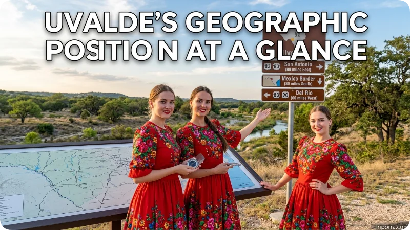
A simple way to picture Uvalde is to place it between several major reference points:
San Antonio → east
Uvalde → center
Del Rio → west
Eagle Pass and Mexico border region → south
Texas Hill Country → north and northeast
This mental map shows why Uvalde is often described as a southwestern or South Texas city.
FAQs
What state is Uvalde in?
Uvalde is in Texas, in the southern part of the United States.
What county is Uvalde, Texas, in?
Uvalde is located in Uvalde County and serves as the county seat.
Is Uvalde in South Texas?
Yes. Uvalde is generally considered part of South Texas, although its location near the southern edge of the Hill Country creates some geographic overlap in regional descriptions.
How far is Uvalde from San Antonio?
Uvalde is about 85 miles west of San Antonio. The exact driving distance varies with the route.
Is Uvalde near the Mexico border?
Yes. Uvalde is roughly 70 miles north of the Mexico border, depending on the point used for measurement.
Is Uvalde in the Texas Hill Country?
Uvalde lies near the southern edge of the Texas Hill Country. Its geographic setting also connects it with the South Texas Plains farther south.
What river runs through Uvalde?
The Leona River runs through the Uvalde area and is one of the city’s main geographic features.
What time zone is Uvalde, Texas, in?
Uvalde is in the Central Time Zone and observes daylight saving time.
Conclusion
Uvalde is a city in Uvalde County, South Texas, about 85 miles west of San Antonio. It lies along the Leona River, roughly 70 miles north of the Mexico border, and near the transition between the Hill Country and South Texas Plains. On a Texas map, its position is easiest to understand as west of San Antonio, east of Del Rio, and north of Eagle Pass.

Silas Vance is a geography enthusiast, travel researcher, and location-focused content writer dedicated to helping readers better understand the world around them on triporra.com. He specializes in creating informative guides about cities, countries, islands, landmarks, universities, and other notable destinations. His work combines geographic accuracy, historical context, and practical insights to answer location-based questions in a simple and engaging way.










