Introduction
Tulum is a city in Quintana Roo, Mexico, on the eastern side of the Yucatán Peninsula. It lies along Mexico’s Caribbean coast in the Riviera Maya region. Tulum is south of Playa del Carmen and Cancún and north of the city of Chetumal. The city is also the municipal seat of Tulum Municipality, which extends inland and along the Caribbean coast.
Tulum sits in southeastern Mexico, close to the Caribbean Sea. Its location places it in the northern part of Quintana Roo, while the larger municipality reaches west toward the state of Yucatán. The municipality borders Solidaridad Municipality to the north, Felipe Carrillo Puerto Municipality to the south and west, and the Caribbean Sea to the east.
On a map of Mexico, Tulum appears far southeast of Mexico City and on the eastern edge of the Yucatán Peninsula. The city itself is slightly inland from the Caribbean shoreline, while the famous archaeological zone lies directly beside the sea.
Featured Snippet Answer
Tulum is a city in Quintana Roo, Mexico, on the eastern coast of the Yucatán Peninsula. It is part of the Riviera Maya and faces the Caribbean Sea. Tulum is about 40 miles south of Playa del Carmen and roughly 80 miles south of Cancún, making it a major population center in southeastern Quintana Roo.
Quick Facts
| Fact | Information |
|---|---|
| City | Tulum |
| Municipality | Tulum Municipality |
| State | Quintana Roo |
| Country | Mexico |
| Continent | North America |
| Geographic region | Yucatán Peninsula |
| Regional area | Riviera Maya |
| Coast | Caribbean Sea |
| Approximate coordinates | 20.2° N, 87.5° W |
| Municipal seat | Tulum |
| Nearby major city | Playa del Carmen |
| Other nearby major city | Cancún |
| State capital | Chetumal |
| Time zone | Eastern Standard Time (UTC−5) |
| Daylight saving time | Not observed |
| Municipal northern border | Solidaridad |
| Municipal southern border | Felipe Carrillo Puerto |
| Western area | Borders Yucatán state |
| Eastern side | Caribbean Sea |
INEGI places Tulum Municipality between approximately 19°46′ and 20°31′ north latitude and 87°18′ and 88°00′ west longitude. Official municipal and geographic sources also identify Tulum as the municipal seat of Tulum Municipality in Quintana Roo.
Where Is Tulum Located in Mexico?
Tulum is in southeastern Mexico, in the state of Quintana Roo. Quintana Roo occupies the eastern side of the Yucatán Peninsula and has a long coastline along the Caribbean Sea.
Tulum is located in the northern-central part of Quintana Roo. The city sits close to the coast, while the municipality covers a much larger area that extends inland. INEGI identifies the municipality as part of the Yucatán Peninsula physiographic province.
This location gives Tulum a clear geographic position within Mexico:
Mexico → Yucatán Peninsula → Quintana Roo → Tulum Municipality → Tulum city
That hierarchy is useful because Tulum can refer to both the city and the municipality. The city is the urban center and municipal seat. The municipality includes the city and a broader area surrounding it.
What State Is Tulum In?
Tulum is in Quintana Roo, one of Mexico’s 32 federal entities.
Quintana Roo occupies the northeastern and eastern portion of the Yucatán Peninsula. The state borders Yucatán to the west and northwest, Campeche to the west, and Belize to the south. The Caribbean Sea forms much of its eastern boundary.
Tulum is in the northern part of the state. It is not in Yucatán state, even though the municipality reaches west toward the Yucatán border.
The state capital of Quintana Roo is Chetumal, which is much farther south than Tulum. Cancún is the state’s best-known large urban center, but it is not the state capital.
Is Tulum on the Yucatán Peninsula?
Yes. Tulum is on the Yucatán Peninsula.
The Yucatán Peninsula extends into the Caribbean Sea and the Gulf of Mexico and includes large parts of southeastern Mexico, northern Guatemala, and Belize. Within Mexico, the peninsula includes the states of Yucatán, Campeche, and Quintana Roo.
Tulum occupies the eastern side of this peninsula. Its location is therefore easy to identify on a regional map: look at the eastern edge of the Yucatán Peninsula, then move south from Cancún and Playa del Carmen.
INEGI classifies the Tulum Municipality within the Yucatán Peninsula physiographic province. Much of the municipality consists of low, limestone-based terrain typical of the peninsula.
Is Tulum on the Caribbean Sea?
Yes. Tulum is on Mexico’s Caribbean coast.
The Caribbean Sea lies east of Tulum. The city’s coastal location is one of its defining geographic features. However, the urban center of Tulum is not directly on the shoreline. The main city lies inland, while the coast and archaeological zone are farther east.
The distinction matters because maps may show “Tulum” in several ways. Some references identify the city, others refer to Tulum Municipality, and others refer to the archaeological site and coastal area.
At the municipal level, the Caribbean Sea forms the eastern boundary of Tulum Municipality. INEGI also identifies the municipality’s eastern and southern boundaries with the Caribbean Sea.
Where Is Tulum on a Map?
On a map of Mexico, Tulum is located on the eastern side of the Yucatán Peninsula, in Quintana Roo.
The city is approximately at 20.2° north latitude and 87.5° west longitude. These coordinates place Tulum well north of the Belize border and south of the larger urban centers around Cancún.
A simple mental map looks like this:
Cancún
↓ south
Playa del Carmen
↓ south
Tulum
↓ south
Chetumal
The Caribbean Sea lies to the east of this coastal corridor, while the interior of the Yucatán Peninsula extends west.
Official geographic maps show Tulum Municipality between Solidaridad Municipality to the north, Felipe Carrillo Puerto Municipality to the south, the Caribbean Sea to the east, and the Yucatán state boundary toward the west.
Where Is Tulum Relative to Cancún?
Tulum is south of Cancún.
The two cities are both in Quintana Roo and are connected by the main coastal transportation corridor through the Riviera Maya. Cancún sits farther north on the Caribbean coast, while Tulum is farther south.
The straight-line distance is roughly 80 miles, while the road distance is longer. The exact distance varies depending on the points used in each city and the route selected.
This makes Cancún a useful reference point for understanding Tulum’s position. If you locate Cancún on the eastern coast of Quintana Roo and move south along the coast, you pass through Playa del Carmen before reaching Tulum.
Where Is Tulum Relative to Playa del Carmen?
Tulum is south of Playa del Carmen.
Playa del Carmen is another major city in Quintana Roo and lies along the same Caribbean coastal corridor. Tulum is roughly 40 to 45 miles south of Playa del Carmen by road, depending on the starting and ending points. A road route between the two cities is about 67 kilometers in one commonly measured route.
The relationship is straightforward:
- Playa del Carmen is north of Tulum.
- Tulum is south of Playa del Carmen.
- Both cities are in Quintana Roo.
- Both are part of the broader Riviera Maya region.
- The Caribbean Sea lies east of both cities.
This north-south relationship helps place Tulum on a map without relying on exact coordinates.
Where Is Tulum Relative to Chetumal?
Tulum is north of Chetumal, the capital of Quintana Roo.
Chetumal lies near the southern end of the state, close to the Belize border. Tulum sits considerably farther north along the Caribbean side of the peninsula.
The approximate road distance between Tulum and Chetumal is around 155 miles, although the exact figure depends on the route and the points measured.
The two cities therefore have different geographic roles within Quintana Roo. Tulum is a northern-central coastal city, while Chetumal is the state capital in the far south.
Where Is Tulum Relative to Mérida?
Tulum is east-southeast of Mérida, the capital of neighboring Yucatán state.
Mérida lies inland and farther west on the Yucatán Peninsula. Tulum, by contrast, sits on the peninsula’s eastern side near the Caribbean coast.
The two cities are separated by roughly 180 to 200 miles in a straight geographic comparison, with the actual road distance being longer. This east-west relationship helps show how far Tulum is from the central and western parts of the peninsula.
Tulum therefore belongs to Quintana Roo rather than Yucatán, even though the two states share the same peninsula.
What Region Is Tulum In?
Tulum is commonly associated with the Riviera Maya, a coastal region of Quintana Roo.
The Riviera Maya extends along the Caribbean coast of the state. It includes several important coastal population centers, with Playa del Carmen and Tulum among the best-known.
Tulum sits on Mexico’s Yucatán Peninsula, within the southeastern state of Quintana Roo. Along the Caribbean coast, the town also forms part of the Riviera Maya, a well-known coastal region stretching through eastern Quintana Roo.
These terms describe different geographic scales rather than competing locations:
| Geographic level | Tulum’s location |
|---|---|
| Country | Mexico |
| Continent | North America |
| Peninsula | Yucatán Peninsula |
| State | Quintana Roo |
| Coastal region | Riviera Maya |
| Municipality | Tulum Municipality |
| City | Tulum |
What Municipality Is Tulum In?
The city of Tulum is the municipal seat of Tulum Municipality.
This distinction is important because Mexico uses municipalities as local administrative divisions. A municipality is not exactly the same as a U.S. county, although it performs some comparable administrative functions.
Tulum Municipality was created in 2008 as the ninth municipality of Quintana Roo. Its territory includes the city of Tulum as well as other settlements and rural areas.
The municipality covers a much larger area than the urban center. Consequently, geographic facts about the municipality, such as its full boundaries and total territory, should not automatically be treated as facts about the city itself.
What Are the Borders of Tulum Municipality?
Tulum Municipality has several important geographic boundaries.
To the north, it borders Solidaridad Municipality. To the south, it borders Felipe Carrillo Puerto Municipality. The east opens to the Caribbean Sea. Toward the west, the municipality reaches the boundary with Yucatán state and also borders Felipe Carrillo Puerto Municipality.
These borders give Tulum a distinctive position within Quintana Roo. It occupies a coastal section of the state while also extending inland toward the center of the peninsula.
The municipal territory is therefore much broader than the narrow coastal strip commonly associated with the name Tulum.
What Are Tulum’s Coordinates?
Tulum is located at approximately 20.2° N latitude and 87.5° W longitude.
INEGI’s municipal geographic data places the broader municipality between approximately 19°46′ and 20°31′ north latitude and 87°18′ and 88°00′ west longitude.
A separate geographic reference places the Tulum municipal seat near 20°13′ N, 87°28′ W.
Coordinates are useful for identifying the location precisely, but a map relationship is often easier to understand. Tulum is on the eastern Yucatán Peninsula, south of Playa del Carmen, south of Cancún, and north of Chetumal.
What Geographic Features Are Near Tulum?
Tulum lies in a low-lying limestone landscape characteristic of the Yucatán Peninsula.
INEGI classifies the municipality within the Carso Yucateco and Costa Baja de Quintana Roo subregions. Its terrain includes rocky plains, coastal areas, beaches, and shallow depressions. Limestone is a major component of the local geology.
The Caribbean Sea is the most important large-scale geographic feature immediately east of Tulum. Inland areas extend across the peninsula’s low limestone terrain.
The region also contains underground water systems and surface features associated with the peninsula’s limestone geology. These features are part of the broader physical geography of Quintana Roo.
Is Tulum in the Northern or Southern Part of Quintana Roo?
Tulum is in the northern-central part of Quintana Roo.
It is south of the major urban corridor that includes Cancún and Playa del Carmen, but it remains well north of Chetumal and the southern end of the state.
This position makes Tulum a useful midpoint when looking at the Caribbean side of Quintana Roo. On a north-to-south map, the general order is:
Cancún → Playa del Carmen → Tulum → Chetumal
The exact spacing between these places is not equal, but the sequence gives a reliable mental map of the state’s eastern side.
What Time Zone Is Tulum In?
Tulum uses Eastern Standard Time (EST), UTC−5.
Quintana Roo currently observes UTC−5 throughout the year and does not change clocks for daylight saving time.
This time zone is different from most of Mexico’s mainland regions farther west. It also means that Tulum’s clock is aligned with the U.S. Eastern Standard Time offset during the year, although U.S. states that observe daylight saving time can have a different clock time during part of the year.
For geographic reference, the key fact is simple: Tulum is in the UTC−5 time zone.
Is Tulum a City or a Municipality?
Tulum is both the name of a city and a municipality in Quintana Roo.
The city is the urban center and the seat of the municipality. The municipality includes a much larger geographic area surrounding the city.
This distinction explains why sources sometimes provide different coordinates, boundaries, areas, or descriptions for Tulum. A source describing Tulum Municipality may cover the entire administrative territory, while a source describing the city focuses on the urban settlement.
For a question asking where Tulum is, the clearest answer is that Tulum is a city in Quintana Roo, Mexico, on the Caribbean side of the Yucatán Peninsula.
How Far Is Tulum From Major Nearby Cities?
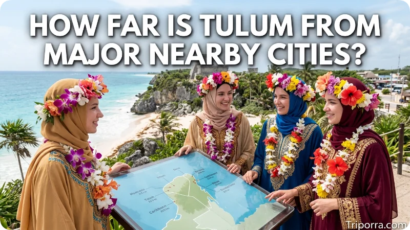
Distances vary depending on whether they are measured from city centers, municipal boundaries, airports, archaeological areas, or road routes. The following figures are useful geographic approximations rather than fixed measurements.
| Place | Direction from Tulum | Approximate distance |
|---|---|---|
| Playa del Carmen | North | About 40–45 miles by road |
| Cancún | North-northeast | About 80 miles straight-line; longer by road |
| Chetumal | South | About 155 miles by road |
| Mérida | West-northwest | Roughly 180–200 miles straight-line |
Playa del Carmen is the closest major city among these reference points. Tulum is farther south than both Playa del Carmen and Cancún, while Chetumal lies far to the south.
Because distances change according to the exact starting point, it is better to treat these figures as map-reading estimates rather than exact city-to-city measurements.
Why Tulum Can Be Confusing on Maps
Tulum lies on the Caribbean coast of Mexico’s Yucatán Peninsula, in the southeastern state of Quintana Roo. Geographically, the town belongs to the Riviera Maya, the coastal region that extends along the eastern side of Quintana Roo.
These are related but distinct geographic entities. A search result that simply says “Tulum” may refer to any one of them.
The city itself is inland from the coastline, while the archaeological zone sits directly on the Caribbean coast. The municipality extends much farther beyond both locations. Official maps from INEGI show the broader municipal boundary and the relationship between Tulum, neighboring municipalities, inland settlements, and the Caribbean Sea.
Tulum’s Place Within the Caribbean Coast of Mexico
Tulum belongs to Mexico’s Caribbean-facing region rather than the Gulf Coast or Pacific Coast.
The Caribbean Sea forms the eastern edge of Quintana Roo. Other major places along this coast include Cancún, Playa del Carmen, and Chetumal farther south.
Tulum’s position is especially easy to recognize because the city’s location falls along the long north-south coastal corridor of eastern Quintana Roo.
From a broader national perspective, Tulum is far southeast of Mexico City. It is also much closer geographically to Belize and the Caribbean than to Mexico’s western Pacific coast.
Tulum and the State of Yucatán
Tulum is not part of Yucatán state.
It is in Quintana Roo, the state immediately east of Yucatán on the peninsula. The two states meet in the western part of Tulum Municipality.
This distinction matters because the phrase “Yucatán” can refer either to the Yucatán Peninsula or to the state of Yucatán.
Tulum is on the Yucatán Peninsula, but it is not in Yucatán state.
Its state is Quintana Roo.
That simple distinction resolves one of the most common geographic sources of confusion about Tulum.
Tulum’s Location in One Simple Map
If you want to remember Tulum’s location without memorizing coordinates, use this sequence:
Mexico
→ Yucatán Peninsula
→ Quintana Roo
→ Riviera Maya
→ Tulum
Then place the surrounding landmarks:
- Caribbean Sea: east
- Playa del Carmen: north
- Cancún: north-northeast
- Chetumal: south
- Yucatán state: west
- Belize: farther south
This gives a clear geographic picture without confusing Tulum with its municipality, archaeological site, or the state of Yucatán.
FAQs
What state is Tulum in?
Tulum is in Quintana Roo, a state in southeastern Mexico. It is located on the eastern side of the Yucatán Peninsula along the Caribbean coast.
Is Tulum in Yucatán?
No. Tulum is in Quintana Roo. However, it is located on the Yucatán Peninsula, which includes the Mexican states of Quintana Roo, Yucatán, and Campeche, along with parts of Belize and Guatemala.
Is Tulum on the Caribbean Sea?
Yes. Tulum is on Mexico’s Caribbean coast. The Caribbean Sea lies east of the city and forms the eastern boundary of Tulum Municipality.
Is Tulum near Cancún?
Yes. Tulum is south of Cancún. The two cities are both in Quintana Roo and lie along the eastern coastal corridor of the Yucatán Peninsula.
Is Tulum near Playa del Carmen?
Yes. Tulum is about 40 to 45 miles south of Playa del Carmen by road, depending on the exact locations measured.
What is Tulum known as geographically?
Tulum is a city and municipal seat in Quintana Roo, within the Riviera Maya on the eastern side of the Yucatán Peninsula.
What are the coordinates of Tulum?
Tulum is approximately at 20.2° N, 87.5° W. Official geographic sources place the broader Tulum Municipality across a larger range of latitude and longitude.
What time zone is Tulum in?
Tulum uses Eastern Standard Time, UTC−5, and Quintana Roo does not observe daylight saving time.
Conclusion
Tulum is a city in Quintana Roo, Mexico, on the eastern side of the Yucatán Peninsula. It forms part of the Riviera Maya and lies along the Caribbean coast. On a simple map, place Tulum south of Playa del Carmen and Cancún, north of Chetumal, and east of the interior Yucatán Peninsula. The city is also the municipal seat of the larger Tulum Municipality.

Elena Rostova bridges the gap between premium hospitality and authentic local experiences. Armed with a background in luxury hospitality management and a passion for fine architecture, she spent years evaluating elite resorts before transitioning into travel journalism. Elena heads the luxury and boutique travel vertical on Triporra.com. Her meticulous guides strip away the guesswork from high-end travel, showcasing unique five-star escapes, fine regional dining, and bespoke private tours that elevate a standard vacation into an unforgettable journey.










