Introduction
Fisher Island is a small island and census-designated place in Miami-Dade County, Florida. It sits just south of the southern tip of Miami Beach, near the entrance to Biscayne Bay and the Atlantic Ocean. Because of this location, the island is part of the wider Miami metropolitan area and lies only a few miles from downtown Miami.
However, Fisher Island is not a separate incorporated city. Instead, the U.S. Census Bureau recognizes it as Fisher Island CDP, or census-designated place. Its approximate location is 25.76° N, 80.14° W.
On a map, the island is easy to identify once you know its main geographic neighbors. Miami Beach is north, Miami is west, Virginia Key is south, and the Atlantic Ocean is east. Meanwhile, Biscayne Bay surrounds much of the area between the island and mainland Miami.
Featured Snippet Answer
Fisher Island is located in Miami-Dade County, Florida, just south of Miami Beach and southeast of downtown Miami. It is a small island near Biscayne Bay and the Atlantic Ocean. Fisher Island is part of the Miami metropolitan area and is recognized by the U.S. Census Bureau as a census-designated place.
Quick Facts
| Fact | Information |
|---|---|
| Place | Fisher Island |
| Official Census designation | Fisher Island CDP |
| County | Miami-Dade County |
| State | Florida |
| U.S. Region | South |
| Subregion | South Florida |
| Country | United States |
| Continent | North America |
| Coordinates | About 25.76° N, 80.14° W |
| Geographic setting | Island in the Miami area |
| West of | Biscayne Bay and mainland Miami |
| North of | Virginia Key |
| South of | Miami Beach |
| East of | Miami and Biscayne Bay |
| Nearby major city | Miami |
| Time zone | Eastern Time |
| 2020 population | 561 |
The U.S. Census Bureau identifies Fisher Island as a census-designated place in Florida. Its geographic center is approximately 25.7609° N, 80.1417° W. In addition, the 2020 Census recorded 561 residents.
Where Is Fisher Island Located?

It is located off the coast of South Florida, within Miami-Dade County. It is separated from the mainland and nearby islands by waterways that connect with Biscayne Bay and the Atlantic Ocean.
More specifically, the island is immediately south of Miami Beach. Government Cut separates It from Miami Beach to the north. At the same time, Norris Cut separates it from Virginia Key to the south.
Biscayne Bay lies mainly west of the island, while the Atlantic Ocean is farther east. As a result, it sits between several major geographic features of the Miami area.
A simple map view looks like this:
- North: Miami Beach
- West: Biscayne Bay and Miami
- South: Virginia Key
- East: Atlantic Ocean
Therefore , it is very close to both Miami and Miami Beach, even though water separates it from both areas.
Is Fisher Island Part of Miami?
It is closely connected to Miami, but it is not the same as the City of Miami.
Instead, the U.S. Census Bureau identifies it as a census-designated place in Miami-Dade County. Miami-Dade County planning records also describe Fisher Island as being within unincorporated Miami-Dade County.
This distinction is important because people often describe the island as part of Miami because of its location and strong connection to the city. Nevertheless, Fisher Island has a different geographic and administrative designation from the City of Miami.
The confusion can increase because the island uses a Miami Beach mailing address and ZIP Code. Even so, its official Census designation is Fisher Island CDP in Miami-Dade County.
Where Is Fisher Island on a Map?
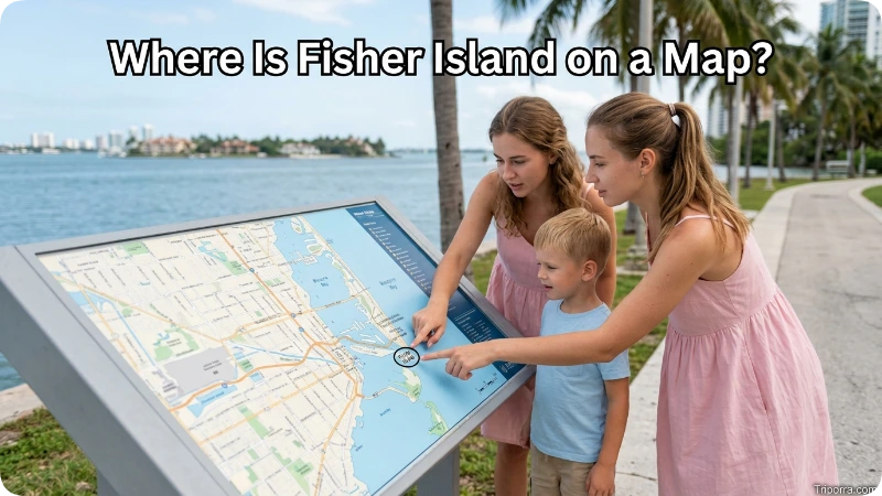
On a map of South Florida, it appears just offshore from the southern end of Miami Beach.
It is near Government Cut, a major waterway between Miami Beach and the Port of Miami area. From there, the island sits close to the channels that connect Biscayne Bay with the Atlantic Ocean.
Its approximate coordinates are:
25.76° north latitude, 80.14° west longitude.
These coordinates place it along Florida’s southeastern coast. Furthermore, they show how close the island is to the urban center of Miami.
How Far Is Fisher Island From Miami?
It is only a few miles from Miami. It is roughly 3 miles east of downtown Miami, although the exact distance depends on the points used for measurement.
Biscayne Bay and nearby waterways separate the island from downtown. Consequently, the distance on a map is short, but the trip itself requires water transportation.
There is no normal public road or bridge connecting Fisher Island directly with mainland Miami. Instead, ferry service provides an important connection between the island and the Miami area.
Miami-Dade planning records identify the Fisher Island car-ferry connection from Terminal Island near the Port of Miami. Thus, it can be close to downtown in geographic terms while still requiring a ferry or boat to reach it.
How Far Is Fisher Island From Miami Beach?
It is even closer to Miami Beach. The island lies directly south of Miami Beach, with Government Cut separating the two areas.
At their closest points, some geographic descriptions place Fisher Island only about 500 feet south of Miami Beach. However, actual travel distances are longer because water separates the two locations.
South Beach is also nearby. Because Fisher Island sits just off the southern end of Miami Beach, both areas form part of the same closely connected coastal landscape.
A simple mental map is:
Miami Beach → Fisher Island → Virginia Key
Meanwhile, Miami and the Port of Miami are to the west, with Biscayne Bay and connected waterways between these locations.
What County Is Fisher Island In?

It is in Miami-Dade County, Florida.
Miami-Dade County covers a large part of southeastern Florida. It includes major communities such as Miami, Miami Beach, Coral Gables, and Hialeah, along with many other cities and communities.
The U.S. Census Bureau specifically identifies Fisher Island as a census-designated place within Florida.
Because it is a CDP rather than an incorporated city, it does not have the same municipal status as nearby cities such as Miami or Miami Beach. Instead, its geographic identity is tied to Miami-Dade County.
What State Is Fisher Island In?
Fisher Island is in Florida.
Florida is located in the Southeastern United States and is part of the U.S. Census Bureau’s South region. Fisher Island sits in the southern part of the state along Florida’s Atlantic coast.
Its position also places it within the Miami-Dade coastal area, close to both Biscayne Bay and the Atlantic Ocean. Therefore, Fisher Island is firmly part of South Florida.
Is Fisher Island Part of South Florida?
Yes. It is geographically part of South Florida.
It lies within the Miami-Dade County area, directly near Miami and Miami Beach. The term South Florida commonly refers to the southern portion of the Florida peninsula and often includes the Miami metropolitan area.
Because it is located near the Atlantic coast and Biscayne Bay, its geographic setting clearly places it within South Florida.
What Is Fisher Island Near?
Several well-known Miami-area locations are close to Fisher Island.
Miami Beach is directly north of the island. Therefore, it is one of the easiest places to use as a reference when locating it .
Miami is west of the island. Downtown Miami is only a few miles away across Biscayne Bay and connected waterways.
Port Miami is also nearby to the northwest. It sits just east of the port area, although several waterways separate the two locations.
Virginia Key is south of it , across Norris Cut. Virginia Key is part of the City of Miami.
Farther south, Key Biscayne provides another useful reference point. It is another major island community in Miami-Dade County.
Together, these locations help show where Fisher Island sits within the South Florida coastal area.
What Water Is Around Fisher Island?

It is surrounded by waterways connected to Biscayne Bay and the Atlantic Ocean.
Biscayne Bay is mainly west of the island. On the other hand, the Atlantic Ocean lies to the east of the Miami Beach and Fisher Island coastal area.
The island is also positioned near two important waterways. Government Cut separates it from Miami Beach to the north, while Norris Cut separates it from Virginia Key to the south.
As a result, water plays a major role in the island’s geography. It also explains why it does not have a conventional road connection with mainland Miami.
How Do You Get to Fisher Island?
It does not have a normal public road connection to Miami or Miami Beach.
Instead, access is primarily by ferry or private boat. Miami-Dade County records identify ferry operations connecting Fisher Island with the Miami area, including the Fisher Island car-ferry station near Terminal Island.
This transportation setup is important when considering the island’s location. Although it is only a few miles from central Miami, Biscayne Bay and surrounding waterways separate it from the mainland.
Therefore, a short distance on a map does not mean that someone can simply drive from downtown Miami onto the island.
Fisher Island and the Miami Metropolitan Area
It is part of the wider Miami metropolitan area.
The island sits within the highly developed coastal landscape of Miami-Dade County. Nearby places include Miami, Miami Beach, PortMiami, Virginia Key, and Key Biscayne.
In addition, Fisher Island is close to several important transportation routes around Biscayne Bay. The Port of Miami and MacArthur Causeway are nearby, while the Atlantic Ocean lies immediately to the east.
Because of this position, Fisher Island is physically close to some of South Florida’s best-known urban areas. At the same time, the surrounding water keeps it separate from the mainland.
Fisher Island Population and Size

It is very small compared with nearby cities.
The 2020 Census counted 561 residents in Fisher Island CDP. Although the population is small, the island contains developed residential areas and other private land uses.
Miami-Dade County planning documents describe the island as approximately 216 acres. They also identify residential development and a golf course among its major land uses.
Therefore, it should not be viewed as a large city or typical mainland community. Instead, it is a small island community located within the Miami metropolitan area.
Fisher Island’s Geographic Position
One of the easiest ways to remember Fisher Island’s location is to connect it with four major points.
Miami Beach is north. Government Cut separates the island from the southern end of Miami Beach.
Miami is west. Downtown Miami is only a few miles away across Biscayne Bay and nearby waterways.
Virginia Key is south. Norris Cut separates Fisher Island from Virginia Key.
The Atlantic Ocean is east. The island sits close to the Atlantic side of the Miami coastal area.
Taken together, these directions provide a simple mental map. Even without knowing the exact coordinates, you can locate Fisher Island by remembering its position between Miami Beach and Virginia Key, just offshore from Miami.
Fisher Island Time Zone

It uses Eastern Time, the same time zone used by Miami, Miami Beach, and most of Florida’s Atlantic coast.
During standard time, the area follows Eastern Standard Time (EST), which is UTC−5. During daylight saving time, it changes to Eastern Daylight Time (EDT), which is UTC−4.
As a result, there is no time difference between it , Miami, and Miami Beach.
FAQs
What state is Fisher Island in?
It is in Florida. It is located in Miami-Dade County in South Florida, close to Miami and Miami Beach.
What county is Fisher Island in?
It is in Miami-Dade County, Florida. The U.S. Census Bureau recognizes it as the Fisher Island census-designated place.
Is Fisher Island part of Miami?
It is part of the Miami metropolitan area, but it is not the City of Miami. It is officially recognized as Fisher Island CDP and is located within unincorporated Miami-Dade County.
Is Fisher Island part of Miami Beach?
Fisher Island is directly south of Miami Beach and is separated from it by Government Cut. Therefore, it is very close to Miami Beach but remains separately identified as Fisher Island CDP.
How far is Fisher Island from downtown Miami?
Fisher Island is approximately 3 miles east of downtown Miami, depending on the exact points being measured. Biscayne Bay and nearby waterways separate the island from downtown.
Can you drive to Fisher Island?
There is no conventional public road or bridge connecting Fisher Island directly to the mainland. Instead, ferry and private boat services provide access to the island.
What is north of Fisher Island?
Miami Beach is directly north of Fisher Island, across Government Cut. Because of this, Miami Beach is one of the easiest reference points for locating the island.
What is south of Fisher Island?
Virginia Key is south of Fisher Island, across Norris Cut. Farther south, Key Biscayne is another major island community in Miami-Dade County.
Conclusion
Fisher Island is a small island community in Miami-Dade County, Florida, located just south of Miami Beach and a few miles east of downtown Miami. The U.S. Census Bureau recognizes it as a census-designated place, and the island forms part of the wider Miami metropolitan area.
The easiest way to locate Fisher Island is to remember its surrounding geography. Miami Beach is north, Miami is west, Virginia Key is south, and the Atlantic Ocean is east. In addition, Biscayne Bay and several connecting waterways surround the island.
Its approximate coordinates are 25.76° N, 80.14° W. Although Fisher Island is physically close to Miami, its water-separated location gives it a distinct geographic identity within South Florida.

Elena Rostova bridges the gap between premium hospitality and authentic local experiences. Armed with a background in luxury hospitality management and a passion for fine architecture, she spent years evaluating elite resorts before transitioning into travel journalism. Elena heads the luxury and boutique travel vertical on Triporra.com. Her meticulous guides strip away the guesswork from high-end travel, showcasing unique five-star escapes, fine regional dining, and bespoke private tours that elevate a standard vacation into an unforgettable journey.










