
Maryland is a state in the eastern United States, located along the Atlantic Coast in the Mid-Atlantic region. Although it is one of the smaller U.S. states by land area, it has an important place in American history, government, and transportation. Its location between the nation’s capital and major East Coast cities makes it a key part of the region.
Maryland is part of the East Coast of the United States and belongs to the Mid-Atlantic region. Although it sits between the Northeast and the South, it is officially classified as a Mid-Atlantic state. Its Atlantic coastline and the Chesapeake Bay give Maryland an important role along the eastern seaboard.
Featured Snippet
Maryland is located in the Mid-Atlantic region of the eastern United States. It borders Pennsylvania to the north, Delaware and the Atlantic Ocean to the east, Virginia and West Virginia to the west and south, and Washington, D.C. The state is known for the Chesapeake Bay, blue crabs, colonial history, and its close connection to the U.S. federal government.
Quick Facts About Maryland
| Fact | Details |
| Official Name | State of Maryland |
| Country | United States |
| Region | Mid-Atlantic, Eastern United States |
| Population | Approximately 6.2 million |
| Area | Approximately 32,130 sq km (12,407 sq mi) |
| Highest Elevation | Hoye-Crest – 1,024 m (3,360 ft) |
| Coordinates | Approximately 39.0° N, 76.7° W |
| Time Zone | Eastern Time (ET) |
| Nearest Major City | Washington, D.C. |
| Known For | Chesapeake Bay, blue crabs, seafood, U.S. Naval Academy, colonial history |
| Primary Language | English |
| Currency | United States Dollar (USD) |
Where Is Maryland?
Maryland is found on the eastern side of the United States in the Mid-Atlantic region. It sits between the Northeast and the South, giving it a mix of cultures, landscapes, and traditions. The state stretches from the Atlantic coastline in the east to the Appalachian Mountains in the west.
Washington, D.C., is surrounded on three sides by Maryland, making the state closely connected to the U.S. government. Baltimore, Maryland’s largest city, lies about 40 miles (64 km) northeast of Washington, D.C., while Philadelphia is around 100 miles (160 km) to the northeast.
Travellers often overlook how varied Maryland is. Within a few hours of driving, you can go from sandy beaches along the Atlantic Ocean to mountain forests in the western part of the state. Many visitors expect Maryland to be mostly coastal, but nearly half of the state has rolling hills and mountain scenery.
What Region Is Maryland In?
Maryland belongs to the Mid-Atlantic region of the United States. This region sits between the Northeast and the South, which is why Maryland shares characteristics of both. Its location makes it an important transportation, business, and government hub on the East Coast.
Administrative Status
Maryland is one of the 50 states of the United States. It joined the Union in 1788 as the seventh state to ratify the U.S. Constitution. The capital city is Annapolis, while Baltimore is the largest city and the state’s main economic center.
The governor leads the state government, while local services are managed through counties and the independent city of Baltimore.
Because Maryland surrounds much of Washington, D.C., thousands of people cross state lines every day for work. Visitors entering Maryland from another U.S. state do not pass through border controls, while international visitors follow standard U.S. visa and immigration rules. The state observes Eastern Time throughout the year, with daylight saving time in summer.
Where Is Maryland Located on the U.S. Map?
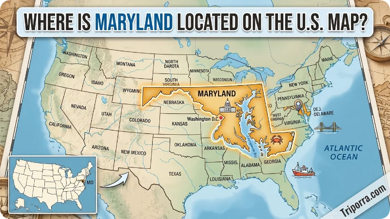
Many people search for Maryland because they want to understand where it sits compared with other well-known states and cities. Maryland is located on the East Coast of the United States in the Mid-Atlantic region. It lies between Pennsylvania to the north and Virginia to the south, while Delaware borders it to the east and West Virginia to the west.
Because Maryland surrounds much of Washington, D.C., it is one of the easiest states to reach from the nation’s capital. It is also within driving distance of Philadelphia, New York City, and Richmond, making it an important transportation hub along the East Coast.
Why Is Maryland Considered a Mid-Atlantic State?
Maryland is classified as part of the Mid-Atlantic region because it sits between the Northeastern and Southern United States. Its geography, climate, economy, and history reflect characteristics of both regions.
The state combines Atlantic beaches, the Chesapeake Bay, fertile farmland, and the Appalachian Mountains within a relatively small area. This diversity gives Maryland a unique identity compared with neighboring states.
Maryland on the Map
Maryland has an unusual shape that many first-time visitors find surprising. The state stretches across nearly 250 miles (400 km) from east to west but is very narrow in some places. Near Hancock, Maryland is less than two miles (3 km) wide.
Pennsylvania borders Maryland to the north. Delaware and the Atlantic Ocean lie to the east. Virginia and West Virginia are to the south and west, with the Potomac River forming much of the southern border.
People often ask where Maryland is compared with other well-known places. Maryland is located south of Pennsylvania, north of Virginia, west of Delaware, and surrounds much of Washington, D.C. It is about a three-hour drive from New York City and roughly two hours from Philadelphia, making it easy to include in an East Coast road trip.
The Chesapeake Bay cuts through the middle of the state, dividing Maryland into eastern and western shores. What most guides miss is that this bay shapes almost every part of life here, from local seafood to transportation and outdoor recreation.
Where Is Maryland on the Map and What Is It Near?
Maryland is located on the East Coast of the United States in the Mid-Atlantic region. On a U.S. map, it sits between Pennsylvania to the north and Virginia to the south, with Delaware and the Atlantic Ocean to the east and West Virginia to the west. Washington, D.C., is bordered by Maryland on three sides.
Maryland is close to several major cities, making it one of the most accessible states in the country. Baltimore is about 40 miles (64 km) from Washington, D.C., while Philadelphia is roughly 100 miles (160 km) away. New York City can also be reached within a few hours by road or rail, making Maryland a convenient base for exploring the northeastern United States.
Major Cities in Maryland
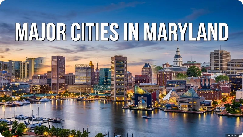
Although Annapolis is the capital city, Baltimore is Maryland’s largest city and serves as its main commercial and cultural center.
Other important cities include Frederick, Rockville, Gaithersburg, Columbia, Silver Spring, and Hagerstown. Many of these communities are located near Washington, D.C., making Maryland one of the country’s most connected states for business and commuting.
Why Is Maryland Famous?
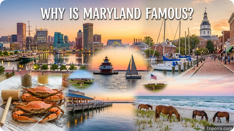
Maryland is best known for the Chesapeake Bay, the largest estuary in the United States. The bay supports fishing, boating, wildlife, and the famous Maryland blue crab, which has become a symbol of the state. Crab cakes and steamed crabs covered in Old Bay seasoning are local favorites.
Another major reason people know Maryland is its close relationship with the U.S. capital. Many federal workers, military personnel, and researchers live in Maryland while working in nearby Washington, D.C. The state is also home to important government agencies, research centers, and military bases.
History plays a big role as well. Annapolis has served as an important colonial port and remains home to the U.S. Naval Academy. Baltimore was the site of the Battle of Baltimore during the War of 1812, which inspired the writing of “The Star-Spangled Banner,” now the national anthem of the United States.
Nature is another highlight. Assateague Island is famous for its wild horses roaming the beaches, while Deep Creek Lake attracts visitors looking for hiking, boating, and winter sports.
Travellers often overlook western Maryland, assuming the whole state is flat and coastal. In reality, the mountains in Garrett County receive snowfall each winter and offer a completely different landscape from the beaches along the Atlantic coast.
One common mistake is thinking Maryland is only important because it borders Washington, D.C. In fact, its seafood industry, ports, universities, healthcare research, and manufacturing all make major contributions to the region.
History of Maryland

For thousands of years before Europeans arrived, Indigenous peoples, including the Piscataway and Nanticoke, lived throughout the region.
Maryland became an English colony in 1634 under the leadership of Cecil Calvert, also known as Lord Baltimore. It was created as a place where English Catholics could practice their religion more freely, although people from different faiths eventually settled there.
During the American Revolution, Maryland supported the fight for independence. The state later became the seventh to ratify the U.S. Constitution in 1788.
The War of 1812 brought one of Maryland’s most famous moments. After watching the British attack Fort McHenry in Baltimore Harbor, Francis Scott Key wrote the poem that later became “The Star-Spangled Banner.”
Maryland remained in the Union during the American Civil War despite being a slave state. Its location between the North and South made it strategically important throughout the conflict.
Today, Maryland combines its colonial history with modern industries such as biotechnology, cybersecurity, education, healthcare, and aerospace.
Maryland is also home to several nationally important institutions, including the National Institutes of Health (NIH), NASA’s Goddard Space Flight Center, and the National Security Agency (NSA). These organizations have helped make the state a leader in science, technology, healthcare, and national security.
Today, Maryland combines centuries of colonial history with one of the strongest knowledge-based economies in the United States. Government agencies, cybersecurity companies, biotechnology firms, and world-class universities continue to shape the state’s modern identity.
Climate and Weather

Maryland has a humid subtropical climate in most areas, while the western mountains experience cooler continental weather.
Spring brings mild temperatures and blooming flowers, making it a popular season for outdoor activities.
Summers are warm and often humid. Coastal areas usually stay slightly cooler because of the Chesapeake Bay and the Atlantic Ocean. Temperatures commonly range from 27°C to 33°C (80°F to 91°F).
Autumn offers colorful leaves, comfortable weather, and many local festivals.
Winters are generally mild in central and eastern Maryland but much colder in the western mountains, where snow is common.
One seasonal trap catches many visitors. Summer afternoons often bring sudden thunderstorms, especially near the Chesapeake Bay, so checking the weather forecast before outdoor plans is a good idea.
Weather conditions can vary significantly across Maryland. Coastal areas generally experience milder winters and humid summers, while western Maryland receives colder temperatures and regular snowfall because of its higher elevation. Hurricane season occasionally affects the Atlantic coastline between June and November.
Things to See and Do

Chesapeake Bay
The Chesapeake Bay is Maryland’s best-known natural attraction. Visitors enjoy boating, kayaking, fishing, seafood restaurants, and waterfront towns.
Historic Places
- Annapolis – Explore the colonial streets, waterfront, and the U.S. Naval Academy.
- Fort McHenry National Monument – Learn about the battle that inspired the U.S. national anthem.
- Antietam National Battlefield – Visit one of the most significant Civil War battlefields.
Nature
- Assateague Island National Seashore – See the famous wild horses and beautiful Atlantic beaches.
- Deep Creek Lake – Popular for hiking, skiing, boating, and camping.
- Cunningham Falls State Park – Home to Maryland’s tallest waterfall.
Cities and Food
- Baltimore’s Inner Harbor – Visit museums, shops, and the National Aquarium.
- Ocean City – Enjoy beaches, boardwalk attractions, and fresh seafood.
- Try Maryland crab cakes, steamed blue crabs, oysters, and Smith Island Cake, the official state dessert.
Top Attractions in Maryland
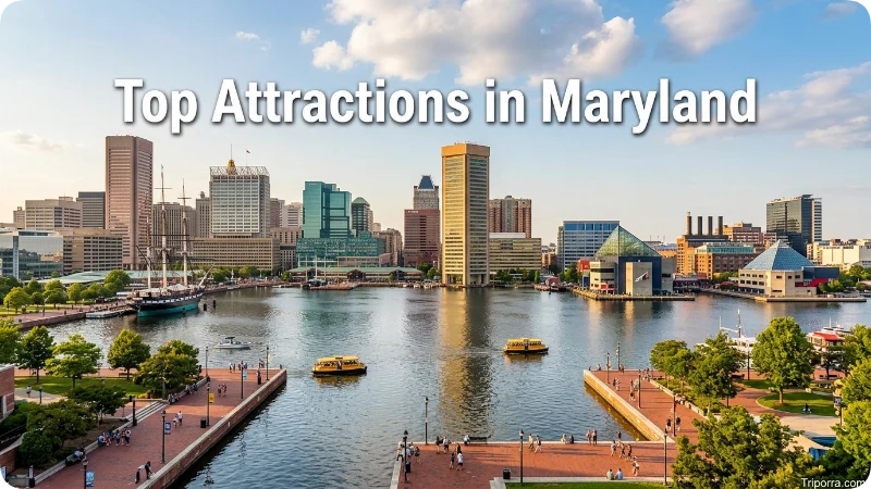
Maryland offers a wide range of attractions for history lovers, outdoor enthusiasts, and families. Some of the state’s most popular places to visit include:
- National Aquarium in Baltimore
- Baltimore Inner Harbor
- Chesapeake Bay
- Assateague Island National Seashore
- Ocean City Boardwalk
- Fort McHenry National Monument
- Deep Creek Lake
- Antietam National Battlefield
- Cunningham Falls State Park
- U.S. Naval Academy in Annapolis
These attractions showcase Maryland’s combination of natural beauty, American history, and waterfront culture.
Best Time to Visit

The best time to visit Maryland depends on what you want to experience.
Spring, from April to May, offers pleasant temperatures, blooming gardens, and fewer crowds. It is an excellent time for sightseeing in Annapolis, Baltimore, and the Chesapeake Bay region.
Autumn, from September through October, is another favorite. Comfortable weather and colorful forests make it ideal for scenic drives and hiking.
Summer is the busiest season, especially in Ocean City and along the Eastern Shore. Beaches are lively, seafood festivals are common, and many families take vacations during this period. However, hotel prices are usually higher, and traffic can become heavy.
Winter is quieter. While coastal areas slow down, western Maryland becomes popular with visitors looking for skiing and snow activities.
What most guides miss is that late September often offers the best balance of warm weather, smaller crowds, and lower accommodation prices compared with the middle of summer.
How to Get to Maryland

Maryland is easily accessible by air, road, and rail. Baltimore/Washington International Thurgood Marshall Airport (BWI) is the state’s primary airport, while nearby Ronald Reagan Washington National Airport and Washington Dulles International Airport also provide convenient access.
Major highways such as Interstate 95, Interstate 70, and Interstate 81 connect Maryland with surrounding states. Amtrak and MARC trains offer reliable rail connections between Maryland, Washington, D.C., Philadelphia, and other major East Coast cities.
Common Misconceptions
Many people believe Maryland is part of the southern United States, while others consider it part of the Northeast. In reality, it belongs to the Mid-Atlantic region and shares characteristics with both.
Another common misunderstanding is that Baltimore is the state capital. The capital is actually Annapolis.
Some visitors also think Maryland has only beaches and waterfront towns. In fact, the western part of the state includes mountains, forests, ski areas, and state parks that look very different from the coastal landscape.
Is Maryland a Good Place to Live?
Maryland is often considered one of the better states to live in because of its strong economy, highly rated schools, quality healthcare, and access to government and technology jobs. Many residents commute to Washington, D.C., while enjoying suburban or smaller-town lifestyles.
The cost of living is generally higher near Washington, D.C., and some parts of central Maryland, but more affordable housing can be found in western and eastern parts of the state.
Related Places
Washington, D.C.
Washington, D.C., borders Maryland on three sides and is only a short drive from many Maryland cities. It is home to the White House, the U.S. Capitol, the Smithsonian museums, and many national monuments. Many people visiting Maryland also spend a day or two exploring the nation’s capital.
Virginia
Virginia lies directly across the Potomac River from Maryland. It offers historic sites such as Colonial Williamsburg, Shenandoah National Park, and Arlington National Cemetery. Together, Maryland and Virginia form much of the greater Washington metropolitan area.
Many travelers also combine visits to Maryland with nearby destinations such as Washington, D.C., Philadelphia, Shenandoah National Park, and Delaware’s Atlantic beaches. These locations are all within a few hours’ drive, making Maryland an excellent base for exploring the Mid-Atlantic region.
Delaware
Delaware is Maryland’s eastern neighbor. It is known for quiet beaches, tax-free shopping, and small coastal towns. Travellers often combine Delaware’s beaches with a trip to Maryland’s Eastern Shore.
Pennsylvania
Pennsylvania borders Maryland to the north. Visitors can easily travel between Baltimore and Philadelphia or explore Gettysburg, one of the most important Civil War sites in the United States.
West Virginia
Western Maryland blends naturally into West Virginia’s mountain landscape. If you enjoy hiking, whitewater rafting, scenic drives, or fall colors, this neighboring state is worth adding to your itinerary.
What Else Do People Want to Know?
Maryland is generally considered a safe destination for tourists, especially in well-known attractions and small towns. Like any travel destination, visitors should stay aware of their surroundings in busy city areas and keep personal belongings secure.
The cost of visiting Maryland depends on where you stay. Hotels near Washington, D.C., and Ocean City are usually more expensive than those in smaller towns. Spring and fall often offer better prices while still providing pleasant weather.
International visitors need to meet U.S. entry requirements, including a valid visa or eligibility under the Visa Waiver Program. Domestic travelers can move freely between states without border checks.
Getting around Maryland is straightforward. Major highways connect the state’s cities, while Baltimore/Washington International (BWI) Airport provides flights to many domestic and international destinations. Trains operated by Amtrak and MARC also make travel convenient.
Local people are generally friendly and appreciate polite behavior. Seafood is an important part of Maryland’s culture, and trying local blue crabs or crab cakes is something many visitors enjoy.
FAQs
Where Is Maryland on a Map?
Maryland is located on the East Coast of the United States in the Mid-Atlantic region. It borders Pennsylvania, Delaware, Virginia, West Virginia, Washington, D.C., and the Atlantic Ocean.
Where Is Maryland Near?
Maryland is near Washington, D.C., Pennsylvania, Virginia, Delaware, and West Virginia. It is also within a few hours of Philadelphia and New York City.
What Are the Major Cities in Maryland?
Maryland’s major cities include Baltimore, Annapolis, Frederick, Rockville, Gaithersburg, Columbia, Hagerstown, and Salisbury.
What State Is MD on the Map?
MD is the official postal abbreviation for Maryland, a state located in the Mid-Atlantic region on the eastern coast of the United States.
What Is the Largest City in Maryland?
Baltimore is the largest city in Maryland and serves as the state’s main economic, cultural, and transportation center.
What Time Is It Now in the U.S. State of Maryland?
Maryland follows the Eastern Time Zone (ET). Check your device or a live world clock for the current local time.
Was Baltimore Ever the Capital of Maryland?
No. Baltimore has never been Maryland’s permanent capital. Annapolis has served as the state capital since 1694.
What State Is Baltimore In?
Baltimore is the largest city in the U.S. state of Maryland. It is located in the north-central part of the state along the Patapsco River.
How long does it take to drive across Maryland?
Driving from the Atlantic coast to the western border usually takes around four to five hours, depending on traffic and your route.
What is the best month to visit Maryland?
September and October are often considered the best months because the weather is comfortable, crowds are smaller than in summer, and fall colors begin to appear across much of the state.
Final Thoughts
Maryland may be one of the smaller U.S. states, but it offers remarkable geographic and cultural diversity. From the Chesapeake Bay and Atlantic beaches to the Appalachian Mountains in the west, the state combines history, nature, and modern cities within a relatively compact area.
Whether you’re planning a visit, researching the state, or simply wondering where Maryland is located, understanding its position in the Mid-Atlantic region helps explain its importance in American history, government, transportation, and tourism.

Elena Rostova bridges the gap between premium hospitality and authentic local experiences. Armed with a background in luxury hospitality management and a passion for fine architecture, she spent years evaluating elite resorts before transitioning into travel journalism. Elena heads the luxury and boutique travel vertical on Triporra.com. Her meticulous guides strip away the guesswork from high-end travel, showcasing unique five-star escapes, fine regional dining, and bespoke private tours that elevate a standard vacation into an unforgettable journey.










