
Introduction
Lake Tahoe is located on the border between California and Nevada in the Sierra Nevada mountain range of the western United States. The lake sits within the Lake Tahoe Basin, with its shoreline and surrounding basin extending across both states. It is about 100 miles northeast of Sacramento, 198 miles northeast of San Francisco, and 58 miles southwest of Reno, Nevada.
Lake Tahoe is not entirely within one state. The California-Nevada state line crosses the lake, making it a bi-state lake. Most of the lake’s area lies on the California side, while the eastern shoreline is in Nevada.
The lake sits high in the Sierra Nevada at roughly 6,224 feet above sea level. Its location near the crest of the mountain range gives the Tahoe Basin a distinct alpine setting.
Featured Snippet Answer
Lake Tahoe is located on the California-Nevada border in the Sierra Nevada of the western United States. The lake extends across California and Nevada, within the Lake Tahoe Basin. It is about 100 miles northeast of Sacramento, 198 miles northeast of San Francisco, and 58 miles southwest of Reno.
Quick Facts
Lake Tahoe Geographic Facts
| Fact | Information |
|---|---|
| Location | California–Nevada border |
| Geographic Region | Sierra Nevada |
| U.S. Region | Western United States |
| Country | United States |
| States | California and Nevada |
| California Counties | El Dorado County and Placer County |
| Nevada Counties | Douglas County and Washoe County; Carson City |
| Approximate Coordinates | 39° N, 120° W |
| Elevation | About 6,224 feet |
| Lake Length | About 22 miles |
| Lake Width | About 12 miles |
| Surface Area | About 192–193 square miles |
| Nearby Major City | Reno, Nevada |
| Other Nearby Cities | Sacramento, California; Carson City, Nevada |
| Time Zone | Pacific Time |
| Geographic Setting | High-elevation alpine lake in the Sierra Nevada |
County note: Lake Tahoe’s surrounding area includes Placer and El Dorado counties in California and Douglas and Washoe counties in Nevada, with Carson City also bordering the lake area. The California–Nevada state line crosses Lake Tahoe itself, dividing the lake and its basin between the two states.
Where Is Lake Tahoe on a Map?

On a map of the United States, Lake Tahoe is in the western part of the country, near the California-Nevada state line. It sits in the Sierra Nevada, east of California’s Central Valley and west of Nevada’s Great Basin.
The lake is positioned near the crest of the Sierra Nevada. This places it in a high mountain basin rather than in a lowland valley or coastal area. USGS describes Lake Tahoe as a large, deep lake located within a granite basin near the crest of the Sierra Nevada.
The California-Nevada boundary runs through the lake. As a result, looking at Lake Tahoe geographically means looking at both California and Nevada rather than assigning the entire lake to one state.
What States Is Lake Tahoe In?
Lake Tahoe is in both California and Nevada.
The western and southern portions of the lake are associated with California, while the eastern shoreline is in Nevada. The state boundary crosses the lake roughly from the north toward the southeast.
About two-thirds of the lake’s area is in California, according to Nevada’s Lake Tahoe basin documentation. The remainder is in Nevada.
This division also affects the surrounding communities. Places such as Tahoe City and South Lake Tahoe are in California, while communities such as Incline Village and Stateline are on the Nevada side.
Which Counties Is Lake Tahoe In?
Lake Tahoe and its basin involve counties on both sides of the state line.
In California, the main counties associated with the lake are:
- Placer County
- El Dorado County
In Nevada, the Lake Tahoe shoreline and basin include:
- Douglas County
- Washoe County
- Carson City, which is an independent city rather than a county
Official Nevada information identifies Douglas, Washoe, and Carson City as the three Nevada jurisdictions bordering Lake Tahoe.
The county boundaries are important because Lake Tahoe is not a city or county itself. It is a lake located within a larger bi-state geographic area.
What Region Is Lake Tahoe In?

Lake Tahoe is part of the Sierra Nevada, a major mountain range extending along eastern California and into western Nevada.
More specifically, the lake lies near the crest of the Sierra Nevada at a high elevation. The surrounding Lake Tahoe Basin covers about 506 square miles, while the lake itself covers roughly 192 square miles.
The basin’s geography is shaped by steep mountain slopes, high elevations, forests, and the lake itself. The surrounding mountains rise thousands of feet above the lake, creating a clearly defined mountain basin.
How Far Is Lake Tahoe From Sacramento?
Lake Tahoe is approximately 100 miles northeast of Sacramento, California.
Sacramento is the nearest major California city commonly used as a reference point for Lake Tahoe’s location. Interstate 80 provides a major route from the Sacramento area across the Sierra Nevada toward the Tahoe region.
The relationship is easy to picture: Sacramento is west of Lake Tahoe, while Tahoe sits farther east in the Sierra Nevada mountains.
How Far Is Lake Tahoe From San Francisco?
Lake Tahoe is about 198 miles northeast of San Francisco, California.
This places Tahoe well inland from the San Francisco Bay Area. The route from San Francisco generally travels east through the Sacramento area before climbing into the Sierra Nevada.
Lake Tahoe is therefore much closer to the Sierra Nevada and Nevada border than it is to California’s Pacific coast.
How Far Is Lake Tahoe From Reno?
Lake Tahoe is approximately 58 miles southwest of Reno, Nevada.
Reno is one of the most useful major-city reference points for understanding Tahoe’s location. Reno lies east of the Sierra Nevada, while Lake Tahoe is farther southwest and high in the mountains.
The two areas are connected by highways crossing the mountain terrain. The Lake Tahoe region is also within relatively easy reach of Reno compared with California’s larger coastal cities.
Is Lake Tahoe in California or Nevada?

Lake Tahoe is in both California and Nevada. The state boundary runs through the lake, so it cannot accurately be described as being entirely in either state.
The California side includes areas around Tahoe City, the west shore, and South Lake Tahoe. The Nevada side includes much of the east shore, including areas around Incline Village and Stateline.
This is why addresses around Lake Tahoe may have either a California or Nevada designation even though they are part of the same lake basin.
What Are the Coordinates of Lake Tahoe?
Lake Tahoe is located at approximately 39° north latitude and 120° west longitude.
Because Lake Tahoe covers a large area, there is no single shoreline point that represents the entire lake. USGS monitoring stations around the lake have different coordinates. For example, a USGS station at Tahoe City is at approximately 39.18° N, 120.12° W, while a station near Zephyr Cove on the Nevada side is at approximately 39.01° N, 119.95° W.
These coordinates place the lake directly along the California-Nevada border in the Sierra Nevada.
How High Is Lake Tahoe?
Lake Tahoe sits at an elevation of roughly 6,224 feet above sea level. USGS describes the average lake elevation as about 6,224 feet, while individual measurement points can vary slightly depending on the reference datum and lake level.
This high elevation is one of the defining geographic characteristics of Lake Tahoe. The lake is surrounded by mountains that rise considerably higher than the water surface.
The natural rim of the lake is around 6,223 feet using the Bureau of Reclamation datum cited by USGS.
How Big Is Lake Tahoe?
Lake Tahoe is approximately 22 miles long and 12 miles wide, with a surface area of about 192 to 193 square miles.
The lake is also exceptionally deep. USGS reports an average depth of about 1,000 feet and a maximum depth of roughly 1,645 feet.
Its combination of large surface area, great depth, and high elevation makes Lake Tahoe a distinctive geographic feature of the Sierra Nevada.
What Is Near Lake Tahoe?
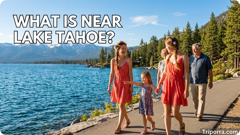
Several cities, towns, and geographic areas help place Lake Tahoe on a map.
Reno, Nevada, lies to the northeast and is the closest major metropolitan reference point commonly associated with the lake.
Carson City, Nevada, is southeast of the lake and is the state capital of Nevada.
Sacramento, California, lies to the southwest and is about 100 miles away.
San Francisco, farther west, is approximately 198 miles from Lake Tahoe.
Other communities directly around the lake include Tahoe City, Kings Beach, South Lake Tahoe, Stateline, and Incline Village.
What Geographic Features Surround Lake Tahoe?
Lake Tahoe is surrounded by the Sierra Nevada mountain range. The basin has steep slopes and mountain ridges that rise substantially above the lake.
The lake’s main natural outlet is the Truckee River, which leaves Lake Tahoe near Tahoe City and flows northeast toward Nevada. USGS identifies the Truckee River as the lake’s regulated outlet.
The surrounding basin also contains numerous smaller streams and tributaries that carry water toward the lake. Together, these waterways form part of the larger Lake Tahoe watershed.
Is Lake Tahoe in the Sierra Nevada?
Yes. Lake Tahoe is located in the Sierra Nevada, near the crest of the mountain range.
USGS describes the lake as being near the crest of the Sierra Nevada and within a granite basin.
Geographically, this is important because Lake Tahoe is not simply near the Sierra Nevada; the lake is a major feature within the mountain system itself.
Is Lake Tahoe Near the California-Nevada Border?

Yes. In fact, the California-Nevada border crosses Lake Tahoe.
This makes Lake Tahoe one of the most recognizable geographic features shared by the two states. The boundary divides portions of the lake and surrounding basin between California and Nevada.
The border also explains why different parts of the Tahoe shoreline fall under different state and local jurisdictions.
FAQs
What State Is Lake Tahoe In?
Lake Tahoe is located on the border of California and Nevada. Therefore, the lake belongs to both states and is shared between them.
Where Is Lake Tahoe Located in the World?
Lake Tahoe is located in North America, specifically in the western United States. Additionally, it sits within the Sierra Nevada mountain range along the California–Nevada border.
Where Is Lake Tahoe Located on a Map?
On a map, Lake Tahoe can be found east of Sacramento, California, and west of Reno, Nevada. As a result, it is one of the most recognizable landmarks in the Sierra Nevada region.
Where Is Lake Tahoe Located in California?
The western side of Lake Tahoe lies in northeastern California. In particular, it extends through parts of El Dorado County and Placer County.
What Are Some Scary Facts About Lake Tahoe?
Lake Tahoe is famous for its extreme depth and icy waters. Furthermore, sudden storms, underwater hazards, and local legends about mysterious events have contributed to its eerie reputation.
How Far Is Lake Tahoe from San Francisco?
Lake Tahoe is about 190 to 200 miles from San Francisco. Depending on traffic and road conditions, the drive usually takes between 3.5 and 4.5 hours.
How Far Is Lake Tahoe from Las Vegas?
Lake Tahoe is approximately 430 to 450 miles from Las Vegas. Consequently, most travelers can expect a drive of around 7 to 8 hours.
What City Is Lake Tahoe In?
Lake Tahoe is not located within a single city. Instead, it is surrounded by several communities, including South Lake Tahoe, Tahoe City, Incline Village, and Stateline.
Conclusion
Lake Tahoe is a large alpine lake on the California-Nevada border in the Sierra Nevada. It lies about 100 miles northeast of Sacramento, 198 miles northeast of San Francisco, and 58 miles southwest of Reno. Its high mountain setting, bi-state location, and position within the Lake Tahoe Basin make it a distinctive geographic feature of the western United States.

About Leo Sterling
Leo Sterling is a geography and travel writer at Triporra.com who believes understanding a place starts with knowing exactly where it is. He turns geographic details on countries, regions, islands, and cities into clear, engaging content for everyday readers.
For Leo, a good location article does more than mark a spot on a map. It shows what borders a place, which region it belongs to, and how it connects to the world around it—an approach reflected in guides like where is Anguilla, where solid research meets a simple, conversational style.
Whether readers are planning a trip, studying, or just curious, Leo’s goal is the same: deliver accurate, easy-to-understand information without unnecessary complexity.
Areas of Focus: Geography | Countries & Regions | Caribbean Islands | Travel Destinations | Location Research | “Where Is?” Content










