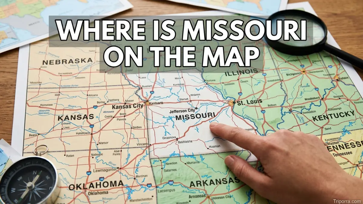
Missouri is located in the central United States and is part of the Midwest. The state sits between the Great Plains and the Mississippi River Valley. It borders eight states: Iowa, Illinois, Kentucky, Tennessee, Arkansas, Oklahoma, Kansas, and Nebraska. Its position places Missouri near the geographic center of the country.
Introduction
Missouri is easy to locate once you know its surrounding states. On a map of the United States, look toward the central part of the country. From there, Missouri lies east of Kansas, west of Illinois, south of Iowa, and north of Arkansas.
The state also occupies an important position between the Great Plains and the Mississippi River. As a result, its geography connects several major parts of the Midwest and central United States.
Kansas City sits near the western edge, while St. Louis is on the eastern side along the Mississippi River. Jefferson City, the state capital, lies closer to the middle of Missouri. Together, these locations provide a simple way to understand where the state sits on the map.
Missouri Location: Quick Facts
| Fact | Information |
|---|---|
| Location | Central United States |
| U.S. Region | Midwest |
| Census Division | West North Central |
| State Abbreviation | MO |
| Country | United States |
| Continent | North America |
| Capital | Jefferson City |
| Bordering States | 8 |
| Counties | 114 counties plus the independent City of St. Louis |
| Geographic Center | Miller County, about 20 miles southwest of Jefferson City |
| Approximate Internal Point | 38.4135° N, 92.5078° W |
| Time Zone | Central Time |
The U.S. Census Bureau classifies Missouri within the Midwest Region and West North Central Division. Meanwhile, the U.S. Geological Survey places Missouri’s geographic center in Miller County, approximately 20 miles southwest of Jefferson City.
Where Is Missouri Located in the United States?
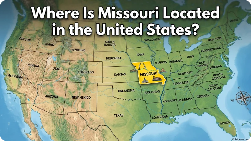
Missouri is in the central part of the United States. It is a landlocked state, so no ocean forms one of its borders. Instead, eight other states surround it.
To picture its position, start with the states immediately around it:
- Iowa lies north of Missouri.
- Nebraska is northwest.
- Kansas is west.
- Oklahoma is southwest.
- Arkansas is south.
- Tennessee is southeast.
- Kentucky lies east and southeast.
- Illinois borders Missouri to the east and northeast.
Therefore, Missouri occupies a useful middle position between the central Plains and the Mississippi River states. Missouri’s state government identifies these eight states as its contiguous neighbors.
What Region Is Missouri In?
Missouri is officially part of the Midwest.
More specifically, the U.S. Census Bureau places it in the West North Central Division. This division also includes Iowa, Kansas, Minnesota, Nebraska, North Dakota, and South Dakota.
Geographically, however, Missouri also has strong connections with nearby regions. Its western side reaches toward the Great Plains, while its eastern boundary follows the Mississippi River. Meanwhile, its southern border meets Arkansas and places Missouri close to the South.
For that reason, Missouri can sometimes seem like a transition point between different parts of the country. Its official Census classification, though, is the Midwest.
Which States Border Missouri?
Missouri has eight neighboring states, placing it among the states with the largest number of state borders in the United States. In fact, only Tennessee shares the same number of state neighbors, with both states bordering eight other states.
The surrounding states can be grouped by direction:
DirectionBordering StateNorthIowaNorthwestNebraskaWestKansasSouthwestOklahomaSouthArkansasSoutheastTennesseeEastIllinoisEast/SoutheastKentucky
The Mississippi River is especially important along Missouri’s eastern side. It forms much of the boundary with Illinois and also separates Missouri from portions of Kentucky and Tennessee.
Where Is Missouri on a Map?
A simple mental map can make Missouri’s location much easier to understand.
Imagine the central United States as a grid. Kansas sits directly west of Missouri, while Illinois is across the Mississippi River to the east. Iowa is above Missouri, and Arkansas is directly below it.
Meanwhile, Nebraska touches the state’s northwest corner, and Oklahoma reaches its southwestern corner. Kentucky and Tennessee are found toward the southeast.
Another useful clue comes from Missouri’s major cities. Kansas City marks the western side of the state, St. Louis marks the eastern side, and Jefferson City is located in the central portion.
So, if you are looking at a U.S. map and find Kansas and Illinois, Missouri is between them.
Where Is Missouri Relative to Kansas City and St. Louis?
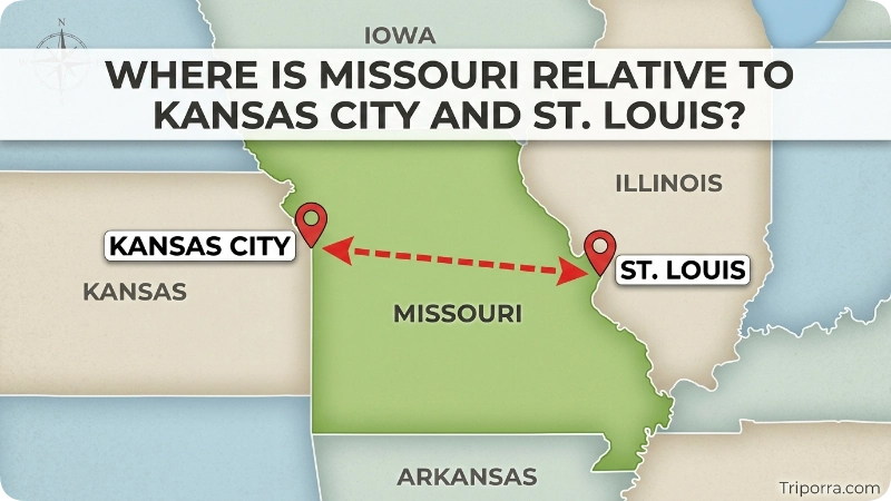
Kansas City and St. Louis provide two of the clearest reference points for understanding Missouri’s shape.
Kansas City is near the western border of Missouri, close to Kansas. It is therefore a useful reference when looking at the western side of the state.
St. Louis is on the eastern side of Missouri, directly along the Mississippi River. Illinois lies across the river from much of the St. Louis area.
Consequently, the two cities give you a quick west-to-east picture of Missouri. Kansas City is toward the west, St. Louis is toward the east, and Jefferson City lies between them.
Missouri state information also describes Kansas City and St. Louis as major metropolitan areas located on the state’s western and eastern borders, respectively.
Where Is Jefferson City on the Map?
Jefferson City is the capital of Missouri and sits near the center of the state.
The city is located along the Missouri River. Because it is near the state’s middle, Jefferson City is a useful reference point when explaining Missouri’s overall location.
In fact, the USGS identifies Missouri’s geographic center in Miller County, about 20 miles southwest of Jefferson City.
That does not mean Jefferson City is the exact geographic center. Rather, its position makes it a convenient central reference for understanding the state’s geography.
What Rivers Help Locate Missouri?
Two major rivers are particularly important when locating Missouri: the Missouri River and the Mississippi River.
The Missouri River enters the state from the northwest and travels across the interior. It eventually reaches the Mississippi River north of St. Louis. The Mississippi, meanwhile, runs along Missouri’s eastern side.
These waterways provide a useful visual clue on a map. The Mississippi River helps define Missouri’s eastern edge, while the Missouri River crosses much of the state from west toward east.
As a result, Missouri’s position is closely connected to two of the most important river systems in the central United States.
What Is Missouri Near?
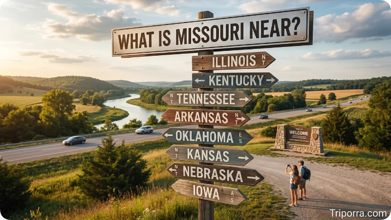
Missouri is near several major geographic regions and states.
To the west, Kansas and Nebraska connect Missouri with the Great Plains. Oklahoma lies farther southwest. To the north, Iowa provides a direct connection to the Upper Midwest.
On the eastern side, Illinois lies across the Mississippi River. Kentucky and Tennessee are also nearby toward the southeast. Arkansas forms Missouri’s southern border.
Because of these relationships, Missouri sits at a crossroads of several major U.S. geographic areas. It is not far from the Plains, the Mississippi River Valley, or the southern states.
What Cities Are Near Missouri?
Several large cities outside and inside the state help explain its location.
Kansas City
Kansas City is in western Missouri near the Kansas border. Its location makes it a useful starting point for understanding Missouri’s relationship with the Great Plains.
St. Louis
St. Louis is on the eastern side of Missouri along the Mississippi River. Across the river is Illinois, making the city an important geographic reference for the state’s eastern boundary.
Springfield
Springfield is in southwestern Missouri. Therefore, it provides a useful reference for the southern and western portions of the state.
Jefferson City
Jefferson City is near the middle of Missouri and serves as the state capital. Its central position makes it helpful when explaining the state’s overall geography.
How Far Is Missouri From Major U.S. Cities?
Because Missouri covers a large area, there is no single distance between the state and another city. The answer changes depending on which Missouri location you use.
For example, St. Louis is much closer to Chicago than Kansas City is. Likewise, Springfield has a different relationship to Memphis than St. Louis does.
For a general map-based understanding, these approximate straight-line distances are useful:
Missouri ReferenceNearby Major CityApproximate DistanceSt. LouisChicagoAbout 260 milesSt. LouisMemphisAbout 240 milesKansas CityOklahoma CityAbout 300 milesJefferson CityDes MoinesAbout 220 milesSpringfieldMemphisAbout 230 miles
These are approximate geographic distances, not driving distances. Therefore, a road trip between the same locations can cover more miles because highways do not follow a straight line.
What Are Missouri’s Coordinates?
Missouri’s location can also be described with latitude and longitude.
The U.S. Census Bureau’s geographic data gives an internal point for Missouri at approximately 38.4135° north latitude and 92.5078° west longitude.
Those coordinates provide a single reference point inside the state. They should not be confused with the state’s geographic center or population center, since each measurement uses a different method.
For a general map search, however, coordinates are another way to identify Missouri’s position in the central United States.
Where Is the Geographic Center of Missouri?
The USGS identifies Missouri’s geographic center in Miller County, about 20 miles southwest of Jefferson City.
This point helps explain why central Missouri is often used as the state’s geographic midpoint. However, a geographic center is an approximation rather than a universally fixed point.
Population centers are different again. The Census Bureau tracks Missouri’s center of population separately, showing how the balance point of residents has changed over time.
Therefore, the geographic center should not be confused with the center of population.
Is Missouri in the Midwest or the South?
Missouri is officially in the Midwest, according to the U.S. Census Bureau.
Its southern border with Arkansas and its proximity to Tennessee and Kentucky can make Missouri feel connected to the South. Even so, the official Census regional classification places it in the Midwest and specifically in the West North Central Division.
Geography can sometimes overlap cultural or regional descriptions. For a standard U.S. geographic classification, though, Missouri belongs to the Midwest.
Is Missouri in the Central United States?
Yes. Missouri is widely described as being in the central United States.
Its location supports that description. Kansas and Nebraska are to the west and northwest, Iowa is north, Illinois is east, and Arkansas is south. Meanwhile, the Missouri and Mississippi rivers reinforce its position within the central river network of the country.
For someone trying to locate Missouri quickly, “central United States” is therefore a useful starting point.
How Do You Find Missouri on a U.S. Map?
Finding Missouri does not require knowing its coordinates.
First, locate the middle section of the United States. Then find Kansas. Missouri is directly east of Kansas.
Next, look for Iowa above Missouri and Arkansas below it. Illinois will appear on the eastern side, separated from much of Missouri by the Mississippi River.
Finally, check the western and southeastern corners. Nebraska and Oklahoma are toward the west, while Kentucky and Tennessee are toward the southeast.
This creates a simple mental picture:
Nebraska — Iowa Kansas — Missouri — Illinois Oklahoma — Arkansas Kentucky / Tennessee
The exact map shape is more complex, but this arrangement gives you a quick way to remember Missouri’s location.
How Large Is Missouri?
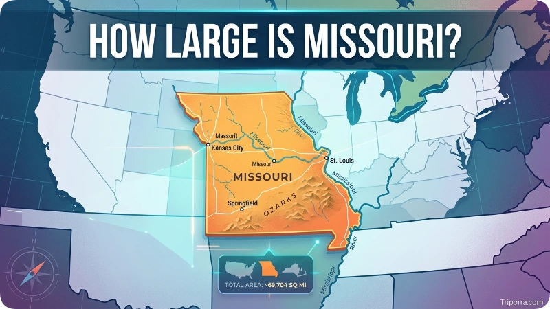
Missouri covers about 69,700 square miles of total area, according to Missouri state information. The state ranks among the larger U.S. states by area.
Its size matters when considering distances. Kansas City and St. Louis are both in Missouri, yet they occupy opposite sides of the state.
Likewise, Springfield and Jefferson City are separated by a substantial portion of the state’s interior. Therefore, saying that a place is “near Missouri” can be less useful than identifying the specific part of the state.
What Is Missouri’s Relationship With the Mississippi River?
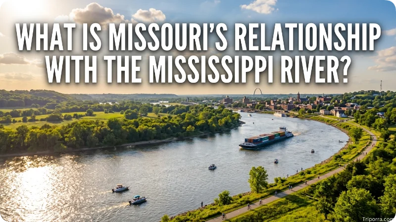
The Mississippi River is one of the most important geographic features for understanding Missouri.
It forms much of Missouri’s eastern boundary and separates the state from Illinois along a large portion of that border. The river also continues along portions of the state’s southeastern boundary.
Meanwhile, the Missouri River crosses the state from the northwest toward the Mississippi. It eventually joins the Mississippi north of St. Louis.
Together, these rivers create a strong geographic framework for locating Missouri on a national map.
Frequently Asked Questions
Where is Missouri on the map?
Missouri is in the central United States and is part of the Midwest. It lies between Kansas and Illinois, with Iowa to the north and Arkansas to the south.
What state is Missouri in?
Missouri is itself one of the 50 U.S. states. It is not part of another state.
What region is Missouri in?
Missouri is in the Midwest Region of the United States and belongs to the West North Central Division under the U.S. Census Bureau’s classification.
Which states border Missouri?
Missouri borders eight states: Iowa, Illinois, Kentucky, Tennessee, Arkansas, Oklahoma, Kansas, and Nebraska.
Is Missouri near Kansas?
Yes. Kansas shares Missouri’s western border. Kansas City, Missouri, is located near that border.
Is Missouri near Illinois?
Yes. Illinois borders Missouri to the east and northeast. The Mississippi River forms much of the boundary between the two states.
What is the capital of Missouri?
Jefferson City is the capital of Missouri. It is located near the center of the state.
What is the largest city in Missouri?
Kansas City is Missouri’s largest city by population. St. Louis is another major city and metropolitan center on the state’s eastern side.
Is Missouri part of the Midwest?
Yes. The U.S. Census Bureau classifies Missouri as part of the Midwest, specifically the West North Central Division.
What are the coordinates of Missouri?
The Census Bureau lists Missouri’s internal geographic point at approximately 38.4135° N, 92.5078° W.
Where is the geographic center of Missouri?
The USGS places Missouri’s geographic center in Miller County, about 20 miles southwest of Jefferson City.
What rivers are associated with Missouri?
The Missouri River crosses the state, while the Mississippi River forms much of its eastern boundary. The two rivers meet north of St. Louis.
Conclusion
Missouri is located in the central United States and the Midwest. On a map, it sits east of Kansas, west of Illinois, south of Iowa, and north of Arkansas, with Nebraska, Oklahoma, Kentucky, and Tennessee also touching its borders.
The state’s central position becomes even clearer through its major landmarks on the map. Kansas City sits toward the west, St. Louis lies along the eastern edge, Jefferson City is near the middle, and the Missouri and Mississippi rivers help define its geographic setting.
So, if you are looking for Missouri on a U.S. map, start near the center of the country and look between the Great Plains and the Mississippi River.

Silas Vance is a geography enthusiast, travel researcher, and location-focused content writer dedicated to helping readers better understand the world around them on triporra.com. He specializes in creating informative guides about cities, countries, islands, landmarks, universities, and other notable destinations. His work combines geographic accuracy, historical context, and practical insights to answer location-based questions in a simple and engaging way.










