
It is a coastal barrier island and town in Brunswick County, North Carolina, on the southeastern U.S. coast. It sits along the Atlantic Ocean, south of Wilmington and near the South Carolina border. The town covers much of the island and lies about 30–34 miles southwest of Wilmington by road, depending on the starting point.
Introduction
If you are searching for where is it , the simplest answer is southeastern North Carolina. It lies in Brunswick County along the Atlantic coast, between the Wilmington area and the South Carolina state line.
The name can refer to both the barrier island and the Town of it , which occupies most of the island. The town shares the island with neighboring Caswell Beach. The Atlantic Ocean lies along the island’s southern side, while the Atlantic Intracoastal Waterway separates it from the mainland to the north.
This location gives it a useful geographic position: it is close to Wilmington, within the Cape Fear coastal area, and not far from the North Carolina–South Carolina border.
Quick Facts
| Fact | Information |
|---|---|
| Location | Southeastern North Carolina coast |
| Type | Barrier island and incorporated town |
| State | North Carolina |
| County | Brunswick County |
| Region | Southeastern North Carolina / Cape Fear coast |
| Country | United States |
| Continent | North America |
| Approximate Coordinates | 33.9434° N, 78.1360° W |
| Nearby Major City | Wilmington, North Carolina |
| Nearby City | Southport, North Carolina |
| Nearby State | South Carolina |
| Ocean | Atlantic Ocean |
| Time Zone | Eastern Time |
| Main Island Access | NC 133 and NC 906 bridges |
Geographic reference: The U.S. Census Bureau’s current geographic data places the Town of it at approximately 33.9434° N, 78.1360° W for its representative point.
Where Is Oak Island Located?
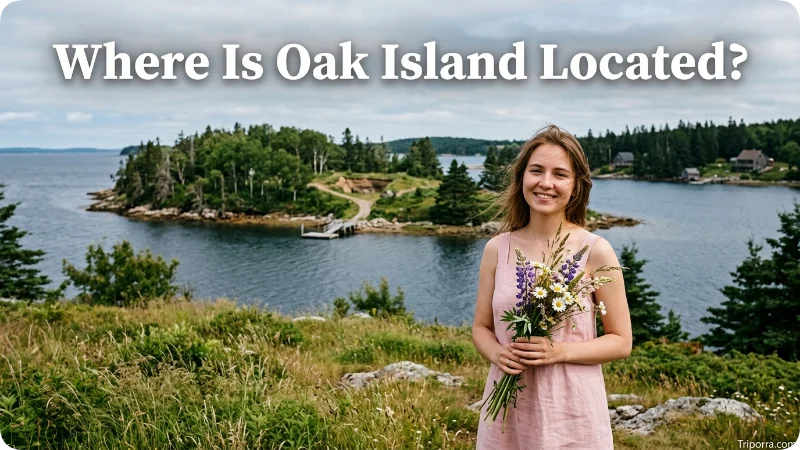
It is located on the southern coast of North Carolina in Brunswick County. It is part of a chain of barrier islands along the state’s southeastern shoreline.
The town occupies most of the island that carries the same name. The island stretches along the Atlantic coast, while the Intracoastal Waterway runs between Oak Island and the mainland. The Town describes its location as being on the southern end of North Carolina’s coastline and says it encompasses nearly 20 square miles with about 10 miles of beachfront.
On a map, you can place it :
- South of Wilmington
- East of the North Carolina–South Carolina border
- South of U.S. 17
- Near Southport
- Along the Atlantic Ocean
- Within Brunswick County
This makes Oak Island part of the coastal geography of southeastern North Carolina rather than the state’s inland or Piedmont regions.
What State Is Oak Island In?
It is in North Carolina.
More specifically, it is in Brunswick County, one of the coastal counties in the southeastern part of the state. The U.S. Census Bureau identifies it as an incorporated town, not a city. Current Census geographic data lists it as “Oak Island town.”
The geographic hierarchy is:
Oak Island → Brunswick County → North Carolina → United States → North America
That distinction matters because Oak Island can describe both a physical island and the municipality located on it.
Is Oak Island an Island or a Town?

It is both.
It is a barrier island along the North Carolina coast. The Town of Oak Island is the incorporated municipality that occupies most of that .
The island also contains Caswell Beach, which is a separate town. The Town of Oak Island’s planning documents describe the major portion of the municipality as being on Oak Island, which it shares with Caswell Beach.
So, when someone asks “where is it ?”, they may mean:
- The geographic island, or
- The Town of Oak Island, North Carolina
For most location searches, both point to the same general coastal area of Brunswick County.
Where Is Oak Island on a Map?
On a North Carolina map, look toward the southeastern corner of the state.
It sits on the Atlantic coast, roughly between the Wilmington area and the South Carolina border. The island runs generally east-west along the shoreline.
A simple mental map looks like this:
Wilmington ↓ southwest Southport / Brunswick County mainland ↓ across the Intracoastal Waterway Oak Island ↓ Atlantic Ocean
The South Carolina border lies farther southwest. Myrtle Beach is also southwest of it across the state line.
The Town of Oak Island’s planning documents place the community about 30 miles east of the South Carolina state line and just south of U.S. 17.
What Is Oak Island Near?
It is close to several recognizable coastal communities.
Southport
Southport is one of the closest mainland communities to it . It lies across the Intracoastal Waterway and serves as an important geographic reference point for the area.
Oak Island’s municipal facilities and recreational areas include locations on both the island and nearby mainland areas around Southport, illustrating how closely connected the two communities are geographically.
Wilmington
Wilmington is the nearest major city commonly used as a reference point for it .
It is roughly 30 to 34 miles from Wilmington, depending on the specific starting and ending points. One current route estimate puts the road distance at about 30 miles, while the Town of Oak Island’s planning document gives approximately 34 miles for the city-to-town relationship.
Wilmington is north-northeast of it .
Myrtle Beach
Myrtle Beach, South Carolina, is another familiar reference point.
The driving distance between Oak Island and Myrtle Beach is roughly 59–60 miles, although the straight-line distance is shorter .It therefore sits considerably closer to Myrtle Beach than many inland North Carolina cities, but it remains in North Carolina.
South Carolina Border
The North Carolina–South Carolina state line is relatively close to it . The Town of Oak Island’s regional planning material places the community approximately 30 miles east of the state line.
How Far Is Oak Island From Wilmington?

It is approximately 30–34 miles southwest of Wilmington, depending on the exact points being measured.
For a practical mental map, Wilmington is the larger city to the north and northeast, while it sits farther down the coast.
The driving route connects the two areas through the regional highway network, and current route information places the trip at roughly 30 miles and about 38 minutes under typical conditions.
Because traffic, the exact destination, and bridge conditions can change travel time, the mileage is more useful as a geographic reference than as a guaranteed travel time.
How Far Is Oak Island From Myrtle Beach?
It is about 59–60 miles by road from Myrtle Beach.
Myrtle Beach lies to the southwest in South Carolina. The two communities are relatively close in coastal terms, but they sit in different states.
This relationship helps place it on a regional map:
- Wilmington: northeast
- Southport: nearby across the waterway
- Myrtle Beach: southwest
- South Carolina: southwest
- Atlantic Ocean: south
What Geographic Region Is Oak Island In?
It is part of southeastern North Carolina and the state’s Atlantic coastal region.
It is also associated with the Cape Fear region. The Town of Oak Island identifies the community as part of the Cape Fear area, which includes the coastal waters and communities around the Cape Fear River and surrounding shoreline.
Unlike cities in North Carolina’s Piedmont or Mountain regions, Oak Island has a distinctly coastal setting. Its physical landscape is shaped by the Atlantic Ocean, barrier-island geography, tidal waterways, beaches, and coastal inlets.
What Is North of Oak Island?
The Atlantic Intracoastal Waterway lies immediately north of Oak Island and separates much of the island from the mainland.
Beyond the waterway are mainland communities and roads in Brunswick County, including the Southport area.
This waterway is an important part of Oak Island’s geography because it explains why the community has bridge connections to the mainland rather than being directly connected by an ordinary road across continuous land. The Town of Oak Island describes the municipality as being separated from the mainland by the Atlantic Intracoastal Waterway.
What Is South of Oak Island?

The Atlantic Ocean lies directly south of it.
The island’s ocean-facing side contains its beachfront, while its northern side faces the Intracoastal Waterway.
The Town of Oak Island describes the island as approximately 12 miles long and says the town has about 10 miles of beachfront.
This north-south relationship provides one of the easiest ways to understand Oak Island:
Mainland → Intracoastal Waterway → Oak Island → Atlantic Ocean
What Is East of Oak Island?
The eastern end of it extends toward the area around Fort Caswell and the Cape Fear coastal waters.
The island’s eastern portion connects geographically with the broader coastal area near the mouth of the Cape Fear River. Caswell Beach occupies part of the island toward this end.
The town’s main eastern access route uses the G.V. Barbee Bridge, which carries NC 133 across the waterway to it .
What Is West of Oak Island?
The western end of it extends toward Lockwoods Folly Inlet and the coastal area around the island’s western point.
The town provides western access through the Swains Cut Bridge, which carries NC 906 across the waterway.
The western end is therefore useful when understanding Oak Island’s shape. Instead of being a small point on the coast, the community occupies a long barrier-island setting stretching for many miles.
How Do You Get to Oak Island?
Most visitors traveling to Oak Island by car reach the island through one of two main bridges.
The Town of Oak Island identifies these two principal access points:
- G.V. Barbee Bridge: connects NC 133 / Long Beach Road with the eastern part of Oak Island.
- Swains Cut Bridge: connects NC 906 / E.F. Middleton Boulevard with the western part of the island.
These bridges cross the Intracoastal Waterway.
For someone approaching from Wilmington, the general geographic direction is southwest toward Brunswick County and then onto the island. From the Myrtle Beach area, Oak Island lies generally northeast.
Because it is a barrier island, bridge access is an important part of its physical geography as well as its transportation network.
What Is the Closest Major City to Oak Island?

Wilmington, North Carolina, is the closest major city commonly used as a regional reference point.
It is approximately 30–34 miles away, depending on the point measured. Wilmington provides the clearest larger-city reference for understanding where it sits along the North Carolina coast.
Southport is closer geographically, but it is a smaller coastal community rather than a major city.
What Are the Coordinates of Oak Island?
The representative coordinates for the Town of Oak Island are approximately:
33.9434° N, 78.1360° W
The U.S. Census Bureau’s current geographic data lists these coordinates for the town’s representative point.
Coordinates place it in the southeastern part of North Carolina, close to the Atlantic coast and well east of the North Carolina–South Carolina border.
Because the town and island cover a relatively large area, a single coordinate should be treated as a reference point rather than the exact location of every part of it .
Is Oak Island Near the South Carolina Border?
Yes. It is relatively close to the North Carolina–South Carolina border.
The Town of Oak Island’s regional planning material places the community approximately 30 miles east of the state line.
That location puts it in a useful middle position along the southeastern coast. It is close enough to South Carolina and Myrtle Beach for regional travel comparisons while remaining firmly within Brunswick County, North Carolina.
Oak Island’s Location in Simple Terms

If you want a quick mental picture, think of it this way:
North Carolina → Southeastern coast → Brunswick County → Southport area → Oak Island barrier island → Atlantic Ocean
From there, the main directional relationships are easy to remember:
- Wilmington is north-northeast.
- Southport is nearby across the Intracoastal Waterway.
- Myrtle Beach is southwest.
- The South Carolina border is southwest.
- The Atlantic Ocean is directly south.
This gives a clearer picture than simply saying Oak Island is “in North Carolina.”
Is Oak Island the Same as Oak Island, North Carolina?
In most location searches, the names refer to the same general coastal area, but there is an important distinction.
It is the physical barrier island.
Oak Island, North Carolina is the incorporated town located mainly on that of it .
The town shares the island with Caswell Beach, so the entire physical island is not identical to the municipal boundary of the Town of it . The town’s official planning material specifically notes that the major portion of the municipality is on Oak Island and that it shares the island with Caswell Beach.
That distinction is useful when reading maps, property information, Census data, or local government documents.
Oak Island Population and Location Context

Population is not necessary to identify Oak Island’s location, but it helps distinguish the town from a small unincorporated beach area.
The U.S. Census Bureau estimates that the Town of it had 9,337 residents as of July 1, 2025, compared with a 2020 Census population of 8,396.
The population figure refers to the incorporated town, not every person who may be staying on or visiting the broader island area at a given time.
This distinction matters because it experiences significant seasonal changes in the number of people using the community.
Why Oak Island’s Location Is Easy to Recognize
It has several geographic features that make its position straightforward to identify.
First, it is directly on the Atlantic coast. Second, it sits in Brunswick County, near the southern end of North Carolina’s coastline. Third, the Intracoastal Waterway separates the island from the mainland.
The Town of Oak Island also identifies two principal bridge connections, giving the community a clear relationship with the mainland transportation network.
Together, these features create a simple geographic pattern:
Atlantic Ocean → Oak Island → Intracoastal Waterway → Brunswick County mainland
That is the easiest way to picture where the community sits.
FAQs
Where is Oak Island located?
It is located in Brunswick County in southeastern North Carolina, along the Atlantic Ocean. It lies south of Wilmington and near the North Carolina–South Carolina border.
What state is Oak Island in?
It is in North Carolina. It is part of Brunswick County on the state’s southeastern coast.
Is Oak Island a town or an island?
It is both. It is a barrier island, while the Town of Oak Island is an incorporated municipality occupying most of the island. Caswell Beach also occupies part of the island.
What county is it in?
It is in Brunswick County, North Carolina. The county is located along the state’s southeastern coast.
How far is Oak Island from Wilmington?
It is approximately 30–34 miles from Wilmington, depending on the exact locations being compared. The driving distance is about 30 miles in common route calculations.
How far is Oak Island from Myrtle Beach?
it is roughly 59–60 miles from Myrtle Beach by road. Myrtle Beach is located southwest of Oak Island in South Carolina.
Is it near Southport, North Carolina?
Yes. Southport is one of the closest mainland communities to Oak Island. The communities are separated by the Intracoastal Waterway and connected through the local road and bridge network.
What ocean is Oak Island on?
It is on the Atlantic Ocean. The ocean lies along the island’s southern shoreline.
What are Oak Island’s coordinates?
The Town of Oak Island’s representative coordinates are approximately 33.9434° N, 78.1360° W.
Is Oak Island close to the South Carolina border?
Yes. It is about 30 miles east of the North Carolina–South Carolina state line, according to the town’s regional planning information.
How do you access it ?
Drivers can reach it through two principal bridges: the G.V. Barbee Bridge on NC 133 at the eastern end and the Swains Cut Bridge on NC 906 at the western end.
What is north of it ?
The Atlantic Intracoastal Waterway lies north of it and separates the island from the mainland. Communities around Southport and the rest of Brunswick County lie beyond the waterway.
Conclusion
It is a barrier island and coastal town in Brunswick County, southeastern North Carolina. It sits between the Atlantic Ocean and the mainland’s Intracoastal Waterway, with Wilmington about 30–34 miles to the north-northeast and Myrtle Beach roughly 60 miles to the southwest.
The easiest way to remember its location is: it is on North Carolina’s southern Atlantic coast, near Southport, south of Wilmington, and relatively close to the South Carolina border.

Elena Rostova bridges the gap between premium hospitality and authentic local experiences. Armed with a background in luxury hospitality management and a passion for fine architecture, she spent years evaluating elite resorts before transitioning into travel journalism. Elena heads the luxury and boutique travel vertical on Triporra.com. Her meticulous guides strip away the guesswork from high-end travel, showcasing unique five-star escapes, fine regional dining, and bespoke private tours that elevate a standard vacation into an unforgettable journey.










